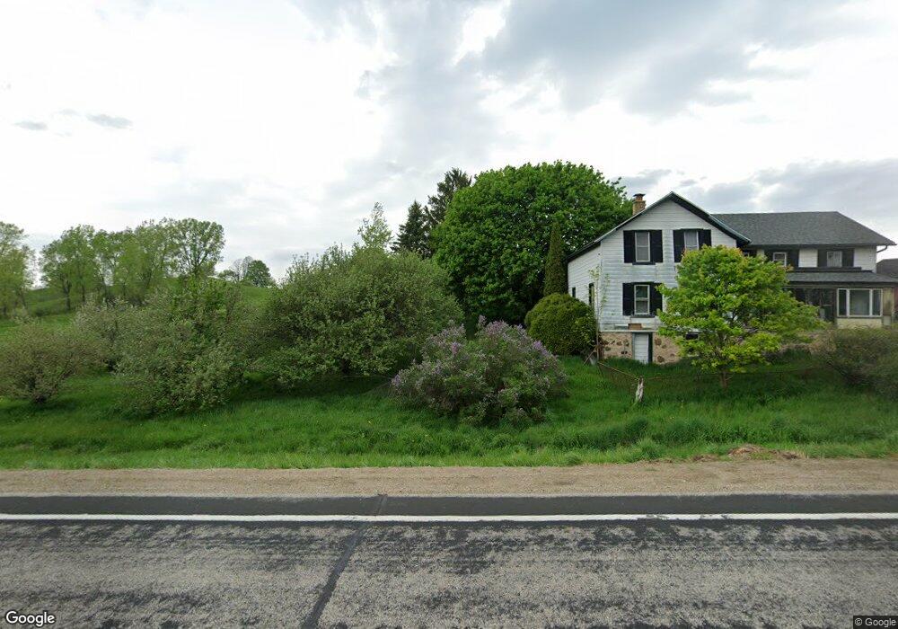
5376 County Road D West Bend, WI 53090
Estimated Value: $371,370 - $554,000
--
Bed
--
Bath
--
Sq Ft
5
Acres
About This Home
This home is located at 5376 County Road D, West Bend, WI 53090 and is currently estimated at $473,593. 5376 County Road D is a home located in Washington County with nearby schools including Kewaskum High School.
Ownership History
Date
Name
Owned For
Owner Type
Purchase Details
Closed on
Aug 13, 2025
Sold by
Evans Michael and Gdowski Julie
Bought by
Evans Lloyd V and Evans Y
Current Estimated Value
Purchase Details
Closed on
Aug 9, 2017
Sold by
Evans Michael and Gdowski Julie
Bought by
Evans Lloyd and Evans Michael
Home Financials for this Owner
Home Financials are based on the most recent Mortgage that was taken out on this home.
Original Mortgage
$129,000
Interest Rate
3.96%
Mortgage Type
New Conventional
Purchase Details
Closed on
May 29, 2015
Sold by
Evans Lloyd V
Bought by
Evans Michael and Gdowski Julie
Purchase Details
Closed on
Jul 1, 2005
Sold by
Becker Development Llc
Bought by
Evans Lloyd V
Home Financials for this Owner
Home Financials are based on the most recent Mortgage that was taken out on this home.
Original Mortgage
$171,000
Interest Rate
5%
Mortgage Type
Assumption
Create a Home Valuation Report for This Property
The Home Valuation Report is an in-depth analysis detailing your home's value as well as a comparison with similar homes in the area
Home Values in the Area
Average Home Value in this Area
Purchase History
| Date | Buyer | Sale Price | Title Company |
|---|---|---|---|
| Evans Lloyd V | -- | -- | |
| Evans Lloyd | -- | Vantage Point Title Inc | |
| Evans Michael | -- | None Available | |
| Evans Lloyd V | $190,000 | None Available |
Source: Public Records
Mortgage History
| Date | Status | Borrower | Loan Amount |
|---|---|---|---|
| Previous Owner | Evans Lloyd | $129,000 | |
| Previous Owner | Evans Lloyd V | $171,000 |
Source: Public Records
Tax History Compared to Growth
Tax History
| Year | Tax Paid | Tax Assessment Tax Assessment Total Assessment is a certain percentage of the fair market value that is determined by local assessors to be the total taxable value of land and additions on the property. | Land | Improvement |
|---|---|---|---|---|
| 2024 | $2,300 | $212,200 | $70,000 | $142,200 |
| 2023 | $2,059 | $212,200 | $70,000 | $142,200 |
| 2022 | $1,878 | $212,200 | $70,000 | $142,200 |
| 2021 | $1,927 | $212,200 | $70,000 | $142,200 |
| 2020 | $1,995 | $212,200 | $70,000 | $142,200 |
| 2019 | $2,176 | $185,700 | $58,000 | $127,700 |
| 2018 | $2,168 | $185,700 | $58,000 | $127,700 |
| 2017 | $2,229 | $185,700 | $58,000 | $127,700 |
| 2016 | $2,186 | $185,700 | $58,000 | $127,700 |
| 2015 | $2,279 | $185,700 | $58,000 | $127,700 |
| 2014 | $2,279 | $185,700 | $58,000 | $127,700 |
| 2013 | $2,515 | $185,700 | $58,000 | $127,700 |
Source: Public Records
Map
Nearby Homes
- 7721 Aurora Rd
- 5036 County Highway D
- 7165 Town Line Rd
- 8480 Fairview Dr
- Lt0 County Hwy W
- 6372 Wildlife Rd
- 5954 Mohawk Rd
- 6386 Alpine Dr
- Lt2 Wilson Dr
- Lt1 Wilson Dr
- 6837 Reuter Ln
- Lt3-5 Schuster Dr
- Lt3 Schuster Dr
- Lt5 Schuster Dr
- Lt4 Schuster Dr
- 4538 Church Dr
- 7087 Nenno Rd
- Lt2 Beaver Dam Rd
- 4262 N Woodcrest Ridge Dr
- 744 Ojibwe Path
- 7757 High Point Cir
- 7758 High Point Cir
- Lt7 Panorama Dr Unit Lt7
- Lt6 Panorama Dr
- Lt6 Panorama Dr Unit Lt6
- 7766 High Point Cir
- 7765 High Point Cir
- Lt11 Hideaway Cir
- 7785 Panorama Dr
- 5441 Hideaway Cir
- Lt8 Panorama Dr
- Lt8 Panorama Dr Unit Lt8
- 5440 Hideaway Cir
- 5445 Hideaway Cir
- 5504 County Road D
- 5507 County Highway D
- 5507 County Road D
- 5444 Hideaway Cir
- 5246 County Road D
- 7540 Aurora Rd