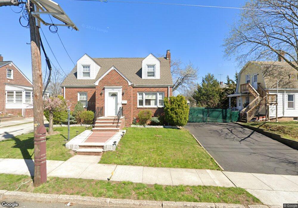
538 Mckeon St Perth Amboy, NJ 08861
Chickentown NeighborhoodEstimated Value: $455,134 - $546,000
--
Bed
--
Bath
1,516
Sq Ft
$332/Sq Ft
Est. Value
About This Home
This home is located at 538 Mckeon St, Perth Amboy, NJ 08861 and is currently estimated at $503,284, approximately $331 per square foot. 538 Mckeon St is a home located in Middlesex County with nearby schools including Perth Amboy High School, Middlesex County STEM Charter School, and Academy for Urban Leadership Charter School.
Ownership History
Date
Name
Owned For
Owner Type
Purchase Details
Closed on
Apr 26, 1994
Sold by
Guarnieri Jean
Bought by
Morales Fernando
Current Estimated Value
Home Financials for this Owner
Home Financials are based on the most recent Mortgage that was taken out on this home.
Original Mortgage
$100,000
Interest Rate
7.7%
Create a Home Valuation Report for This Property
The Home Valuation Report is an in-depth analysis detailing your home's value as well as a comparison with similar homes in the area
Home Values in the Area
Average Home Value in this Area
Purchase History
| Date | Buyer | Sale Price | Title Company |
|---|---|---|---|
| Morales Fernando | $115,000 | -- |
Source: Public Records
Mortgage History
| Date | Status | Borrower | Loan Amount |
|---|---|---|---|
| Closed | Morales Fernando | $100,000 |
Source: Public Records
Tax History Compared to Growth
Tax History
| Year | Tax Paid | Tax Assessment Tax Assessment Total Assessment is a certain percentage of the fair market value that is determined by local assessors to be the total taxable value of land and additions on the property. | Land | Improvement |
|---|---|---|---|---|
| 2025 | $8,384 | $277,900 | $120,600 | $157,300 |
| 2024 | $8,368 | $277,900 | $120,600 | $157,300 |
| 2023 | $8,368 | $277,900 | $120,600 | $157,300 |
| 2022 | $8,268 | $277,900 | $120,600 | $157,300 |
| 2021 | $8,279 | $277,900 | $120,600 | $157,300 |
| 2020 | $8,276 | $277,900 | $120,600 | $157,300 |
| 2019 | $8,306 | $277,900 | $120,600 | $157,300 |
| 2018 | $8,234 | $277,900 | $120,600 | $157,300 |
| 2017 | $8,218 | $277,900 | $120,600 | $157,300 |
| 2016 | $8,004 | $277,900 | $120,600 | $157,300 |
| 2015 | $8,059 | $277,900 | $120,600 | $157,300 |
| 2014 | $8,109 | $277,900 | $120,600 | $157,300 |
Source: Public Records
Map
Nearby Homes
- 617 Lee St
- 678 Bingle St
- 693 Hanson Ave
- 559 Compton Ave
- 6 Worden Ave
- 552 Compton Ave
- 773 Colgate Ave
- 448 Baker Place
- 130-132 Judy Dr
- 113 Judy Dr Unit 115
- 485 Compton Ave
- 689 Mary St
- 720 Donald Ave
- 424 Steadman Place
- 113-115 Judy Dr
- 744 Donald Ave
- 752 Donald Ave
- 133 Howard St
- 459 Brace Ave
- 461 Lawrie St
- 542 Mckeon St
- 546 Mckeon St
- 702 New Brunswick Ave
- 706 New Brunswick Ave
- 539 Colgate Ave Unit 541
- 543 Mckeon St
- 537 Mckeon St
- 543 Colgate Ave
- 714 New Brunswick Ave
- 700 New Brunswick Ave
- 541 Mckeon St
- 696 New Brunswick Ave
- 552 Mckeon St Unit 554
- 547 Colgate Ave
- 549 Colgate Ave
- 545 Mckeon St
- 718 New Brunswick Ave
- 551 Colgate Ave
- 554 Mckeon St
- 540 Hazel Ave