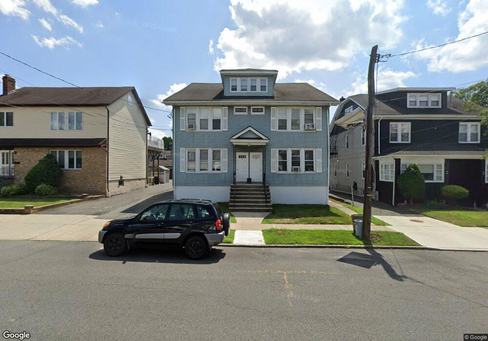
538 Page Ave Unit 540 Lyndhurst, NJ 07071
Estimated Value: $860,000 - $1,204,000
2
Beds
1
Bath
4,514
Sq Ft
$227/Sq Ft
Est. Value
About This Home
This home is located at 538 Page Ave Unit 540, Lyndhurst, NJ 07071 and is currently estimated at $1,022,880, approximately $226 per square foot. 538 Page Ave Unit 540 is a home located in Bergen County with nearby schools including Lyndhurst High School and Sacred Heart School.
Ownership History
Date
Name
Owned For
Owner Type
Purchase Details
Closed on
Jan 30, 2007
Sold by
Lago Manuel
Bought by
Petracco Alphonse
Current Estimated Value
Home Financials for this Owner
Home Financials are based on the most recent Mortgage that was taken out on this home.
Original Mortgage
$620,000
Outstanding Balance
$371,353
Interest Rate
6.16%
Estimated Equity
$651,527
Purchase Details
Closed on
Jan 15, 2004
Sold by
Mathieu Elaine
Bought by
Lago Manuel and Lago Lidia Ortelio
Home Financials for this Owner
Home Financials are based on the most recent Mortgage that was taken out on this home.
Original Mortgage
$567,000
Interest Rate
5.89%
Create a Home Valuation Report for This Property
The Home Valuation Report is an in-depth analysis detailing your home's value as well as a comparison with similar homes in the area
Home Values in the Area
Average Home Value in this Area
Purchase History
| Date | Buyer | Sale Price | Title Company |
|---|---|---|---|
| Petracco Alphonse | $775,000 | -- | |
| Lago Manuel | $630,000 | -- |
Source: Public Records
Mortgage History
| Date | Status | Borrower | Loan Amount |
|---|---|---|---|
| Open | Petracco Alphonse | $620,000 | |
| Previous Owner | Lago Manuel | $567,000 |
Source: Public Records
Tax History Compared to Growth
Tax History
| Year | Tax Paid | Tax Assessment Tax Assessment Total Assessment is a certain percentage of the fair market value that is determined by local assessors to be the total taxable value of land and additions on the property. | Land | Improvement |
|---|---|---|---|---|
| 2025 | $15,251 | $749,000 | $311,100 | $437,900 |
| 2024 | $14,699 | $731,100 | $304,500 | $426,600 |
| 2023 | $13,525 | $723,400 | $301,600 | $421,800 |
| 2022 | $13,525 | $426,400 | $178,600 | $247,800 |
| 2021 | $12,942 | $426,400 | $178,600 | $247,800 |
| 2020 | $12,681 | $426,400 | $178,600 | $247,800 |
| 2019 | $12,587 | $426,400 | $178,600 | $247,800 |
| 2018 | $12,690 | $426,400 | $178,600 | $247,800 |
| 2017 | $12,370 | $426,400 | $178,600 | $247,800 |
| 2016 | $12,093 | $426,400 | $178,600 | $247,800 |
| 2015 | $11,713 | $426,400 | $178,600 | $247,800 |
| 2014 | $11,560 | $426,400 | $178,600 | $247,800 |
Source: Public Records
Map
Nearby Homes
- 524 Octavia Place
- 518 8th St
- 506 Park Place
- 416 Kingsland Ave
- 448 Fern Ave
- 609 Chase Ave
- 614 10th St
- 549-1-551 Laurel Ave
- 683 Kingsland Ave
- 748 6th St
- 471 Harding Ave
- 274 Warren St
- 771 5th St
- 773 5th St
- 10 4th St
- 748 Pennsylvania Ave
- 258 Kingsland Ave
- 105 Jauncey Ave
- 325 Valley Brook Ave
- 217 Mountain Way
- 544 Page Ave Unit 1
- 544 Page Ave
- 534 Page Ave Unit 536
- 548 Page Ave
- 548 Page Ave Unit 2
- 530 Page Ave
- 552 Page Ave
- 552 Page Ave Unit 2
- 528 Page Ave
- 553 Sollas Ct
- 549 Sollas Ct
- 557 Sollas Ct
- 556 Page Ave
- 545 Sollas Ct
- 526 Page Ave
- 526 Page Ave Unit 2
- 561 Sollas Ct
- 541 Page Ave
- 545 Page Ave
- 533 Page Ave