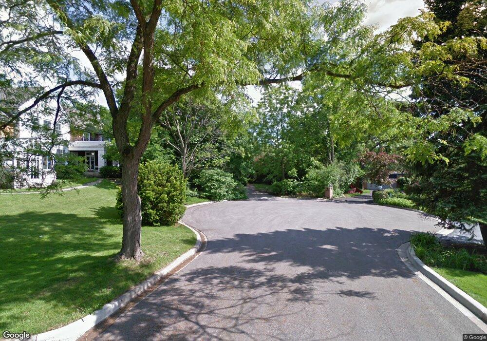
538 Pinewood Dr Glencoe, IL 60022
Estimated Value: $957,000 - $1,367,000
3
Beds
3
Baths
2,237
Sq Ft
$551/Sq Ft
Est. Value
About This Home
This home is located at 538 Pinewood Dr, Glencoe, IL 60022 and is currently estimated at $1,232,337, approximately $550 per square foot. 538 Pinewood Dr is a home located in Cook County with nearby schools including South Elementary School, West School, and Central School.
Ownership History
Date
Name
Owned For
Owner Type
Purchase Details
Closed on
Nov 14, 2012
Sold by
Guttman Lanya
Bought by
Guttman Lanya and Lanya Guttman Trust
Current Estimated Value
Purchase Details
Closed on
Dec 14, 2010
Sold by
Guttman Lanya and Cuthbert Dennine
Bought by
Guttman Lanya and Eleanor D Guttman Trust
Purchase Details
Closed on
Dec 22, 1999
Sold by
Chicago Title Land Trust Company
Bought by
Guttman Eleanor D and Eleanor D Guttman Trust
Purchase Details
Closed on
May 26, 1999
Sold by
Guttman Eleanor
Bought by
Cole Taylor Bank and Trust #998-50
Create a Home Valuation Report for This Property
The Home Valuation Report is an in-depth analysis detailing your home's value as well as a comparison with similar homes in the area
Home Values in the Area
Average Home Value in this Area
Purchase History
| Date | Buyer | Sale Price | Title Company |
|---|---|---|---|
| Guttman Lanya | -- | None Available | |
| Guttman Lanya | -- | None Available | |
| Guttman Eleanor D | -- | Chicago Title Land Trust Co | |
| Cole Taylor Bank | -- | -- |
Source: Public Records
Tax History
| Year | Tax Paid | Tax Assessment Tax Assessment Total Assessment is a certain percentage of the fair market value that is determined by local assessors to be the total taxable value of land and additions on the property. | Land | Improvement |
|---|---|---|---|---|
| 2025 | $18,036 | $101,000 | $32,742 | $68,258 |
| 2024 | $18,036 | $79,598 | $27,412 | $52,186 |
| 2023 | $18,031 | $85,000 | $27,412 | $57,588 |
| 2022 | $18,031 | $85,000 | $27,412 | $57,588 |
| 2021 | $13,475 | $52,995 | $20,559 | $32,436 |
| 2020 | $13,196 | $52,995 | $20,559 | $32,436 |
| 2019 | $12,719 | $57,604 | $20,559 | $37,045 |
| 2018 | $13,793 | $60,441 | $17,513 | $42,928 |
| 2017 | $15,001 | $66,816 | $17,513 | $49,303 |
| 2016 | $14,501 | $66,816 | $17,513 | $49,303 |
| 2015 | $13,497 | $51,534 | $14,467 | $37,067 |
| 2014 | $13,621 | $57,726 | $14,467 | $43,259 |
| 2013 | $12,967 | $57,726 | $14,467 | $43,259 |
Source: Public Records
Map
Nearby Homes
- 1180 Oak Ridge Dr
- 1171 Hohlfelder Rd
- 1200 Green Bay Rd
- 1125 Hohlfelder Rd
- 1265 Longmeadow Ln
- 1133 Mayfair Ln
- 1106 Hohlfelder Rd
- 1077 Green Bay Rd
- 908 Elm Place
- 537 County Line Rd
- 759 Strawberry Hill Dr
- 396 Forest Edge Dr
- 808 Prairie Rd
- 794 Greenwood Ave
- 64 Crescent Dr
- 219 Lincoln Dr
- 8 Heritage Dr
- 130 Maple Hill Rd
- 55 S Deere Park Dr
- 488 Park Ave
- 540 Pinewood Dr
- 534 Pinewood Dr
- 561 Westwood Ln
- 1212 Hohlfelder Rd
- 1224 Hohlfelder Rd
- 542 Pinewood Dr
- 1204 Hohlfelder Rd
- 565 Westwood Ln
- 530 Pinewood Dr
- 1196 Hohlfelder Rd
- 544 Pinewood Dr
- 1211 Mayfair Ln
- 1190 Hohlfelder Rd
- 1255 Fairfield Rd
- 573 Westwood Ln
- 1261 Fairfield Rd
- 530 Westley Rd
- 1240 Hohlfelder Rd
- 1201 Mayfair Ln
- 536 Westley Rd
