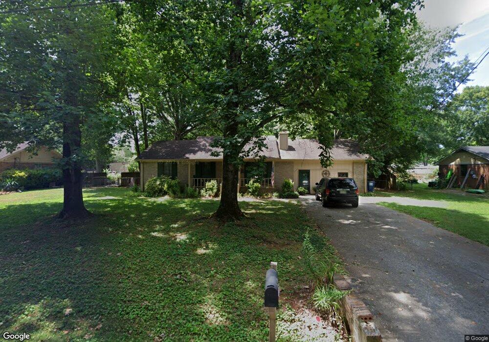
538 Wess Taylor Rd Huntsville, AL 35811
Ryland NeighborhoodEstimated Value: $253,000 - $298,000
3
Beds
2
Baths
1,769
Sq Ft
$154/Sq Ft
Est. Value
About This Home
This home is located at 538 Wess Taylor Rd, Huntsville, AL 35811 and is currently estimated at $271,865, approximately $153 per square foot. 538 Wess Taylor Rd is a home located in Madison County with nearby schools including Central School and Madison County High School.
Ownership History
Date
Name
Owned For
Owner Type
Purchase Details
Closed on
May 11, 2009
Sold by
The United States Department Of Hud
Bought by
Allison Bryan
Current Estimated Value
Home Financials for this Owner
Home Financials are based on the most recent Mortgage that was taken out on this home.
Original Mortgage
$87,912
Outstanding Balance
$55,365
Interest Rate
4.79%
Mortgage Type
FHA
Estimated Equity
$216,500
Purchase Details
Closed on
Nov 17, 2008
Sold by
Midfirst Bank
Bought by
Secretary Of Hud
Purchase Details
Closed on
Jun 18, 2008
Sold by
Thomas Robert W and Thomas Tressia A
Bought by
Midfirst Bank
Create a Home Valuation Report for This Property
The Home Valuation Report is an in-depth analysis detailing your home's value as well as a comparison with similar homes in the area
Home Values in the Area
Average Home Value in this Area
Purchase History
| Date | Buyer | Sale Price | Title Company |
|---|---|---|---|
| Allison Bryan | $81,500 | -- | |
| Secretary Of Hud | -- | -- | |
| Midfirst Bank | $108,340 | -- |
Source: Public Records
Mortgage History
| Date | Status | Borrower | Loan Amount |
|---|---|---|---|
| Open | Allison Bryan | $87,912 |
Source: Public Records
Tax History Compared to Growth
Tax History
| Year | Tax Paid | Tax Assessment Tax Assessment Total Assessment is a certain percentage of the fair market value that is determined by local assessors to be the total taxable value of land and additions on the property. | Land | Improvement |
|---|---|---|---|---|
| 2024 | $570 | $17,220 | $3,500 | $13,720 |
| 2023 | $556 | $16,840 | $3,500 | $13,340 |
| 2022 | $471 | $14,380 | $2,000 | $12,380 |
| 2021 | $422 | $13,040 | $2,000 | $11,040 |
| 2020 | $394 | $12,280 | $2,000 | $10,280 |
| 2019 | $380 | $11,900 | $2,000 | $9,900 |
| 2018 | $356 | $11,220 | $0 | $0 |
| 2017 | $356 | $11,220 | $0 | $0 |
| 2016 | $356 | $11,220 | $0 | $0 |
| 2015 | $356 | $11,220 | $0 | $0 |
| 2014 | $352 | $11,120 | $0 | $0 |
Source: Public Records
Map
Nearby Homes
- 104 Louise Taylor
- 403 Ryland Pike
- 105 Alice Janes Cir
- 900 Wes Taylor Rd
- 232 Pops Corner
- 908 Wess Taylor Rd
- 2368 Jordan Rd
- 129 Season Ln
- 118 Sydney St
- 123 Delta Pine Dr
- 350 Moontown Rd
- 362 Moontown Rd
- 506 Moontown Rd
- 477 Moontown Rd
- 3208 Jordan Farm Cir NE
- 483 Moontown Rd
- 111 Cool Cir
- 101 Dolf Leaf Ln
- 103 Dolf Leaf Ln
- 109 Dolf Leaf Ln
- 546 Wess Taylor Rd
- 530 Wess Taylor Rd
- 554 Wess Taylor Rd
- 107 Allenwood Dr
- 3239 Dug Hill Rd
- 3229 Dug Hill Rd NE
- 103 Allenwood Dr
- 547 Wess Taylor Rd
- 109 Allenwood Dr
- 562 Wess Taylor Rd
- 3253 Dug Hill Rd
- 101 Allenwood Dr
- 111 Allenwood Dr
- 3236 Dug Hill Rd
- 104 Allenwood Dr
- 570 Wess Taylor Rd
- 553 Wess Taylor Rd
- 106 Allenwood Dr
- 3218 Dug Hill Rd
- 102 Allenwood Dr