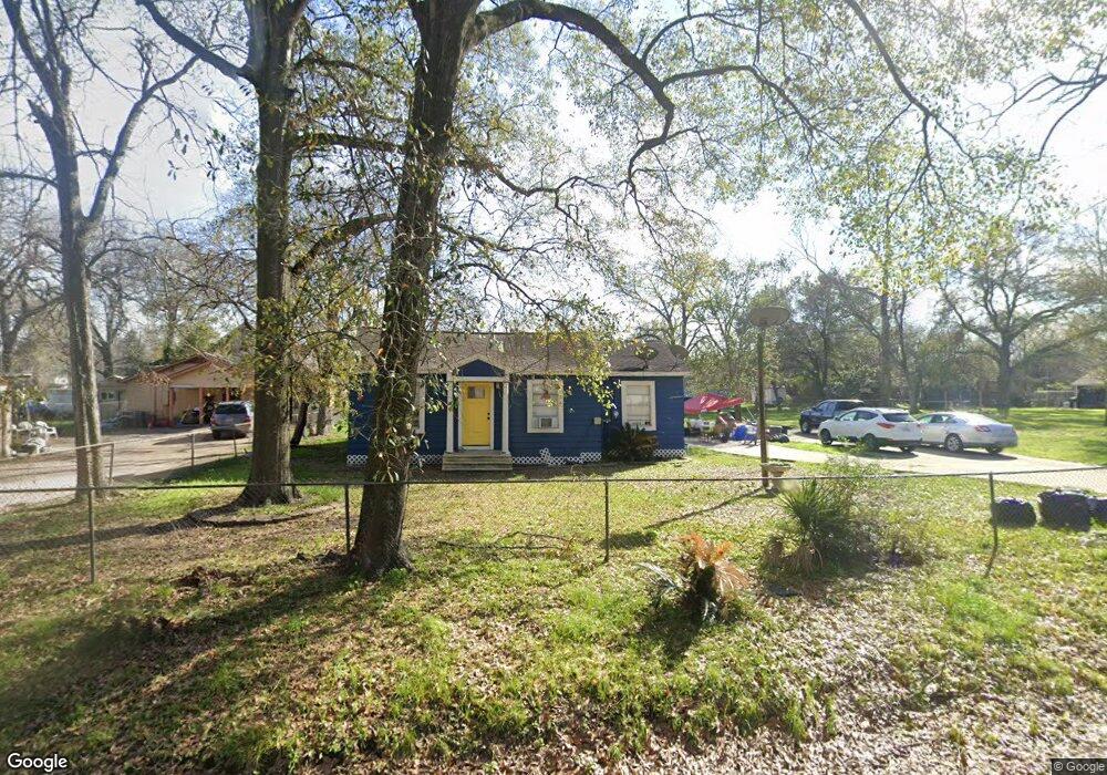
538 Westford St Houston, TX 77022
Northside-Northline NeighborhoodEstimated Value: $256,000 - $296,266
2
Beds
1
Bath
704
Sq Ft
$385/Sq Ft
Est. Value
About This Home
This home is located at 538 Westford St, Houston, TX 77022 and is currently estimated at $271,317, approximately $385 per square foot. 538 Westford St is a home located in Harris County with nearby schools including Herrera Elementary School, Burbank Middle School, and Sam Houston Math, Science & Technology Center.
Ownership History
Date
Name
Owned For
Owner Type
Purchase Details
Closed on
Apr 9, 2007
Sold by
Lozano Arnoldo and Lozano Marianela J
Bought by
Garcia Anthony
Current Estimated Value
Home Financials for this Owner
Home Financials are based on the most recent Mortgage that was taken out on this home.
Original Mortgage
$86,250
Outstanding Balance
$52,149
Interest Rate
6.15%
Mortgage Type
Purchase Money Mortgage
Estimated Equity
$219,168
Purchase Details
Closed on
Nov 30, 2002
Sold by
Welch J T and Welch Bennie L
Bought by
Lozano Arnoldo and Lozano Marianela J
Create a Home Valuation Report for This Property
The Home Valuation Report is an in-depth analysis detailing your home's value as well as a comparison with similar homes in the area
Home Values in the Area
Average Home Value in this Area
Purchase History
| Date | Buyer | Sale Price | Title Company |
|---|---|---|---|
| Garcia Anthony | -- | Access National Title Co | |
| Lozano Arnoldo | -- | -- |
Source: Public Records
Mortgage History
| Date | Status | Borrower | Loan Amount |
|---|---|---|---|
| Open | Garcia Anthony | $86,250 |
Source: Public Records
Tax History Compared to Growth
Tax History
| Year | Tax Paid | Tax Assessment Tax Assessment Total Assessment is a certain percentage of the fair market value that is determined by local assessors to be the total taxable value of land and additions on the property. | Land | Improvement |
|---|---|---|---|---|
| 2025 | $5,608 | $273,201 | $212,500 | $60,701 |
| 2024 | $5,608 | $268,034 | $212,500 | $55,534 |
| 2023 | $5,608 | $251,847 | $184,375 | $67,472 |
| 2022 | $4,303 | $195,408 | $137,500 | $57,908 |
| 2021 | $4,261 | $182,827 | $137,500 | $45,327 |
| 2020 | $4,307 | $177,878 | $137,500 | $40,378 |
| 2019 | $3,868 | $152,878 | $112,500 | $40,378 |
| 2018 | $2,853 | $112,760 | $78,125 | $34,635 |
| 2017 | $2,851 | $112,760 | $78,125 | $34,635 |
| 2016 | $2,227 | $104,253 | $78,125 | $26,128 |
| 2015 | $1,325 | $90,298 | $62,500 | $27,798 |
| 2014 | $1,325 | $73,095 | $43,750 | $29,345 |
Source: Public Records
Map
Nearby Homes
- 7206 Helmers St Unit A
- 605 Post St
- 7015 Roswell St
- 6825 Appleton St
- 809 Dorchester St
- 7311 Roswell St
- 311 & 309 Bennington St
- 7317 Roswell St
- 249 Basswood St
- 7111 Bauman Rd
- 7315 Roswell St
- 428 Van Molan St
- 214 Frisco St
- 931 Bennington St
- 121-123 Van Molan St
- 6515 Lloyd St
- 1009 Wainwright St
- 164 Wallace St
- 729 Caperton St
- 7009 Amber St
- 538 Westford St
- 540 Westford St
- 542 Westford St
- 529 Westford St
- 527 Westford St
- 531 Westford St
- 7103 Helmers St
- 525 Westford St
- 7111 Helmers St
- 522 Westford St
- 521 Westford St
- 528 Wainwright St
- 535 Plymouth St
- 535 Plymouth St Unit B
- 535 Plymouth St Unit A
- 539 Plymouth St
- 601 Westford St
- 530 Wainwright St
- 520 Wainwright St
- 542 Wainwright St