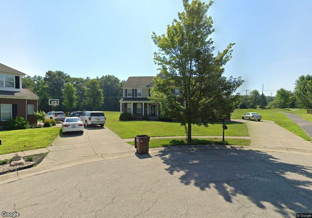
5384 Canyon Ridge Dr Liberty Township, OH 45011
Estimated Value: $493,000 - $612,000
4
Beds
3
Baths
3,872
Sq Ft
$150/Sq Ft
Est. Value
About This Home
This home is located at 5384 Canyon Ridge Dr, Liberty Township, OH 45011 and is currently estimated at $580,326, approximately $149 per square foot. 5384 Canyon Ridge Dr is a home located in Butler County with nearby schools including Cherokee Elementary School, Heritage Early Childhood School, and Lakota Plains Junior School.
Ownership History
Date
Name
Owned For
Owner Type
Purchase Details
Closed on
Jun 28, 2004
Sold by
The Ryland Group Inc
Bought by
Gast Joseph R and Gast Courtney N
Current Estimated Value
Home Financials for this Owner
Home Financials are based on the most recent Mortgage that was taken out on this home.
Original Mortgage
$330,550
Outstanding Balance
$166,433
Interest Rate
6.34%
Mortgage Type
Purchase Money Mortgage
Estimated Equity
$413,893
Create a Home Valuation Report for This Property
The Home Valuation Report is an in-depth analysis detailing your home's value as well as a comparison with similar homes in the area
Home Values in the Area
Average Home Value in this Area
Purchase History
| Date | Buyer | Sale Price | Title Company |
|---|---|---|---|
| Gast Joseph R | $347,965 | -- |
Source: Public Records
Mortgage History
| Date | Status | Borrower | Loan Amount |
|---|---|---|---|
| Open | Gast Joseph R | $330,550 |
Source: Public Records
Tax History Compared to Growth
Tax History
| Year | Tax Paid | Tax Assessment Tax Assessment Total Assessment is a certain percentage of the fair market value that is determined by local assessors to be the total taxable value of land and additions on the property. | Land | Improvement |
|---|---|---|---|---|
| 2024 | $7,536 | $12,360 | $12,360 | -- |
| 2023 | $7,438 | $12,360 | $12,360 | -- |
| 2022 | $6,745 | $12,360 | $12,360 | $0 |
| 2021 | $6,709 | $12,360 | $12,360 | $0 |
| 2020 | $6,887 | $238,690 | $7,850 | $230,840 |
| 2019 | $10,736 | $111,450 | $12,360 | $99,090 |
| 2018 | $6,777 | $12,360 | $12,360 | $0 |
| 2017 | $6,891 | $12,360 | $12,360 | $0 |
| 2016 | $5,922 | $12,360 | $12,360 | $0 |
| 2015 | $710 | $12,360 | $12,360 | $0 |
| 2014 | $5,302 | $12,360 | $12,360 | $0 |
| 2013 | $5,302 | $12,360 | $12,360 | $0 |
Source: Public Records
Map
Nearby Homes
- 5259 Aspen Valley Dr
- 5200 Poets Way
- 4360 Watoga Dr
- 5618 Rachels View
- 5609 Selu Dr
- 5627 Eagle Dance Dr
- 4957 Streamside Ct
- 5406 Sugar Maple Run
- 5008 N Star Ct
- 5617 Creekside Meadows Dr
- 4943 Silver Creek Ct
- 5238 Brougham Ln
- 5114 Princeton Glendale Rd
- 5565 Eagle Ct
- 5276 Brougham Ln
- 5567 Eagle Ct
- 5396 Brougham Ln
- 5100 Brougham Ln
- 4902 Harrier Ln
- 5145 Brougham Ln
- 5374 Canyon Ridge Dr
- 5373 Canyon Ridge Dr
- 5363 Canyon Ridge Dr
- 5364 Canyon Ridge Dr
- 0 Kyles Station Rd Unit 1266256
- 0 Kyles Station Rd Unit 1604930
- 5343 Canyon Ridge Dr
- 5354 Canyon Ridge Dr
- 5350 Kyles Station Rd
- 5344 Canyon Ridge Dr
- 5333 Canyon Ridge Dr
- 5350 Lesourdsville West Chester Rd
- 5212 Aspen Valley Dr
- 5222 Aspen Valley Dr
- 5313 Canyon Ridge Dr
- 5324 Canyon Ridge Dr
- 5232 Aspen Valley Dr
- 5202 Aspen Valley Dr
- 5427 Kyles Station Rd
- 5336 Lesourdsville W Chester