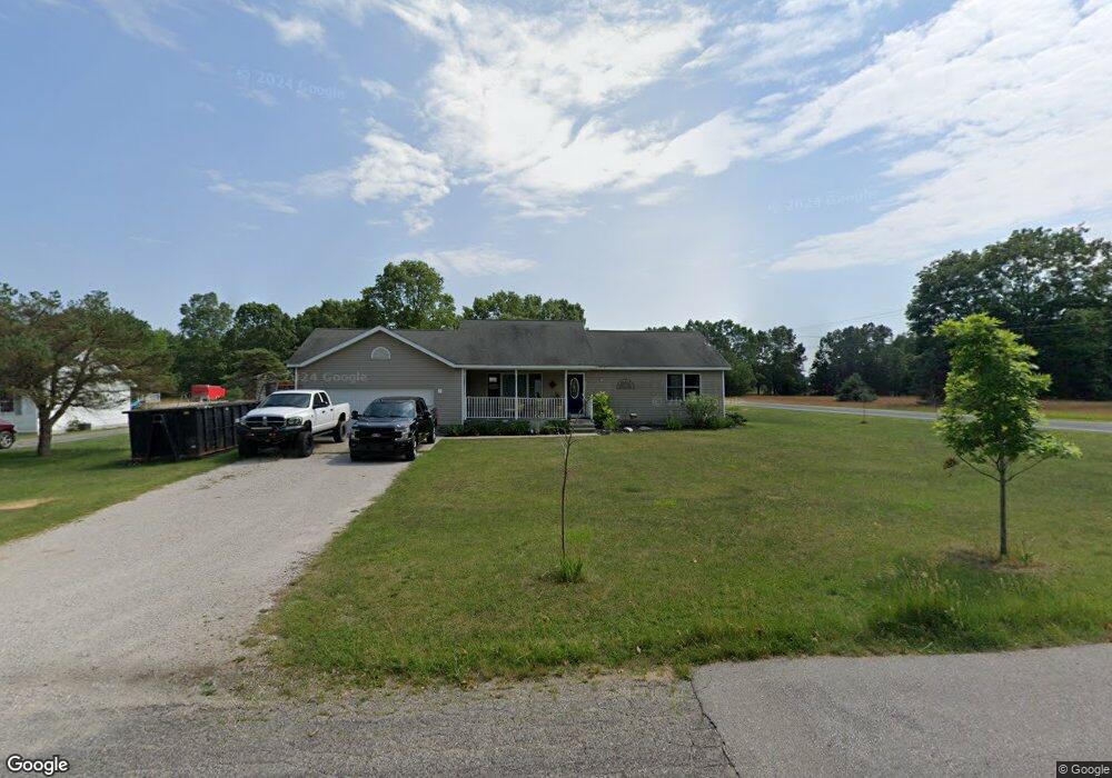
5387 Anderson Rd Montague, MI 49437
Estimated Value: $283,000 - $404,000
2
Beds
2
Baths
1,554
Sq Ft
$209/Sq Ft
Est. Value
About This Home
This home is located at 5387 Anderson Rd, Montague, MI 49437 and is currently estimated at $325,113, approximately $209 per square foot. 5387 Anderson Rd is a home located in Muskegon County with nearby schools including Montague Area Childhood Center, Oehrli Elementary School, and Nellie B. Chisholm Middle School.
Ownership History
Date
Name
Owned For
Owner Type
Purchase Details
Closed on
Nov 30, 2021
Sold by
Maressa Jolene Rae
Bought by
Maressa Olene Rae and Parrott Nathanial
Current Estimated Value
Home Financials for this Owner
Home Financials are based on the most recent Mortgage that was taken out on this home.
Original Mortgage
$175,000
Outstanding Balance
$160,824
Interest Rate
3.05%
Mortgage Type
New Conventional
Estimated Equity
$164,289
Purchase Details
Closed on
Jan 7, 2005
Sold by
Waller Dustin C and Waller Sherry
Bought by
Maressa Jolene Rae
Home Financials for this Owner
Home Financials are based on the most recent Mortgage that was taken out on this home.
Original Mortgage
$143,857
Interest Rate
5.83%
Mortgage Type
FHA
Create a Home Valuation Report for This Property
The Home Valuation Report is an in-depth analysis detailing your home's value as well as a comparison with similar homes in the area
Home Values in the Area
Average Home Value in this Area
Purchase History
| Date | Buyer | Sale Price | Title Company |
|---|---|---|---|
| Maressa Olene Rae | -- | None Available | |
| Maressa Jolene Rae | -- | -- |
Source: Public Records
Mortgage History
| Date | Status | Borrower | Loan Amount |
|---|---|---|---|
| Open | Maressa Olene Rae | $175,000 | |
| Closed | Maressa Jolene Rae | $143,857 |
Source: Public Records
Tax History Compared to Growth
Tax History
| Year | Tax Paid | Tax Assessment Tax Assessment Total Assessment is a certain percentage of the fair market value that is determined by local assessors to be the total taxable value of land and additions on the property. | Land | Improvement |
|---|---|---|---|---|
| 2025 | $3,958 | $140,600 | $0 | $0 |
| 2024 | $3,431 | $146,100 | $0 | $0 |
| 2023 | $3,286 | $124,900 | $0 | $0 |
| 2022 | $3,640 | $106,000 | $0 | $0 |
| 2021 | $3,534 | $95,900 | $0 | $0 |
| 2020 | $3,513 | $92,200 | $0 | $0 |
| 2019 | $3,458 | $85,100 | $0 | $0 |
| 2018 | $3,394 | $79,900 | $0 | $0 |
| 2017 | $3,325 | $72,000 | $0 | $0 |
| 2016 | $2,847 | $64,000 | $0 | $0 |
| 2015 | -- | $64,900 | $0 | $0 |
| 2014 | -- | $65,900 | $0 | $0 |
| 2013 | -- | $63,400 | $0 | $0 |
Source: Public Records
Map
Nearby Homes
- 7544 Old Channel Trail
- 7967 Meade St
- V/L Whitbeck Rd
- 4894 Bowen St
- 7211 Mcfall Cir
- 5221 Jackson Ct
- Lot 2 Old Channel Trail
- 8493 Cook St
- Lot 3 Old Channel Trail
- V/L Meade St
- 1002 S Cove Cir
- 5795 Old Channel Trail
- V/L Cook St
- 1020 S Cove Cir
- 940 S Lake St
- 930 S Lake St
- The Sebastian Plan at Tannery Bay
- The Jamestown Plan at Tannery Bay
- The Manistee Plan at Tannery Bay
- The Birkshire II Plan at Tannery Bay
- 5367 Anderson Rd
- 5380 Anderson Rd
- 5362 Anderson Rd
- 5353 Anderson Rd
- 7762 Whitbeck Rd
- 5337 Anderson Rd
- 5340 Anderson Rd
- 5323 Anderson Rd
- 5307 Anderson Rd
- 5310 Anderson Rd
- 7884 Whitbeck Rd
- 7892 Whitbeck Rd
- 5262 Anderson Rd
- 5212 Anderson Rd
- 0000 Anderson Rd
- 5193 Anderson Rd
- 5200 Anderson Rd
- 5180 Anderson Rd
- 5149 Lakeview St
- 0 Anderson Rd