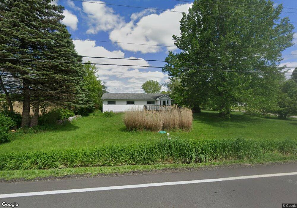
5388 State Route 46 Cortland, OH 44410
Estimated Value: $158,000 - $188,000
3
Beds
2
Baths
1,392
Sq Ft
$122/Sq Ft
Est. Value
About This Home
This home is located at 5388 State Route 46, Cortland, OH 44410 and is currently estimated at $169,756, approximately $121 per square foot. 5388 State Route 46 is a home located in Trumbull County with nearby schools including Maplewood Middle School, Maplewood Elementary School, and Maplewood High School.
Ownership History
Date
Name
Owned For
Owner Type
Purchase Details
Closed on
Mar 15, 2020
Sold by
Klein Ernest G
Bought by
Smith Cody T and Smith Sarah J
Current Estimated Value
Home Financials for this Owner
Home Financials are based on the most recent Mortgage that was taken out on this home.
Original Mortgage
$101,788
Outstanding Balance
$89,976
Interest Rate
3.4%
Mortgage Type
VA
Estimated Equity
$79,780
Purchase Details
Closed on
Jul 22, 2014
Sold by
White Sonja E
Bought by
Klein Ernest C
Purchase Details
Closed on
Nov 2, 2005
Sold by
Koren Friederike
Bought by
Koren Friederike
Purchase Details
Closed on
Sep 19, 2003
Sold by
Blackann Micheal N and Blackann Katherine M
Bought by
Koren Friederike
Purchase Details
Closed on
Dec 19, 2001
Sold by
Blackann Harriet
Bought by
Blackann Michael N and Blackann Katherine M
Purchase Details
Closed on
Jan 1, 1990
Bought by
Harriet Blackann
Create a Home Valuation Report for This Property
The Home Valuation Report is an in-depth analysis detailing your home's value as well as a comparison with similar homes in the area
Home Values in the Area
Average Home Value in this Area
Purchase History
| Date | Buyer | Sale Price | Title Company |
|---|---|---|---|
| Smith Cody T | $97,500 | None Available | |
| Klein Ernest C | $33,500 | None Available | |
| Koren Friederike | -- | -- | |
| Koren Friederike | $95,000 | -- | |
| Blackann Michael N | $69,500 | -- | |
| Harriet Blackann | -- | -- |
Source: Public Records
Mortgage History
| Date | Status | Borrower | Loan Amount |
|---|---|---|---|
| Open | Smith Cody T | $101,788 |
Source: Public Records
Tax History Compared to Growth
Tax History
| Year | Tax Paid | Tax Assessment Tax Assessment Total Assessment is a certain percentage of the fair market value that is determined by local assessors to be the total taxable value of land and additions on the property. | Land | Improvement |
|---|---|---|---|---|
| 2024 | $1,444 | $36,580 | $5,180 | $31,400 |
| 2023 | $1,444 | $36,580 | $5,180 | $31,400 |
| 2022 | $1,150 | $25,910 | $4,870 | $21,040 |
| 2021 | $1,213 | $25,910 | $4,870 | $21,040 |
| 2020 | $1,189 | $25,910 | $4,870 | $21,040 |
| 2019 | $1,137 | $23,630 | $4,520 | $19,110 |
| 2018 | $1,291 | $23,630 | $4,520 | $19,110 |
| 2017 | $1,289 | $23,630 | $4,520 | $19,110 |
| 2016 | $1,332 | $27,970 | $4,100 | $23,870 |
| 2015 | $1,293 | $27,970 | $4,100 | $23,870 |
| 2014 | $1,288 | $27,970 | $4,100 | $23,870 |
| 2013 | $1,321 | $27,970 | $4,100 | $23,870 |
Source: Public Records
Map
Nearby Homes
- 4869 Phillips Rice Rd
- 2684 Griffith Dr
- 6101 Private
- 507 Tournament Trail
- 5294 Cottage Dr
- 400 Tournament Trail Unit 400
- 121 Fairway Dr
- 525 Sycamore Trail
- 428 Cherry Hill Ln
- 101 Elizabeth Ct
- 404 Cherry Hill Ln
- 0 N High St
- 6247 Love Warner Rd
- 0 St Andrews Unit 5113795
- 155 Heritage Ln
- 160 Saint Andrews
- 163 N Mecca St Unit 167
- 124 Saint Andrews
- 20 Harneds Landing Unit 20
- 167 S Mecca St
- 5388 Ohio 46
- 5372 State Route 46
- 5372 State Route 46
- 6381 State Route 46
- 5362 State Route 46
- 5391 State Route 46
- 5421 State Route 46
- 5333 State Route 46
- 5431 State Route 46
- 5419 State Route 46
- 5451 State Route 46
- 5375 State Route 46 Unit F
- 5375 State Route 46 Unit F
- 5375 State Route 46
- 5375 State Route 46
- 5371 State Route 46
- 5371 State Route 46 Unit B
- 5371 State Route 46 Unit H
- 5371 State Route 46
- 5371 State Route 46