Estimated Value: $115,000 - $168,000
3
Beds
1
Bath
921
Sq Ft
$159/Sq Ft
Est. Value
About This Home
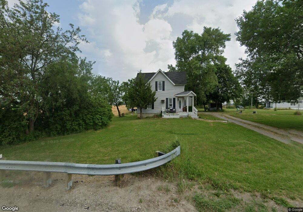
This home is located at 5388 Us Highway 20a, Delta, OH 43515 and is currently estimated at $146,324, approximately $158 per square foot. 5388 Us Highway 20a is a home located in Fulton County with nearby schools including Delta Elementary School, Pike-Delta-York Middle School, and Pike-Delta-York High School.
Ownership History
Date
Name
Owned For
Owner Type
Purchase Details
Closed on
Jun 20, 2006
Sold by
Brown Kevin W
Bought by
Brown Lori Ann
Current Estimated Value
Purchase Details
Closed on
Jul 27, 1995
Sold by
Shanteau Donn M
Bought by
Anderson Richard C
Purchase Details
Closed on
Jan 1, 1990
Bought by
Brown Kevin W and Brown Lori A
Create a Home Valuation Report for This Property
The Home Valuation Report is an in-depth analysis detailing your home's value as well as a comparison with similar homes in the area
Home Values in the Area
Average Home Value in this Area
Purchase History
| Date | Buyer | Sale Price | Title Company |
|---|---|---|---|
| Brown Lori Ann | -- | None Available | |
| Anderson Richard C | $27,000 | -- | |
| Brown Kevin W | -- | -- |
Source: Public Records
Tax History Compared to Growth
Tax History
| Year | Tax Paid | Tax Assessment Tax Assessment Total Assessment is a certain percentage of the fair market value that is determined by local assessors to be the total taxable value of land and additions on the property. | Land | Improvement |
|---|---|---|---|---|
| 2024 | $3,934 | $40,950 | $14,630 | $26,320 |
| 2023 | $1,607 | $40,950 | $14,630 | $26,320 |
| 2022 | $1,576 | $31,680 | $12,180 | $19,500 |
| 2021 | $1,463 | $31,680 | $12,180 | $19,500 |
| 2020 | $1,482 | $28,950 | $9,450 | $19,500 |
| 2019 | $1,090 | $22,120 | $8,820 | $13,300 |
| 2018 | $1,082 | $22,120 | $8,820 | $13,300 |
| 2017 | $1,074 | $22,120 | $8,820 | $13,300 |
| 2016 | $1,070 | $21,250 | $8,820 | $12,430 |
| 2015 | $1,097 | $21,250 | $8,820 | $12,430 |
| 2014 | $1,095 | $21,250 | $8,820 | $12,430 |
| 2013 | $956 | $18,310 | $9,030 | $9,280 |
Source: Public Records
Map
Nearby Homes
- 929 Linwood Ave
- 11 Meadow Lane Dr
- 703 Linwood Ave
- 701 Palmwood St
- 518 Providence St
- 600 Fernwood St
- 305 Mckinley St
- 421 Providence St
- 413 Fernwood St
- 500 Sandalwood Ln
- 308 Monroe St
- 434 Monroe St
- 452 Monroe St
- 6854 County Road 3
- 3121 County Road Ef
- 5390 County Road D
- 7893 County Road 2
- 4265 County Road 3
- 2076 County Rd E
- 9163 County Road F
- 5389 Us Highway 20a
- 5320 Us Highway 20a
- 5270 Us Highway 20a
- 0 Co Road 5-2 County Rd Unit 6044766
- 0 Co Road 5-2 County Rd Unit 6044765
- 0 Co Road 5-2 County Rd Unit 6044763
- 5529 Us Highway 20a
- 5332 US Highway 20a
- 7053 Co Rd 5-2
- 7053 County Road 5 2 Unit 4
- 6931 County Road E Unit 5-2
- 5181 Us Highway 20a
- 5618 Us Highway 20a
- 5618 Us Highway 20a
- 5618 U S 20a
- 5100 U S 20 Alternate
- 7330 County Road 5 2
- 5720 Us Highway 20a
- 5750 County Road G
- 5810 County Road G Unit 6-3