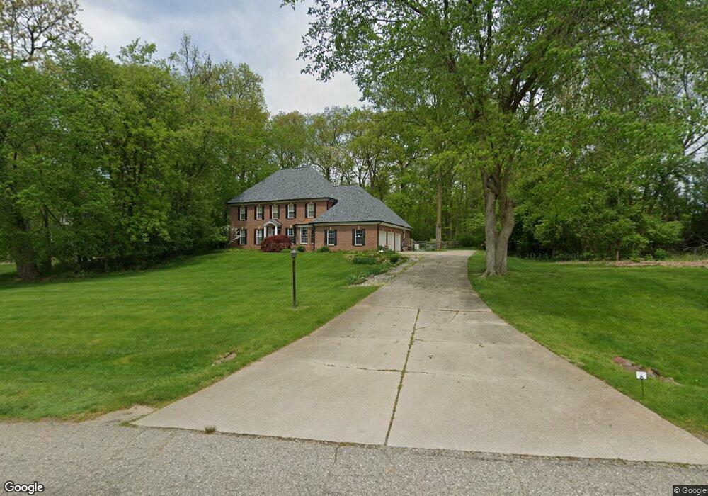
5389 Overbrook Dr Unit 19 Ann Arbor, MI 48105
Thurston NeighborhoodEstimated Value: $924,017 - $1,091,000
4
Beds
3
Baths
3,386
Sq Ft
$305/Sq Ft
Est. Value
About This Home
This home is located at 5389 Overbrook Dr Unit 19, Ann Arbor, MI 48105 and is currently estimated at $1,032,754, approximately $305 per square foot. 5389 Overbrook Dr Unit 19 is a home located in Washtenaw County with nearby schools including Logan Elementary School, Clague Middle School, and Huron High School.
Ownership History
Date
Name
Owned For
Owner Type
Purchase Details
Closed on
May 19, 2003
Sold by
Wolk Seth W and Wolk Ruth Anne
Bought by
Freatman Ellis B and Freatman Sara E
Current Estimated Value
Home Financials for this Owner
Home Financials are based on the most recent Mortgage that was taken out on this home.
Original Mortgage
$504,000
Outstanding Balance
$220,802
Interest Rate
5.9%
Mortgage Type
Purchase Money Mortgage
Estimated Equity
$811,952
Create a Home Valuation Report for This Property
The Home Valuation Report is an in-depth analysis detailing your home's value as well as a comparison with similar homes in the area
Home Values in the Area
Average Home Value in this Area
Purchase History
| Date | Buyer | Sale Price | Title Company |
|---|---|---|---|
| Freatman Ellis B | $630,000 | -- |
Source: Public Records
Mortgage History
| Date | Status | Borrower | Loan Amount |
|---|---|---|---|
| Open | Freatman Ellis B | $504,000 |
Source: Public Records
Tax History
| Year | Tax Paid | Tax Assessment Tax Assessment Total Assessment is a certain percentage of the fair market value that is determined by local assessors to be the total taxable value of land and additions on the property. | Land | Improvement |
|---|---|---|---|---|
| 2025 | $8,491 | $430,300 | $0 | $0 |
| 2024 | $8,287 | $395,400 | $0 | $0 |
| 2023 | $7,963 | $362,200 | $0 | $0 |
| 2022 | $11,821 | $339,800 | $0 | $0 |
| 2021 | $11,537 | $339,700 | $0 | $0 |
| 2020 | $11,640 | $312,000 | $0 | $0 |
| 2019 | $10,973 | $288,700 | $288,700 | $0 |
| 2018 | $10,535 | $308,000 | $60,000 | $248,000 |
| 2017 | $10,161 | $306,900 | $0 | $0 |
| 2016 | $6,630 | $263,288 | $0 | $0 |
| 2015 | $9,179 | $262,501 | $0 | $0 |
| 2014 | $9,179 | $254,300 | $0 | $0 |
| 2013 | -- | $254,300 | $0 | $0 |
Source: Public Records
Map
Nearby Homes
- 3418 N Dixboro Rd
- 6270 Plymouth Rd
- 5860 Ford Rd
- 6480 Warren Rd
- 3753 Kinsley Blvd
- 6400 Warren Rd
- 1696 Warren Rd
- 1688 Warren Rd
- 3300 Hillshire Ct
- 1688-1696 Warren Rd
- 5900 Cherry Hill Rd
- 5024 E Joy Rd
- 5980 Cherry Hill Rd
- 5583 Great Hawk Cir Unit G6
- 3418 Burbank Dr Unit 367
- 3252 Bolgos Cir
- 3184 Bolgos Cir
- 3213 Kilburn Park Cir Unit 118
- 3374 Cromwell Rd Unit 29
- 5902 Cherry Hill Rd
- 5355 Kelsey Cir
- 5366 Overbrook Dr
- 3689 Rolling Ridge Ct
- 3711 Rolling Ridge Ct Unit 17
- 3671 Deer Ridge Ct
- 3723 Rolling Ridge Ct
- 5301 Overbrook Dr
- 5410 Overbrook Dr
- 3735 Rolling Ridge Ct
- 3694 Rolling Ridge Ct Unit 11
- 3674 Knoll Creek Ct
- 3664 Deer Ridge Ct
- 5516 Overbrook Dr
- 5257 Overbrook Dr
- 5369 Kelsey Cir
- 0 Knoll Creek Ct
- 3747 Rolling Ridge Ct
- 3742 Rolling Ridge Ct
- 3718 Rolling Ridge Ct
- 3652 Deer Ridge Ct
Your Personal Tour Guide
Ask me questions while you tour the home.