H
Seller's Agent in 2022
Heather Mistretta
Windermere RE Southern Oregon
(541) 660-4317
81 Total Sales
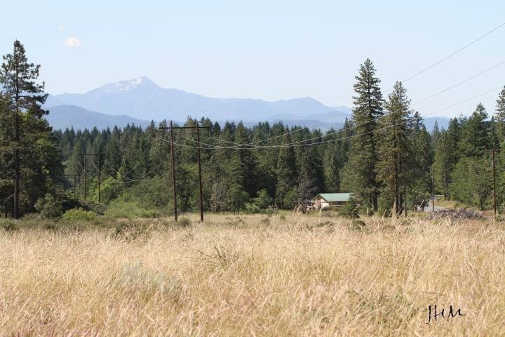

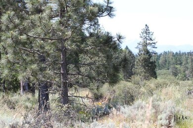
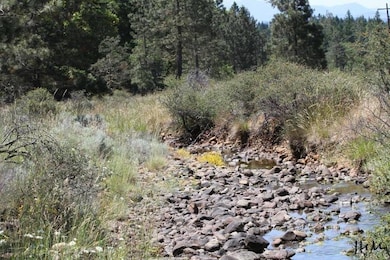
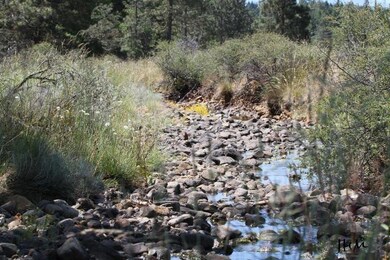
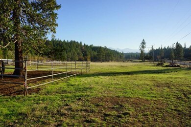

Nearly 50 acres of land, seasonal stream, pond, level pasture ground with southern exposure (full sun all day long!). Build your dream home atop the hill & enjoy gorgeous mountain & valley views. The property is adjoined by acres of BLM & the Westside Trails System, part of the Illinois River Forks State Park, a network of loop trails that start at the three mile marker on Westside Rd and go for miles through the forest to vista points overlooking the Illinois River & Valley. All this could be right at your own back door! The Serpentine (S) zoning allows for dividing as small as 20 acre parcels (check with county). Serpentine zoning allows for MANY different uses: Agricultural, farmland, residential to name only a few. Owner will consider carrying with large down.
Last Agent to Sell the Property
Windermere RE Southern Oregon Brokerage Phone: 541-476-2000 License #201207503 Listed on: 11/12/2022

Last Buyer's Agent
Windermere RE Southern Oregon Brokerage Phone: 541-476-2000 License #201207503 Listed on: 11/12/2022
| Date | Event | Price | List to Sale | Price per Sq Ft |
|---|---|---|---|---|
| 12/16/2022 12/16/22 | Sold | $130,000 | -16.1% | -- |
| 11/29/2022 11/29/22 | Pending | -- | -- | -- |
| 11/12/2022 11/12/22 | For Sale | $155,000 | 0.0% | -- |
| 10/30/2022 10/30/22 | Pending | -- | -- | -- |
| 09/22/2022 09/22/22 | For Sale | $155,000 | -- | -- |
| Year | Tax Paid | Tax Assessment Tax Assessment Total Assessment is a certain percentage of the fair market value that is determined by local assessors to be the total taxable value of land and additions on the property. | Land | Improvement |
|---|---|---|---|---|
| 2025 | $129 | $18,290 | -- | -- |
| 2024 | $129 | $17,760 | -- | -- |
| 2023 | $105 | $17,250 | $0 | $0 |
| 2022 | $103 | $16,760 | $0 | $0 |
| 2021 | $102 | $16,270 | $0 | $0 |
H
Seller's Agent in 2022
Heather Mistretta
Windermere RE Southern Oregon
(541) 660-4317
81 Total Sales
Source: Oregon Datashare
MLS Number: 220154132
APN: R347773
Disclaimer: Certain information contained herein is derived from information provided by parties other than Homes.com. All information provided is deemed reliable, but is not guaranteed to be accurate and should be independently verified.
![]() © 2026 Oregon Datashare (KCAR | MLSCO | SOMLS). All rights reserved. The data relating to real estate for sale on this web site comes in part from the Internet Data Exchange Program of the Oregon Datashare. Real estate listings held by IDX Brokerage firms other than Ten-X are marked with the Internet Data Exchange logo or the Internet Data Exchange thumbnail logo and detailed information about them includes the name of the listing Brokers. Information provided is for consumers' personal, non-commercial use and may not be used for any purpose other than to identify prospective properties the viewer may be interested in purchasing. The consumer will not copy, retransmit nor redistribute any of the content from this website. Information provided is deemed reliable, but not guaranteed.
© 2026 Oregon Datashare (KCAR | MLSCO | SOMLS). All rights reserved. The data relating to real estate for sale on this web site comes in part from the Internet Data Exchange Program of the Oregon Datashare. Real estate listings held by IDX Brokerage firms other than Ten-X are marked with the Internet Data Exchange logo or the Internet Data Exchange thumbnail logo and detailed information about them includes the name of the listing Brokers. Information provided is for consumers' personal, non-commercial use and may not be used for any purpose other than to identify prospective properties the viewer may be interested in purchasing. The consumer will not copy, retransmit nor redistribute any of the content from this website. Information provided is deemed reliable, but not guaranteed.
Ask me questions while you tour the home.