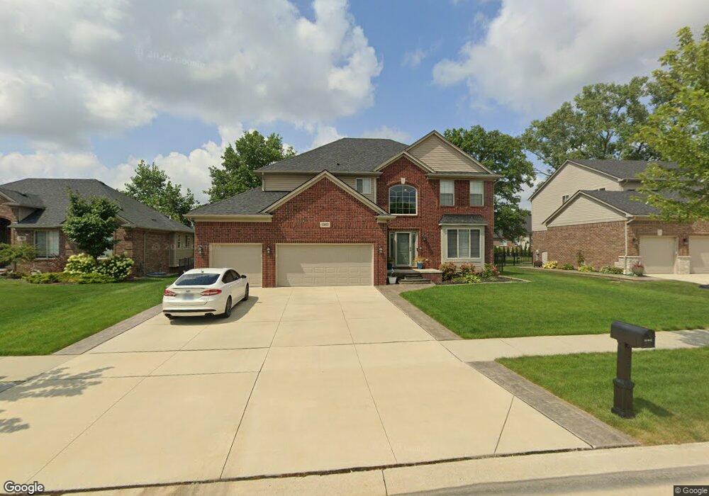
53893 Connor Dr New Baltimore, MI 48051
Estimated Value: $465,015 - $556,000
4
Beds
3
Baths
2,581
Sq Ft
$195/Sq Ft
Est. Value
About This Home
This home is located at 53893 Connor Dr, New Baltimore, MI 48051 and is currently estimated at $503,254, approximately $194 per square foot. 53893 Connor Dr is a home with nearby schools including Francis A. Higgins Elementary School, L'Anse Creuse High School - North, and Merritt Academy.
Ownership History
Date
Name
Owned For
Owner Type
Purchase Details
Closed on
Nov 29, 2023
Sold by
Kierzkowski Steven and Kierzkowski Marilena
Bought by
Kierzkowski Family Revocable Trust and Kierzkowski
Current Estimated Value
Purchase Details
Closed on
Mar 31, 2017
Sold by
Acadia Home Builders Llc
Bought by
Kierzkowski Steven and Kierzkowski Marilena
Home Financials for this Owner
Home Financials are based on the most recent Mortgage that was taken out on this home.
Original Mortgage
$299,250
Interest Rate
4.1%
Mortgage Type
New Conventional
Purchase Details
Closed on
Mar 11, 2009
Sold by
Hickey Road Joint Venture
Bought by
Acadia Development Group Llc
Create a Home Valuation Report for This Property
The Home Valuation Report is an in-depth analysis detailing your home's value as well as a comparison with similar homes in the area
Home Values in the Area
Average Home Value in this Area
Purchase History
| Date | Buyer | Sale Price | Title Company |
|---|---|---|---|
| Kierzkowski Family Revocable Trust | -- | None Listed On Document | |
| Kierzkowski Family Revocable Trust | -- | None Listed On Document | |
| Kierzkowski Steven | $316,875 | First American Title Insuran | |
| Acadia Home Builders Llc | -- | First American Title Insuran | |
| Acadia Development Group Llc | -- | None Available |
Source: Public Records
Mortgage History
| Date | Status | Borrower | Loan Amount |
|---|---|---|---|
| Previous Owner | Kierzkowski Steven | $299,250 |
Source: Public Records
Tax History
| Year | Tax Paid | Tax Assessment Tax Assessment Total Assessment is a certain percentage of the fair market value that is determined by local assessors to be the total taxable value of land and additions on the property. | Land | Improvement |
|---|---|---|---|---|
| 2025 | $4,673 | $228,700 | $0 | $0 |
| 2024 | $45 | $212,700 | $0 | $0 |
| 2023 | $4,309 | $186,200 | $0 | $0 |
| 2022 | $6,006 | $179,100 | $0 | $0 |
| 2021 | $5,841 | $175,600 | $0 | $0 |
| 2020 | $3,903 | $170,000 | $0 | $0 |
| 2019 | $5,309 | $162,400 | $0 | $0 |
| 2018 | $5,270 | $160,500 | $18,100 | $142,400 |
| 2017 | $849 | $18,150 | $0 | $0 |
| 2016 | $677 | $18,150 | $0 | $0 |
| 2015 | $148 | $18,150 | $0 | $0 |
| 2014 | $148 | $18,150 | $18,150 | $0 |
| 2012 | -- | $0 | $0 | $0 |
Source: Public Records
Map
Nearby Homes
- 53925 Andrew Dr
- 29104 Philadelphia Dr Unit 13
- 29384 Jennifer Dr
- 30060 Hickey Rd
- 30100 Hickey Rd
- 30009 Quincy St
- 53261 Butternut St
- 53114 Ridgewood Dr
- 53244 Glen Oak Dr
- 53392 Crawford Dr
- 52668 Cedarwood Ct Unit 30
- 30641 Sarah Melisa Dr
- 53064 Barberry Cir
- 53153 Gratiot Ave
- 52526 Green Ash Ct Unit 150
- 53650 N Foster Rd
- N W Corner 24 Mile & Gratiot Ave
- 53198 Spurry Ln
- 52239 Landsdowne Cir
- 53990 N Foster Rd
- 53905 Connor Dr
- 53881 Connor Dr
- 53917 Connor Dr
- 53869 Connor Dr
- 53929 Connor Dr
- 53857 Connor Dr
- 53894 Connor Dr
- 29686 Anthony Ct
- 59156 Connor Dr
- 53906 Connor Dr
- 53882 Connor Dr
- 29662 Anthony Ct
- 29673 Anthony Ct
- 53918 Connor Dr
- 53870 Connor Dr
- 53858 Connor Dr
- 53941 Connor Dr
- 53930 Connor Dr
- 29707 Kevin Dr
- 53845 Connor Dr
Your Personal Tour Guide
Ask me questions while you tour the home.