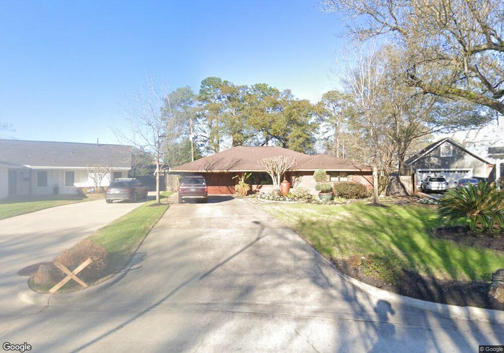
539 Azaleadell Dr Houston, TX 77018
Oak Forest-Garden Oaks NeighborhoodEstimated Value: $713,000 - $831,000
3
Beds
2
Baths
1,916
Sq Ft
$414/Sq Ft
Est. Value
About This Home
This home is located at 539 Azaleadell Dr, Houston, TX 77018 and is currently estimated at $794,108, approximately $414 per square foot. 539 Azaleadell Dr is a home located in Harris County with nearby schools including Garden Oaks Montessori, Frank Black Middle School, and Waltrip High School.
Ownership History
Date
Name
Owned For
Owner Type
Purchase Details
Closed on
Nov 12, 2015
Sold by
Barley Michael Lynn
Bought by
Scarborough Lisa L and The Gloria L Gothard Separate Property T
Current Estimated Value
Purchase Details
Closed on
Aug 28, 2007
Sold by
Hull Kevin B
Bought by
Barley Lonnie Glen
Purchase Details
Closed on
Jun 20, 1994
Sold by
Tompkins Guy Kendall and Tompkins Ellen Ruth
Bought by
Barley Lonnie Glen and Hull Kevin B
Home Financials for this Owner
Home Financials are based on the most recent Mortgage that was taken out on this home.
Original Mortgage
$121,600
Interest Rate
8.75%
Create a Home Valuation Report for This Property
The Home Valuation Report is an in-depth analysis detailing your home's value as well as a comparison with similar homes in the area
Home Values in the Area
Average Home Value in this Area
Purchase History
| Date | Buyer | Sale Price | Title Company |
|---|---|---|---|
| Scarborough Lisa L | -- | None Available | |
| Barley Lonnie Glen | -- | None Available | |
| Barley Lonnie Glen | -- | Texas American Title Company |
Source: Public Records
Mortgage History
| Date | Status | Borrower | Loan Amount |
|---|---|---|---|
| Previous Owner | Barley Lonnie Glen | $121,600 |
Source: Public Records
Tax History Compared to Growth
Tax History
| Year | Tax Paid | Tax Assessment Tax Assessment Total Assessment is a certain percentage of the fair market value that is determined by local assessors to be the total taxable value of land and additions on the property. | Land | Improvement |
|---|---|---|---|---|
| 2025 | $17,081 | $863,345 | $621,814 | $241,531 |
| 2024 | $17,081 | $816,347 | $471,375 | $344,972 |
| 2023 | $17,081 | $735,358 | $401,170 | $334,188 |
| 2022 | $15,193 | $689,995 | $401,170 | $288,825 |
| 2021 | $15,677 | $672,623 | $401,170 | $271,453 |
| 2020 | $15,918 | $657,332 | $401,170 | $256,162 |
| 2019 | $14,844 | $586,621 | $250,731 | $335,890 |
| 2018 | $13,285 | $525,000 | $250,731 | $274,269 |
| 2017 | $13,275 | $525,000 | $250,731 | $274,269 |
| 2016 | $13,275 | $525,000 | $250,731 | $274,269 |
| 2015 | $6,397 | $409,467 | $250,731 | $158,736 |
| 2014 | $6,397 | $387,380 | $250,731 | $136,649 |
Source: Public Records
Map
Nearby Homes
- 535 Azaleadell Dr
- 702 Azaleadell Dr
- 752 Curtin St
- 750 Curtin St
- 748 Curtin St
- 744 Curtin St
- 742 Curtin St
- 739 Azaleadell Dr
- 719 Thornton Rd Unit B
- 719 Thornton Rd Unit E
- 719 Thornton Rd Unit A
- 719 Thornton Rd Unit F
- 9388 Plan at Thornton Oaks
- 9384 Plan at Thornton Oaks
- 811 Thornton Rd Unit B
- 4510 Curtin Park Ct
- 817 Thornton Rd Unit G
- 812 Thornton Rd Unit B
- 4703 Thornton Grove
- 814 Azalea St
- 603 Azaleadell Dr
- 531 Azaleadell Dr
- 607 Azaleadell Dr
- 530 Azaleadell Dr
- 527 Azaleadell Dr
- 611 Azaleadell Dr
- 522 Azaleadell Dr
- 803 Curtin St
- 615 Azaleadell Dr
- 702 Sleepyvale Ln
- 519 Azaleadell Dr
- 518 Azaleadell Dr
- 811 Curtin St
- 710 Sleepyvale Ln
- 623 Azaleadell Dr
- 807 Curtin St
- 514 Azaleadell Dr
- 515 Azaleadell Dr
- 716 Sleepyvale Ln
- 703 Sleepyvale Ln