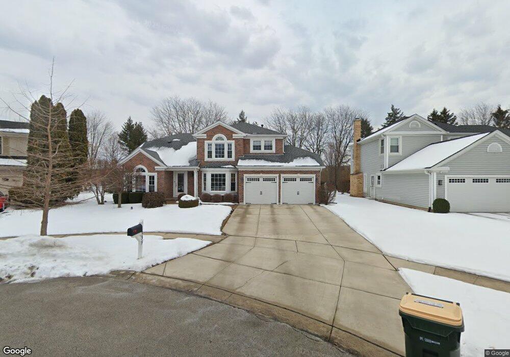
539 Brown Cir Elk Grove Village, IL 60007
Elk Grove Village West NeighborhoodEstimated Value: $669,628 - $708,000
4
Beds
3
Baths
2,518
Sq Ft
$273/Sq Ft
Est. Value
About This Home
This home is located at 539 Brown Cir, Elk Grove Village, IL 60007 and is currently estimated at $688,657, approximately $273 per square foot. 539 Brown Cir is a home located in Cook County with nearby schools including Frederick Nerge Elementary School, Margaret Mead Junior High School, and J B Conant High School.
Ownership History
Date
Name
Owned For
Owner Type
Purchase Details
Closed on
Nov 10, 2005
Sold by
Davis Kirt P and Davis Laura K
Bought by
Davis Kirt P and The Kirt P Davis Declaration Of Trust
Current Estimated Value
Purchase Details
Closed on
Jul 31, 1998
Sold by
Salemi Vincent A and Salemi Roseann
Bought by
Davis Kirt P and Davis Laura K
Home Financials for this Owner
Home Financials are based on the most recent Mortgage that was taken out on this home.
Original Mortgage
$258,200
Outstanding Balance
$54,475
Interest Rate
7.05%
Estimated Equity
$634,182
Create a Home Valuation Report for This Property
The Home Valuation Report is an in-depth analysis detailing your home's value as well as a comparison with similar homes in the area
Home Values in the Area
Average Home Value in this Area
Purchase History
| Date | Buyer | Sale Price | Title Company |
|---|---|---|---|
| Davis Kirt P | -- | None Available | |
| Davis Laura K | -- | None Available | |
| Davis Kirt P | $287,000 | Lawyers Title Insurance Corp |
Source: Public Records
Mortgage History
| Date | Status | Borrower | Loan Amount |
|---|---|---|---|
| Open | Davis Kirt P | $258,200 |
Source: Public Records
Tax History Compared to Growth
Tax History
| Year | Tax Paid | Tax Assessment Tax Assessment Total Assessment is a certain percentage of the fair market value that is determined by local assessors to be the total taxable value of land and additions on the property. | Land | Improvement |
|---|---|---|---|---|
| 2024 | $13,271 | $49,000 | $10,911 | $38,089 |
| 2023 | $12,873 | $49,000 | $10,911 | $38,089 |
| 2022 | $12,873 | $49,000 | $10,911 | $38,089 |
| 2021 | $11,913 | $40,767 | $7,134 | $33,633 |
| 2020 | $12,316 | $40,767 | $7,134 | $33,633 |
| 2019 | $11,690 | $45,297 | $7,134 | $38,163 |
| 2018 | $12,316 | $42,862 | $6,084 | $36,778 |
| 2017 | $12,201 | $42,862 | $6,084 | $36,778 |
| 2016 | $11,634 | $42,862 | $6,084 | $36,778 |
| 2015 | $10,691 | $37,120 | $5,035 | $32,085 |
| 2014 | $10,567 | $37,120 | $5,035 | $32,085 |
| 2013 | $10,278 | $37,120 | $5,035 | $32,085 |
Source: Public Records
Map
Nearby Homes
- 725 Bismark Ct
- 1845 Maryland Dr
- 924 Surrey Dr Unit 1A
- 409 New York Ln
- 833 Thornton Ct Unit 2B
- 826 Thornton Ct Unit 2AL
- 263 Doral Ct Unit 1
- 1810 Hawk Ln
- 1224 Knottingham Ct Unit 1A
- 718 N Point Dr
- 160 Inverness Ct Unit A
- 1124 Lovell Ct
- 722 Merlin Dr Unit 16
- 932 Kentucky Ln
- 1453 Armstrong Ln
- 1385 Scarboro Rd Unit 204
- 1517 White Trail
- 1386 Scarboro Rd Unit 1102
- 373 Southbury Ct Unit D-1
- 620 S Point Dr
- 543 Rutgers Ln
- 537 Brown Cir
- 535 Brown Cir
- 547 Rutgers Ln
- 531 Rutgers Ln
- 544 Rutgers Ln
- 530 Rutgers Ln
- 529 Rutgers Ln
- 552 Rutgers Ln
- 559 Rutgers Ln
- 493 Franklin Ln
- 491 Franklin Ln
- 558 Rutgers Ln
- 495 Franklin Ln
- 526 Rutgers Ln
- 525 Rutgers Ln
- 489 Franklin Ln
- 565 Rutgers Ln
- 600 Meacham Rd Unit B
- 600 Meacham Rd Unit D