Estimated Value: $286,000 - $336,000
3
Beds
2
Baths
1,594
Sq Ft
$190/Sq Ft
Est. Value
About This Home
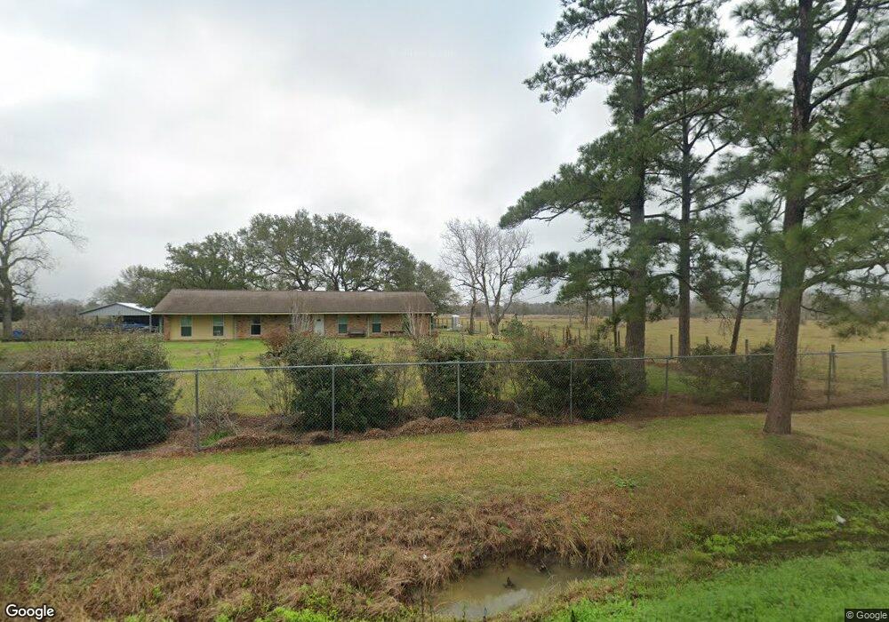
This home is located at 539 Cr 296a, Alvin, TX 77511 and is currently estimated at $303,223, approximately $190 per square foot. 539 Cr 296a is a home located in Brazoria County with nearby schools including Mark Twain Elementary School, G.W. Harby Junior High School, and Alvin High School.
Ownership History
Date
Name
Owned For
Owner Type
Purchase Details
Closed on
Oct 21, 2005
Sold by
Federal National Mortgage Association
Bought by
Teng Sok
Current Estimated Value
Home Financials for this Owner
Home Financials are based on the most recent Mortgage that was taken out on this home.
Original Mortgage
$65,835
Outstanding Balance
$35,216
Interest Rate
5.75%
Mortgage Type
Fannie Mae Freddie Mac
Estimated Equity
$268,007
Purchase Details
Closed on
Jul 5, 2005
Sold by
Mcgilberry William E and Mcgilberry Tariss
Bought by
Mortgage Electronic Registration Systems
Purchase Details
Closed on
Mar 27, 2001
Sold by
Andrews Nancy Lou
Bought by
Mcgilberry William E and Mcgilberry Tariss
Home Financials for this Owner
Home Financials are based on the most recent Mortgage that was taken out on this home.
Original Mortgage
$85,120
Interest Rate
7.13%
Create a Home Valuation Report for This Property
The Home Valuation Report is an in-depth analysis detailing your home's value as well as a comparison with similar homes in the area
Home Values in the Area
Average Home Value in this Area
Purchase History
| Date | Buyer | Sale Price | Title Company |
|---|---|---|---|
| Teng Sok | -- | Texas American Title Company | |
| Mortgage Electronic Registration Systems | $82,083 | -- | |
| Mcgilberry William E | -- | Stewart Title |
Source: Public Records
Mortgage History
| Date | Status | Borrower | Loan Amount |
|---|---|---|---|
| Open | Teng Sok | $65,835 | |
| Previous Owner | Mcgilberry William E | $85,120 |
Source: Public Records
Tax History Compared to Growth
Tax History
| Year | Tax Paid | Tax Assessment Tax Assessment Total Assessment is a certain percentage of the fair market value that is determined by local assessors to be the total taxable value of land and additions on the property. | Land | Improvement |
|---|---|---|---|---|
| 2025 | $794 | $124,434 | $50,000 | $194,210 |
| 2023 | $794 | $102,838 | $50,000 | $196,670 |
| 2022 | $1,981 | $93,489 | $15,000 | $109,030 |
| 2021 | $1,886 | $84,990 | $15,000 | $69,990 |
| 2020 | $1,908 | $84,990 | $15,000 | $69,990 |
| 2019 | $1,976 | $85,510 | $15,000 | $70,510 |
| 2018 | $2,460 | $106,170 | $15,000 | $91,170 |
| 2017 | $2,556 | $109,000 | $15,000 | $94,000 |
| 2016 | $2,556 | $109,000 | $15,000 | $94,000 |
| 2014 | $2,468 | $104,000 | $15,000 | $89,000 |
Source: Public Records
Map
Nearby Homes
- 432 Kendall Crest Dr
- 424 Kendall Crest Dr
- 415 Kendall Crest Dr
- 406 Kendall Crest Dr
- 396 Kendall Crest Dr
- 431 Kendall Crest Dr
- 418 Kendall Crest Dr
- 414 Kendall Crest Dr
- 404 Kendall Crest Dr
- 390 Kendall Crest Dr
- 394 Kendall Crest Dr
- 397 Kendall Crest Dr
- 380 Kendall Crest Dr
- 3629 County Road 870
- 368 Selah Ct
- 103 Cline Dr
- 356 Selah Ct
- 350 Selah Ct
- 726 Rim Water Dr
- 20006 Sanchez Rd
- 539 County Road 296a
- 545 Oliver Ln
- 579 County Road 296a
- 515 County Road 296a
- 591 County Road 296a
- 554 County Road 296a
- lot 46 Oliver Ln
- 577 County Road 296a
- 457 County Road 296a
- 590 County Road 296a
- 605 County Road 296a
- 470 County Road 296a
- 762 County Road 296d
- 296 County Road 296
- 458 County Road 296a
- 748 County Road 296d
- 665 County Road 296a
- 627 County Road 296a
- 792 County Rd
- 712 County Road 296d