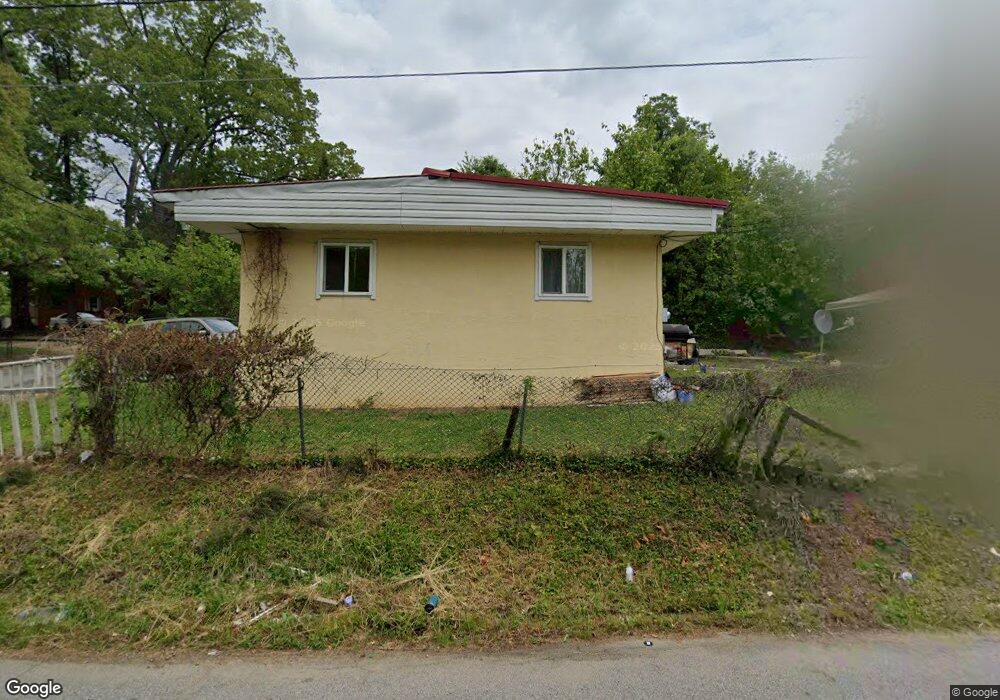
539 Flint Ave High Point, NC 27260
Greater High Point NeighborhoodEstimated Value: $80,591 - $147,000
2
Beds
1
Bath
780
Sq Ft
$138/Sq Ft
Est. Value
About This Home
This home is located at 539 Flint Ave, High Point, NC 27260 and is currently estimated at $107,398, approximately $137 per square foot. 539 Flint Ave is a home located in Guilford County with nearby schools including Oak Hill Elementary School, Ferndale Middle School, and High Point Central High School.
Ownership History
Date
Name
Owned For
Owner Type
Purchase Details
Closed on
Nov 21, 1998
Sold by
Valdes Jorge S and Kroff Riga M
Bought by
Hurtaldo Serafin and Hurtaldo Victoria
Current Estimated Value
Home Financials for this Owner
Home Financials are based on the most recent Mortgage that was taken out on this home.
Original Mortgage
$12,000
Interest Rate
6.77%
Mortgage Type
Seller Take Back
Create a Home Valuation Report for This Property
The Home Valuation Report is an in-depth analysis detailing your home's value as well as a comparison with similar homes in the area
Home Values in the Area
Average Home Value in this Area
Purchase History
| Date | Buyer | Sale Price | Title Company |
|---|---|---|---|
| Hurtaldo Serafin | $16,000 | -- |
Source: Public Records
Mortgage History
| Date | Status | Borrower | Loan Amount |
|---|---|---|---|
| Closed | Hurtaldo Serafin | $12,000 |
Source: Public Records
Tax History
| Year | Tax Paid | Tax Assessment Tax Assessment Total Assessment is a certain percentage of the fair market value that is determined by local assessors to be the total taxable value of land and additions on the property. | Land | Improvement |
|---|---|---|---|---|
| 2025 | $383 | $27,800 | $6,000 | $21,800 |
| 2024 | $383 | $27,800 | $6,000 | $21,800 |
| 2023 | $383 | $27,800 | $6,000 | $21,800 |
| 2022 | $375 | $27,800 | $6,000 | $21,800 |
| 2021 | $296 | $21,500 | $5,500 | $16,000 |
| 2020 | $296 | $21,500 | $5,500 | $16,000 |
| 2019 | $296 | $21,500 | $0 | $0 |
| 2018 | $295 | $21,500 | $0 | $0 |
| 2017 | $295 | $21,500 | $0 | $0 |
| 2016 | $321 | $22,900 | $0 | $0 |
| 2015 | $323 | $22,900 | $0 | $0 |
| 2014 | $328 | $22,900 | $0 | $0 |
Source: Public Records
Map
Nearby Homes
- 537 Flint Ave
- 407 W Willis Ave
- 405 W Willis Ave
- 1213 S Elm St
- 308 W Kearns Ave
- 323 Coltrane Ave
- 1217 Cloverdale St
- 1410 Cloverdale St
- 816 Tryon Ave
- 812 Tryon Ave
- 604 W Ward Ave
- 1504 Cloverdale St
- 703 Langford Ave
- 616 S Elm St
- 328 Ennis St
- 527 Amos St
- 525 Amos St
- 4304 Griffins Gate Ln
- 1603 Connor Place
- 1618 Connor Place
- 1102 Cassell St
- 1105 Cassell St
- 535 Flint Ave
- 1107 Cassell St
- 533 Flint Ave
- 534 Flint Ave
- 1012 Cassell St
- 532 Flint Ave
- 531 Flint Ave Unit A
- 531 Flint Ave
- 1009 Cassell St
- 536 Roy Ave
- 538 Roy Ave
- 530 Flint Ave
- 534 Roy Ave
- 532 Roy Ave
- 529 Flint Ave
- 529 Flint Ave Unit A & B
- 528 Flint Ave
- 528 Roy Ave Unit 530
Your Personal Tour Guide
Ask me questions while you tour the home.