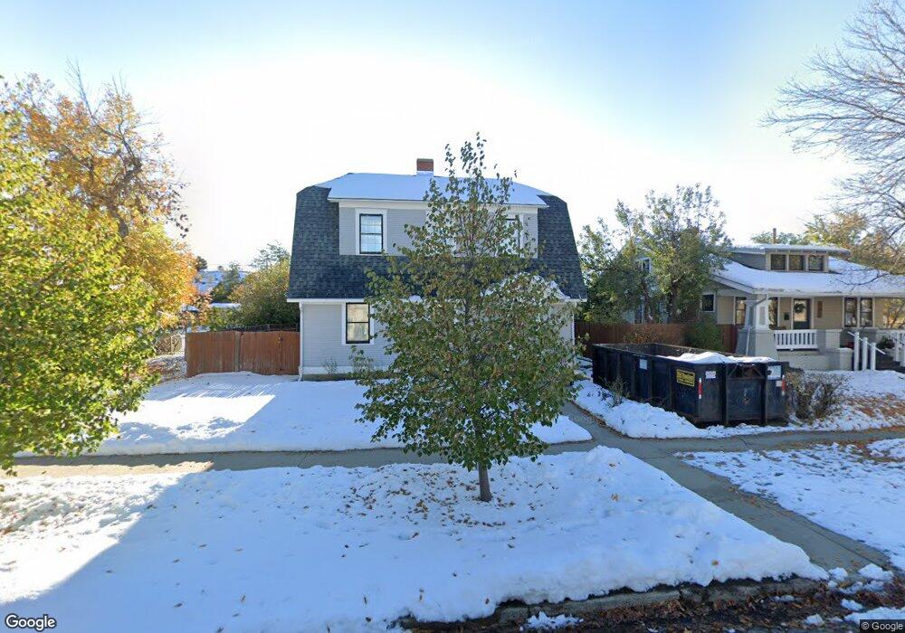
539 Grant Ave Casper, WY 82601
Central Casper NeighborhoodEstimated Value: $310,000
3
Beds
2
Baths
2,504
Sq Ft
$124/Sq Ft
Est. Value
About This Home
This home is located at 539 Grant Ave, Casper, WY 82601 and is currently priced at $310,000, approximately $123 per square foot. 539 Grant Ave is a home located in Natrona County with nearby schools including St. Anthony Tri-Parish Catholic School.
Ownership History
Date
Name
Owned For
Owner Type
Purchase Details
Closed on
Dec 5, 2023
Sold by
5150 Investments Llc
Bought by
Freel Steven and Freel Jennifer
Current Estimated Value
Purchase Details
Closed on
Mar 4, 2022
Sold by
Reeves Richard A and Reeves Janene
Bought by
5150 Investments Llc
Home Financials for this Owner
Home Financials are based on the most recent Mortgage that was taken out on this home.
Original Mortgage
$400,000
Interest Rate
3.69%
Mortgage Type
New Conventional
Create a Home Valuation Report for This Property
The Home Valuation Report is an in-depth analysis detailing your home's value as well as a comparison with similar homes in the area
Home Values in the Area
Average Home Value in this Area
Purchase History
| Date | Buyer | Sale Price | Title Company |
|---|---|---|---|
| Freel Steven | -- | American Title Agency | |
| 5150 Investments Llc | -- | American Title Company |
Source: Public Records
Mortgage History
| Date | Status | Borrower | Loan Amount |
|---|---|---|---|
| Previous Owner | 5150 Investments Llc | $400,000 |
Source: Public Records
Tax History
| Year | Tax Paid | Tax Assessment Tax Assessment Total Assessment is a certain percentage of the fair market value that is determined by local assessors to be the total taxable value of land and additions on the property. | Land | Improvement |
|---|---|---|---|---|
| 2023 | $2,090 | $28,677 | $5,163 | $23,514 |
| 2022 | $1,917 | $26,296 | $4,357 | $21,939 |
| 2021 | $1,459 | $23,010 | $4,501 | $18,509 |
| 2020 | $1,710 | $23,460 | $7,182 | $16,278 |
| 2019 | $1,361 | $21,670 | $4,389 | $17,281 |
| 2018 | $1,449 | $22,877 | $4,389 | $18,488 |
| 2017 | $1,226 | $22,813 | $4,389 | $18,424 |
| 2015 | $1,736 | $26,810 | $4,389 | $22,421 |
| 2014 | $1,704 | $26,384 | $4,389 | $21,995 |
Source: Public Records
Map
Nearby Homes
- 46000 U S Highway 20
- 239 S Mckinley St
- 632 S Jackson St
- 623 S Wolcott St
- 205 E 8th St
- 440 E 11th St
- 1117 S Lincoln St
- 1007 S Wolcott St
- 1302 E 7th St
- 340 S David St
- 336 S David St
- 1016 S Washington St
- 241 S Mckinley St
- 1227 S Center St
- 1223 S Wilson St
- 428 W 12th St
- 1242 S Elm St
- 0 Casper Mountain Rd Unit 20256509
- 606 W 11th St
- 1545 S David St
- 527 Grant Ave
- 547 Grant Ave
- 718 Badger Ave
- 517 Grant Ave
- 517 Grant Ave Unit 5th St.
- 730 Badger Ave
- 562 S Lincoln St
- 562 S Lincoln St Unit 5th
- 558 S Lincoln St
- 719 Badger Ave
- 536 Grant Ave
- 602 S Lincoln St
- 603 Grant Ave
- 603 Grant Ave Unit Badger Ave.
- 612 S Lincoln St
- 526 Grant Ave
- 731 Badger Ave
- 719 E 5th St
- 544 Grant Ave
- 709 E 5th St
Your Personal Tour Guide
Ask me questions while you tour the home.