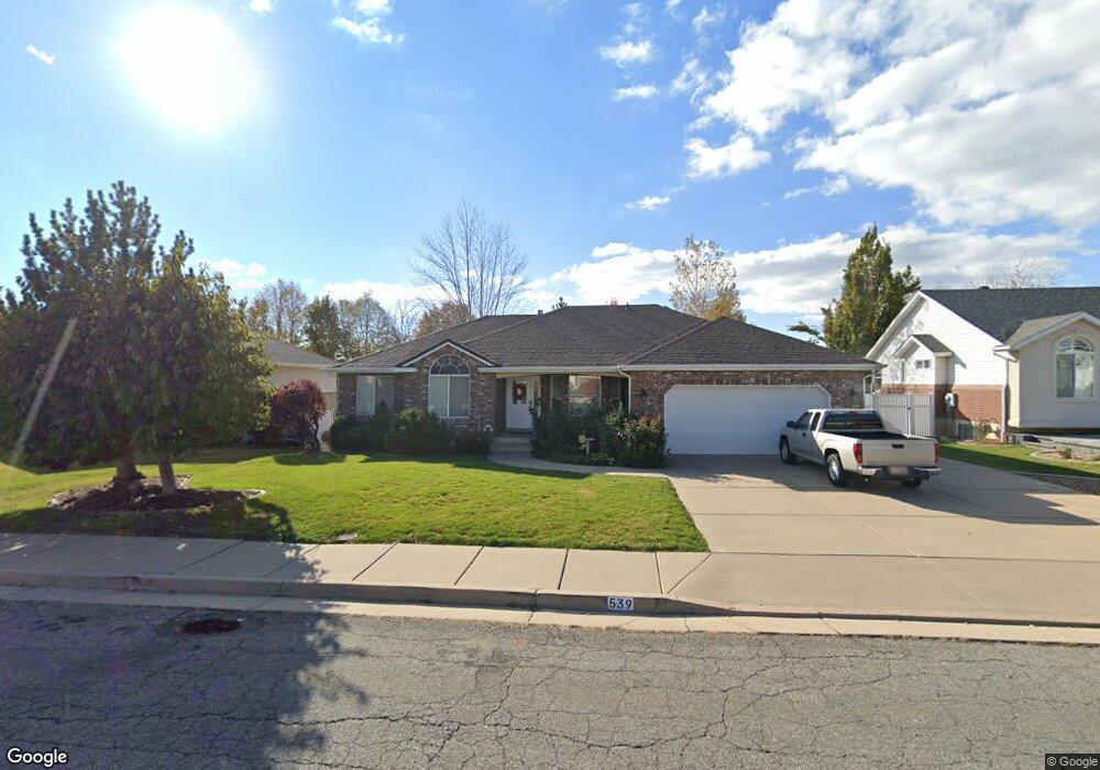
539 N 1100 E Layton, UT 84040
Estimated Value: $645,000 - $726,000
6
Beds
4
Baths
3,544
Sq Ft
$192/Sq Ft
Est. Value
About This Home
This home is located at 539 N 1100 E, Layton, UT 84040 and is currently estimated at $680,179, approximately $191 per square foot. 539 N 1100 E is a home located in Davis County with nearby schools including King Elementary School, Central Davis Junior High School, and Layton High School.
Ownership History
Date
Name
Owned For
Owner Type
Purchase Details
Closed on
Sep 3, 2021
Sold by
Mcdonald Diana E and Mcdonald James Brett
Bought by
Mcdonald James Brett and Mcdonald Diana E
Current Estimated Value
Home Financials for this Owner
Home Financials are based on the most recent Mortgage that was taken out on this home.
Original Mortgage
$212,000
Outstanding Balance
$177,783
Interest Rate
2.8%
Mortgage Type
New Conventional
Estimated Equity
$502,396
Purchase Details
Closed on
Jun 13, 2014
Sold by
Mcdonald Diana E and Mcdonald James B
Bought by
Mcdonald Diana E and Mcdonald James Brett
Home Financials for this Owner
Home Financials are based on the most recent Mortgage that was taken out on this home.
Original Mortgage
$237,600
Interest Rate
4.16%
Mortgage Type
New Conventional
Purchase Details
Closed on
Aug 18, 2005
Sold by
Mcdonald James B and Mcdonald Diana E
Bought by
Mcdonald Diana E and Mcdonald James B
Home Financials for this Owner
Home Financials are based on the most recent Mortgage that was taken out on this home.
Original Mortgage
$182,700
Interest Rate
5.61%
Mortgage Type
New Conventional
Purchase Details
Closed on
Dec 3, 1997
Sold by
Covington Vaughn T
Bought by
Mcdonald James B and Mcdonald Diana E
Home Financials for this Owner
Home Financials are based on the most recent Mortgage that was taken out on this home.
Original Mortgage
$137,700
Interest Rate
7.31%
Create a Home Valuation Report for This Property
The Home Valuation Report is an in-depth analysis detailing your home's value as well as a comparison with similar homes in the area
Home Values in the Area
Average Home Value in this Area
Purchase History
| Date | Buyer | Sale Price | Title Company |
|---|---|---|---|
| Mcdonald James Brett | -- | Cottonwood Title Ins | |
| Mcdonald Diana E | -- | Cottonwood Title | |
| Mcdonald Diana E | -- | Canyon View Title Ins Agency | |
| Mcdonald James B | -- | Security Title Company |
Source: Public Records
Mortgage History
| Date | Status | Borrower | Loan Amount |
|---|---|---|---|
| Open | Mcdonald James Brett | $212,000 | |
| Closed | Mcdonald Diana E | $237,600 | |
| Closed | Mcdonald Diana E | $182,700 | |
| Closed | Mcdonald James B | $137,700 |
Source: Public Records
Tax History
| Year | Tax Paid | Tax Assessment Tax Assessment Total Assessment is a certain percentage of the fair market value that is determined by local assessors to be the total taxable value of land and additions on the property. | Land | Improvement |
|---|---|---|---|---|
| 2025 | $3,071 | $322,300 | $134,914 | $187,386 |
| 2024 | $2,934 | $310,200 | $156,836 | $153,364 |
| 2023 | $3,015 | $562,000 | $207,475 | $354,525 |
| 2022 | $3,179 | $321,750 | $111,637 | $210,113 |
| 2021 | $224 | $408,000 | $170,459 | $237,541 |
| 2020 | $2,479 | $359,000 | $140,259 | $218,741 |
| 2019 | $2,418 | $343,000 | $124,808 | $218,192 |
| 2018 | $2,240 | $319,000 | $98,914 | $220,086 |
| 2016 | $2,398 | $176,165 | $51,694 | $124,471 |
| 2015 | $2,227 | $155,265 | $51,694 | $103,571 |
| 2014 | $2,078 | $148,184 | $51,694 | $96,490 |
| 2013 | -- | $141,870 | $29,444 | $112,426 |
Source: Public Records
Map
Nearby Homes
- 479 N 1375 E
- 508 N Adamswood Rd
- 1503 E 530 N
- 556 N Fairfield Rd Unit A2
- 556 N Fairfield Rd Unit D1
- 556 N Fairfield Rd Unit D2
- 556 N Fairfield Rd Unit A3
- 556 N Fairfield Rd Unit D3
- 556 N Fairfield Rd Unit D4
- 556 N Fairfield Rd Unit A1
- 556 N Fairfield Rd Unit A4
- 861 E 575 N
- 187 N Talbot Dr
- 1515 E Gentile St
- 1033 E 825 N
- 997 E 825 N
- 1690 E Gentile St
- 109 Beacon Ave
- 9 Colonial Ave
- 1545 E 975 N
Your Personal Tour Guide
Ask me questions while you tour the home.