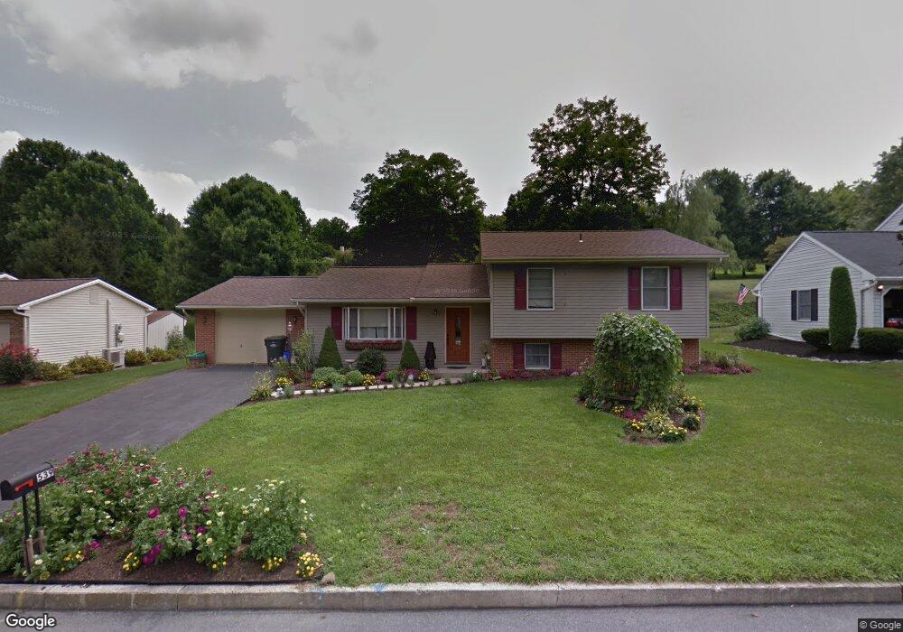
539 Randall Cir Hummelstown, PA 17036
Estimated Value: $386,000 - $432,000
4
Beds
3
Baths
1,450
Sq Ft
$282/Sq Ft
Est. Value
About This Home
This home is located at 539 Randall Cir, Hummelstown, PA 17036 and is currently estimated at $408,711, approximately $281 per square foot. 539 Randall Cir is a home located in Dauphin County with nearby schools including Hershey Elementary School, Hershey Primary Elementary School, and Hershey Middle School.
Ownership History
Date
Name
Owned For
Owner Type
Purchase Details
Closed on
Jun 12, 2008
Sold by
Quiafe Jason R
Bought by
Deiterick Laureen K
Current Estimated Value
Home Financials for this Owner
Home Financials are based on the most recent Mortgage that was taken out on this home.
Original Mortgage
$93,000
Outstanding Balance
$59,556
Interest Rate
6.01%
Mortgage Type
New Conventional
Estimated Equity
$349,155
Purchase Details
Closed on
Jul 29, 2005
Sold by
Yaklowich Joseph J
Bought by
Quaife Jason R
Home Financials for this Owner
Home Financials are based on the most recent Mortgage that was taken out on this home.
Original Mortgage
$199,192
Interest Rate
5.67%
Mortgage Type
VA
Create a Home Valuation Report for This Property
The Home Valuation Report is an in-depth analysis detailing your home's value as well as a comparison with similar homes in the area
Home Values in the Area
Average Home Value in this Area
Purchase History
| Date | Buyer | Sale Price | Title Company |
|---|---|---|---|
| Deiterick Laureen K | $215,000 | -- | |
| Quaife Jason R | $195,000 | -- |
Source: Public Records
Mortgage History
| Date | Status | Borrower | Loan Amount |
|---|---|---|---|
| Open | Deiterick Laureen K | $93,000 | |
| Previous Owner | Quaife Jason R | $199,192 |
Source: Public Records
Tax History Compared to Growth
Tax History
| Year | Tax Paid | Tax Assessment Tax Assessment Total Assessment is a certain percentage of the fair market value that is determined by local assessors to be the total taxable value of land and additions on the property. | Land | Improvement |
|---|---|---|---|---|
| 2025 | $5,488 | $175,600 | $31,100 | $144,500 |
| 2024 | $5,158 | $175,600 | $31,100 | $144,500 |
| 2023 | $5,066 | $175,600 | $31,100 | $144,500 |
| 2022 | $4,954 | $175,600 | $31,100 | $144,500 |
| 2021 | $4,954 | $175,600 | $31,100 | $144,500 |
| 2020 | $4,954 | $175,600 | $31,100 | $144,500 |
| 2019 | $4,864 | $175,600 | $31,100 | $144,500 |
| 2018 | $4,735 | $175,600 | $31,100 | $144,500 |
| 2017 | $4,735 | $175,600 | $31,100 | $144,500 |
| 2016 | $0 | $175,600 | $31,100 | $144,500 |
| 2015 | -- | $175,600 | $31,100 | $144,500 |
| 2014 | -- | $175,600 | $31,100 | $144,500 |
Source: Public Records
Map
Nearby Homes
- 1243 Peggy Dr
- 579 Roslaire Dr
- 547 Roslaire Dr
- 1165 Wicklow Ct
- 610 Carrington Ct
- 1203 Galway Ct
- 589 Lovell Ct
- 1421 Jill Dr
- 612 Olde Ventura Farm Rd
- 954 Debra Dr
- 875 Verden Dr
- 908 Sunnyside Rd
- 1565 Brookline Dr
- 162 High Pointe Dr
- 159 High Pointe Dr
- 124 High Pointe Dr Unit 35
- 123 High Pointe Dr Unit 36
- 931 Hill Church Rd
- 817 Appenzell Dr
- 1300 Sand Hill Rd
- 531 Randall Cir
- 547 Randall Cir
- 555 Randall Cir
- 523 Randall Cir
- 542 Randall Cir
- 1211 Jill Dr
- 1207 Jill Dr
- 538 Randall Cir
- 563 Randall Cir
- 550 Randall Cir
- 515 Randall Cir
- 532 Randall Cir
- 558 Randall Cir
- 1231 Jill Dr
- 1203 Jill Dr
- 1221 Jill Dr
- 524 Randall Cir
- 571 Randall Cir
- 511 Randall Cir
- 1197 Jill Dr