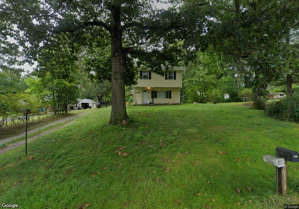
539 Sheridan Rd Jackson, MI 49203
Estimated Value: $146,000 - $190,525
3
Beds
2
Baths
1,697
Sq Ft
$103/Sq Ft
Est. Value
About This Home
This home is located at 539 Sheridan Rd, Jackson, MI 49203 and is currently estimated at $175,631, approximately $103 per square foot. 539 Sheridan Rd is a home located in Jackson County with nearby schools including East Jackson Elementary School, East Jackson Middle School, and East Jackson High School.
Ownership History
Date
Name
Owned For
Owner Type
Purchase Details
Closed on
Mar 22, 2011
Sold by
Rinesmith Latosha
Bought by
Mcmanamon Timothy M
Current Estimated Value
Purchase Details
Closed on
Nov 9, 2009
Sold by
Citimortgage Inc
Bought by
Department Of Veterans Affairs
Purchase Details
Closed on
Aug 1, 1990
Bought by
Winberry
Create a Home Valuation Report for This Property
The Home Valuation Report is an in-depth analysis detailing your home's value as well as a comparison with similar homes in the area
Home Values in the Area
Average Home Value in this Area
Purchase History
| Date | Buyer | Sale Price | Title Company |
|---|---|---|---|
| Mcmanamon Timothy M | -- | None Available | |
| Department Of Veterans Affairs | -- | None Available | |
| Winberry | $48,900 | -- |
Source: Public Records
Tax History Compared to Growth
Tax History
| Year | Tax Paid | Tax Assessment Tax Assessment Total Assessment is a certain percentage of the fair market value that is determined by local assessors to be the total taxable value of land and additions on the property. | Land | Improvement |
|---|---|---|---|---|
| 2025 | $1,498 | $64,013 | $0 | $0 |
| 2024 | $1,177 | $55,956 | $0 | $0 |
| 2023 | $1,121 | $54,793 | $0 | $0 |
| 2022 | $1,360 | $47,949 | $0 | $0 |
| 2021 | $1,331 | $44,127 | $0 | $0 |
| 2020 | $1,316 | $34,757 | $0 | $0 |
| 2019 | $1,277 | $31,961 | $0 | $0 |
| 2018 | $1,246 | $26,602 | $1,065 | $25,537 |
| 2017 | $1,192 | $25,059 | $0 | $0 |
| 2016 | $951 | $24,345 | $24,345 | $0 |
| 2015 | -- | $22,536 | $22,536 | $0 |
| 2014 | -- | $39,162 | $0 | $0 |
| 2013 | -- | $39,162 | $39,162 | $0 |
Source: Public Records
Map
Nearby Homes
- 539 S Dettman Rd
- 698 S Dettman Rd
- 324 Amos St
- Vl Watts St
- 210 Watts Rd
- 2718 Page Ave
- 1139 S Dettman Rd
- 2505 Page Ave
- vl Seymour Rd
- Unit 48 Sanctuary Dr
- Unit 55 Sanctuary Dr
- Unit 50 Sanctuary Dr
- Unit 28 Sanctuary Dr
- Unit 53, 5 Sanctuary Dr
- Unit 53 Sanctuary Dr
- Unit 48,49 Sanctuary Dr
- 0 Page Ave Unit 25019979
- 210 S Forbes St
- 2016 Pringle Ave
- 130 N Horton St
- 537 Sheridan Rd
- 559 Sheridan Rd
- 557 Sheridan Rd
- 556 Sheridan Rd
- 515 Sheridan Rd
- 550 Sheridan Rd
- 562 Sheridan Rd
- 567 Sheridan Rd
- 530 Sheridan Rd
- 511 Sheridan Rd
- 570 Sheridan Rd
- 3218 Pearlman Rd
- 505 Sheridan Rd
- 3210 Pearlman Rd
- 3217 Matthews St
- 501 Sheridan Rd
- 3213 Pearlman Rd
- 441 Sheridan Rd
- 3226 Matthews St
- 603 Sheridan Rd