Estimated Value: $500,000 - $536,141
4
Beds
2
Baths
1,824
Sq Ft
$287/Sq Ft
Est. Value
About This Home
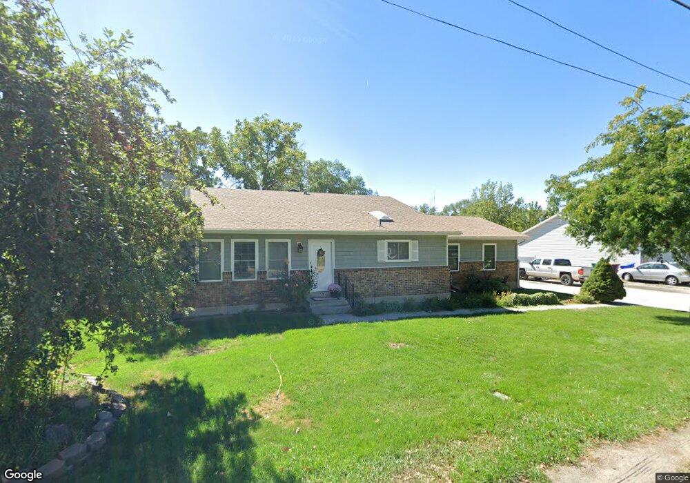
This home is located at 539 W 2100 N, Lehi, UT 84043 and is currently estimated at $524,285, approximately $287 per square foot. 539 W 2100 N is a home located in Utah County with nearby schools including Eaglecrest Elementary School, Lehi Junior High School, and Skyridge High School.
Ownership History
Date
Name
Owned For
Owner Type
Purchase Details
Closed on
Jun 22, 2020
Sold by
Deason Daulton and Deason Kadell
Bought by
Deason Daulton and Deason Kadell Mark
Current Estimated Value
Home Financials for this Owner
Home Financials are based on the most recent Mortgage that was taken out on this home.
Original Mortgage
$209,700
Outstanding Balance
$185,883
Interest Rate
3.2%
Mortgage Type
New Conventional
Estimated Equity
$338,402
Purchase Details
Closed on
Aug 10, 2015
Sold by
Deason Daulton
Bought by
Deason Daulton and Deason Kadell
Home Financials for this Owner
Home Financials are based on the most recent Mortgage that was taken out on this home.
Original Mortgage
$229,900
Interest Rate
3.97%
Mortgage Type
New Conventional
Purchase Details
Closed on
Dec 12, 2012
Sold by
Laws Lloyd K and Laws Connie
Bought by
Laws Lloyd Kenneth and Laws Connie
Purchase Details
Closed on
Aug 29, 1996
Sold by
Williams Carl R and Williams Lori S
Bought by
Laws Lloyd K and Laws Connie
Home Financials for this Owner
Home Financials are based on the most recent Mortgage that was taken out on this home.
Original Mortgage
$115,100
Interest Rate
8.23%
Create a Home Valuation Report for This Property
The Home Valuation Report is an in-depth analysis detailing your home's value as well as a comparison with similar homes in the area
Home Values in the Area
Average Home Value in this Area
Purchase History
| Date | Buyer | Sale Price | Title Company |
|---|---|---|---|
| Deason Daulton | -- | Union Title | |
| Deason Daulton | -- | Accommodation | |
| Deason Daulton | -- | Integrated Title Ins Se | |
| Laws Lloyd Kenneth | -- | None Available | |
| Laws Lloyd K | -- | -- |
Source: Public Records
Mortgage History
| Date | Status | Borrower | Loan Amount |
|---|---|---|---|
| Open | Deason Daulton | $209,700 | |
| Closed | Deason Daulton | $229,900 | |
| Previous Owner | Laws Lloyd K | $115,100 |
Source: Public Records
Tax History Compared to Growth
Tax History
| Year | Tax Paid | Tax Assessment Tax Assessment Total Assessment is a certain percentage of the fair market value that is determined by local assessors to be the total taxable value of land and additions on the property. | Land | Improvement |
|---|---|---|---|---|
| 2025 | $2,110 | $274,120 | $229,400 | $269,000 |
| 2024 | $2,110 | $246,950 | $0 | $0 |
| 2023 | $1,946 | $247,280 | $0 | $0 |
| 2022 | $1,936 | $238,425 | $0 | $0 |
| 2021 | $1,712 | $318,900 | $113,100 | $205,800 |
| 2020 | $1,613 | $297,000 | $104,700 | $192,300 |
| 2019 | $1,421 | $271,900 | $104,700 | $167,200 |
| 2018 | $1,334 | $241,300 | $90,700 | $150,600 |
| 2017 | $1,280 | $123,145 | $0 | $0 |
| 2016 | $1,235 | $110,165 | $0 | $0 |
| 2015 | $1,221 | $103,400 | $0 | $0 |
| 2014 | $1,118 | $94,105 | $0 | $0 |
Source: Public Records
Map
Nearby Homes
- 497 W 2200 N
- 516 W 2280 N
- 2287 N 750 W
- 424 W 1700 N
- 1011 W Mountain Way Unit 316
- 902 W 1500 N
- 1610 N 1125 W
- 1272 W 1800 N
- 1249 W 1800 N
- 51 N Carter Dr
- 4333 N Baiken Ridge Dr Unit 1020
- 192 E 2200 N
- 1301 N 900 W Unit 12
- 2600 N 1200 W Unit 6
- 2539 N 300 E
- 1332 W 1500 N
- 5344 N Trail Side Ct
- 1329 N 100 E Unit 21
- 1150 N 200 W Unit 6
- 2908 N 1080 W
- 551 W 2100 N
- 551 W 2100 N Unit 1
- 2085 N 500 W
- 2075 N 500 W
- 550 W 2100 N
- 540 W 2100 N
- 563 W 2100 N
- 563 W 2100 N Unit 2
- 510 W 2100 N
- 2069 N 500 W
- 575 W 2100 N
- 575 W 2100 N Unit 3
- 471 W 2100 N Unit 1
- 566 W 2100 N
- 470 W 2070 N Unit 12
- 2090 N 500 W Unit 12
- 490 W 2100 N
- 2086 N 500 W
- 2059 N 500 W
- 473 W 2070 N Unit 13