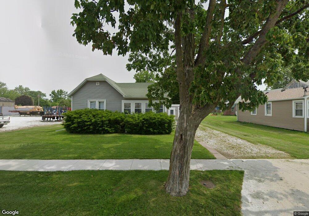
539 W Davis St Bushnell, IL 61422
Estimated Value: $49,000 - $59,000
2
Beds
--
Bath
899
Sq Ft
$59/Sq Ft
Est. Value
About This Home
This home is located at 539 W Davis St, Bushnell, IL 61422 and is currently estimated at $52,944, approximately $58 per square foot. 539 W Davis St is a home located in McDonough County with nearby schools including Bushnell-Prairie City Elementary School, Bushnell-Prairie City Junior High School, and Bushnell-Prairie City High School.
Ownership History
Date
Name
Owned For
Owner Type
Purchase Details
Closed on
Mar 14, 2023
Sold by
Batson Alexander J
Bought by
Shafer James K
Current Estimated Value
Home Financials for this Owner
Home Financials are based on the most recent Mortgage that was taken out on this home.
Original Mortgage
$40,000
Outstanding Balance
$38,735
Interest Rate
6.09%
Mortgage Type
New Conventional
Estimated Equity
$14,209
Purchase Details
Closed on
Aug 16, 2022
Sold by
Batson David E and Batson Stacy J
Bought by
Batson Alexander J
Create a Home Valuation Report for This Property
The Home Valuation Report is an in-depth analysis detailing your home's value as well as a comparison with similar homes in the area
Home Values in the Area
Average Home Value in this Area
Purchase History
| Date | Buyer | Sale Price | Title Company |
|---|---|---|---|
| Shafer James K | -- | -- | |
| Batson Alexander J | -- | None Listed On Document |
Source: Public Records
Mortgage History
| Date | Status | Borrower | Loan Amount |
|---|---|---|---|
| Open | Shafer James K | $40,000 |
Source: Public Records
Tax History Compared to Growth
Tax History
| Year | Tax Paid | Tax Assessment Tax Assessment Total Assessment is a certain percentage of the fair market value that is determined by local assessors to be the total taxable value of land and additions on the property. | Land | Improvement |
|---|---|---|---|---|
| 2024 | $1,019 | $11,082 | $1,875 | $9,207 |
| 2023 | $980 | $10,965 | $1,855 | $9,110 |
| 2022 | $892 | $9,912 | $1,677 | $8,235 |
| 2021 | $856 | $9,490 | $1,606 | $7,884 |
| 2020 | $866 | $10,939 | $1,583 | $9,356 |
| 2019 | $902 | $9,748 | $1,649 | $8,099 |
| 2018 | $900 | $9,953 | $1,684 | $8,269 |
| 2017 | $900 | $9,811 | $1,660 | $8,151 |
| 2016 | $845 | $9,072 | $1,535 | $7,537 |
| 2015 | $857 | $9,072 | $1,535 | $7,537 |
| 2014 | $871 | $8,934 | $1,512 | $7,422 |
| 2013 | $856 | $9,650 | $1,633 | $8,017 |
Source: Public Records
Map
Nearby Homes
- 425 N Jackson St
- 310 N Dean St
- 555 N Jackson St
- 651 N Washington St
- 195 W Hail St
- 134 W Osborne St
- 1091 N Jackson St
- 651 N Sperry St
- 1024 W Main St
- 295 W Harris Ave
- 924 N Crafford St
- 994 N Crafford St
- 777 Cole St
- 4 Hiel Dr
- 14 Hillcrest Dr
- 20620 N 2300 Rd
- 20620 N 2300th Rd
- 18520 N 1450th Rd
- 16905 E 1600th St
- 22561 N Cornerstone Rd
- 525 W Davis St
- 550 W Barnes St
- 518 W Barnes St
- 558 W Barnes St
- 506 W Barnes St
- 580 W Barnes St
- 594 W Barnes St
- 605 W Davis St
- 494 W Barnes St
- 625 W Davis St
- 494 W Davis St
- 630 W Davis St
- 3 Lakelawn Dr
- 636 W Barnes St
- 659 W Davis St
- 517 W Barnes St
- 440 W Barnes St
- 345 Walnut St
- 585 W Barnes St
- 595 W Barnes St