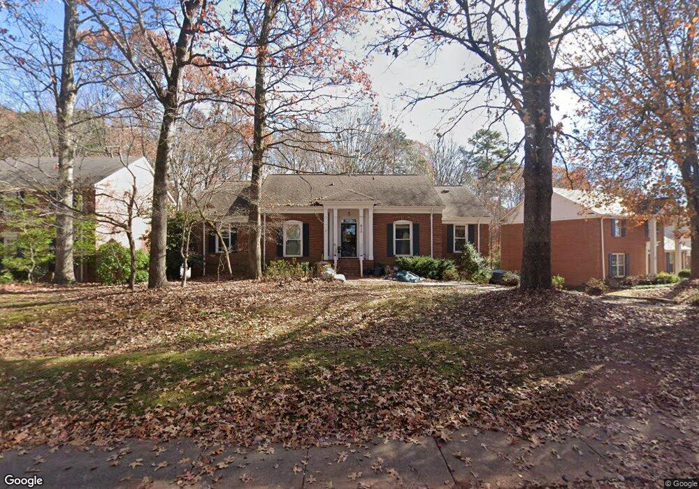
539 Walnut Point Dr Matthews, NC 28105
Estimated Value: $578,000 - $683,000
3
Beds
3
Baths
2,867
Sq Ft
$217/Sq Ft
Est. Value
About This Home
This home is located at 539 Walnut Point Dr, Matthews, NC 28105 and is currently estimated at $622,624, approximately $217 per square foot. 539 Walnut Point Dr is a home located in Mecklenburg County with nearby schools including Elizabeth Lane Elementary, South Charlotte Middle, and Providence High.
Ownership History
Date
Name
Owned For
Owner Type
Purchase Details
Closed on
Feb 24, 2025
Sold by
Smith Bruce Lee Raymond and Smith Elise
Bought by
Bruce Lee Raymond Smith Revocable Trust and Smith
Current Estimated Value
Purchase Details
Closed on
Sep 5, 2015
Sold by
Smith Bruce L R and Smith Elise
Bought by
Smith Bruce L R and Smith Elise
Purchase Details
Closed on
Mar 16, 2015
Sold by
Smith Bruce L R and Smith Elise
Bought by
Smith Bruce L R and Smith Elise
Purchase Details
Closed on
Jun 27, 2013
Sold by
Epps Daniel E and Epps Cynthia C
Bought by
Smith Bruce L R
Purchase Details
Closed on
Apr 1, 1992
Bought by
Epps Daniel E and Epps Cynthia C
Create a Home Valuation Report for This Property
The Home Valuation Report is an in-depth analysis detailing your home's value as well as a comparison with similar homes in the area
Home Values in the Area
Average Home Value in this Area
Purchase History
| Date | Buyer | Sale Price | Title Company |
|---|---|---|---|
| Bruce Lee Raymond Smith Revocable Trust | -- | None Listed On Document | |
| Smith Bruce L R | -- | None Available | |
| Smith Bruce L R | -- | None Available | |
| Smith Bruce L R | $275,000 | None Available | |
| Epps Daniel E | -- | -- |
Source: Public Records
Tax History
| Year | Tax Paid | Tax Assessment Tax Assessment Total Assessment is a certain percentage of the fair market value that is determined by local assessors to be the total taxable value of land and additions on the property. | Land | Improvement |
|---|---|---|---|---|
| 2025 | $3,750 | $493,600 | $100,000 | $393,600 |
| 2024 | $3,750 | $493,600 | $100,000 | $393,600 |
| 2023 | $3,750 | $493,600 | $100,000 | $393,600 |
| 2022 | $3,118 | $347,600 | $90,000 | $257,600 |
| 2021 | $3,118 | $347,600 | $90,000 | $257,600 |
| 2020 | $3,157 | $347,600 | $90,000 | $257,600 |
| 2019 | $2,785 | $347,600 | $90,000 | $257,600 |
| 2018 | $2,849 | $239,500 | $67,900 | $171,600 |
| 2017 | $2,792 | $239,500 | $67,900 | $171,600 |
| 2016 | -- | $239,500 | $67,900 | $171,600 |
| 2015 | $2,785 | $239,500 | $67,900 | $171,600 |
| 2014 | $2,737 | $235,200 | $61,800 | $173,400 |
Source: Public Records
Map
Nearby Homes
- 406 Port Royal Dr
- 609 Fredricksburg Rd
- 425 Clairview Ln
- 440 Bubbling Well Rd
- 1062 Elizabeth Manor Ct
- 614 Ashgrove Ln
- 1111 Somersby Ln
- 101 Umi Ct
- 1015 Chelsea Place
- 1311 Somersby Ln
- 2724 Artesian Ct
- 8207 Schooner Ln
- 115 Chesney Glen Dr
- 429 Eberle Way
- 2601 Rustic Ridge Ct
- 2310 Keara Way
- 1405 Elmsford Ln
- 1300 Reverdy Ln Unit 2
- 3218 Pollard Ct
- 1216 Reverdy Ln Unit 5
- 601 Walnut Point Dr
- 533 Walnut Point Dr
- 607 Walnut Point Dr
- 527 Walnut Point Dr
- 500 Laurel Fork Dr
- 600 Walnut Point Dr
- 604 Port Royal Dr
- 532 Walnut Point Dr
- 613 Walnut Point Dr
- 520 Walnut Point Dr
- 521 Walnut Point Dr
- 506 Laurel Fork Dr
- 522 Laurel Fork Dr
- 619 Walnut Point Dr
- 515 Laurel Fork Dr
- 510 Walnut Point Dr
- 620 Walnut Point Dr
- 628 Courtney Ln
- 511 Walnut Point Dr
Your Personal Tour Guide
Ask me questions while you tour the home.