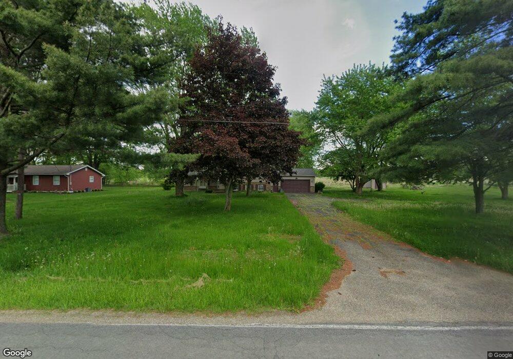
5390 Phillips Rice Rd Cortland, OH 44410
Estimated Value: $228,000 - $276,000
3
Beds
2
Baths
1,872
Sq Ft
$133/Sq Ft
Est. Value
About This Home
This home is located at 5390 Phillips Rice Rd, Cortland, OH 44410 and is currently estimated at $249,231, approximately $133 per square foot. 5390 Phillips Rice Rd is a home located in Trumbull County with nearby schools including Maplewood Middle School, Maplewood Elementary School, and Maplewood High School.
Ownership History
Date
Name
Owned For
Owner Type
Purchase Details
Closed on
May 27, 2021
Sold by
Hunter Kenneth D and Davis Mark A
Current Estimated Value
Purchase Details
Closed on
Jun 24, 2002
Sold by
Hunter Kenneth
Bought by
Hunter Kenneth
Purchase Details
Closed on
Mar 15, 2002
Sold by
Hunter Kenneth D and Hunter Betty L
Bought by
Hunter Kenneth D
Purchase Details
Closed on
Jan 1, 1990
Bought by
Kenneth D Hunter
Create a Home Valuation Report for This Property
The Home Valuation Report is an in-depth analysis detailing your home's value as well as a comparison with similar homes in the area
Home Values in the Area
Average Home Value in this Area
Purchase History
| Date | Buyer | Sale Price | Title Company |
|---|---|---|---|
| -- | -- | -- | |
| Hunter Kenneth | -- | -- | |
| Hunter Kenneth D | -- | -- | |
| Kenneth D Hunter | -- | -- |
Source: Public Records
Tax History Compared to Growth
Tax History
| Year | Tax Paid | Tax Assessment Tax Assessment Total Assessment is a certain percentage of the fair market value that is determined by local assessors to be the total taxable value of land and additions on the property. | Land | Improvement |
|---|---|---|---|---|
| 2024 | $2,466 | $59,500 | $6,440 | $53,060 |
| 2023 | $2,349 | $59,500 | $6,440 | $53,060 |
| 2022 | $2,109 | $47,500 | $5,880 | $41,620 |
| 2021 | $1,769 | $47,500 | $5,880 | $41,620 |
| 2020 | $1,731 | $47,500 | $5,880 | $41,620 |
| 2019 | $1,619 | $43,300 | $5,460 | $37,840 |
| 2018 | $1,609 | $43,300 | $5,460 | $37,840 |
| 2017 | $1,605 | $43,300 | $5,460 | $37,840 |
| 2016 | $1,600 | $43,270 | $4,870 | $38,400 |
| 2015 | $1,552 | $43,270 | $4,870 | $38,400 |
| 2014 | $1,547 | $43,270 | $4,870 | $38,400 |
| 2013 | $1,586 | $43,270 | $4,870 | $38,400 |
Source: Public Records
Map
Nearby Homes
- 2684 Griffith Dr
- 121 Fairway Dr
- 507 Tournament Trail
- 400 Tournament Trail Unit 400
- 428 Cherry Hill Ln
- 525 Sycamore Trail
- 404 Cherry Hill Ln
- 6247 Love Warner Rd
- 0 St Andrews Unit 5113795
- 101 Elizabeth Ct
- 160 Saint Andrews
- 0 N High St
- 155 Heritage Ln
- 124 Saint Andrews
- 20 Harneds Landing Unit 20
- 5294 Cottage Dr
- 6555 Love Warner Rd
- 4400 Ridge Rd
- 5953 Warren Rd
- 278 Rosewae Ave
- 5392 Phillips Rice Rd
- 5406 Phillips Rice Rd
- 5424 Phillips Rice Rd
- 5430 Phillips Rice Rd
- 5453 Phillips Rice Rd
- 5480 Phillips Rice Rd
- 5494 Phillips Rice Rd
- 9 Perkins Jones
- 1086 Perkins Jones Rd
- 5493 Phillips Rice Rd
- 5503 Phillips Rice Rd
- 5508 Phillips Rice Rd
- 5240 Phillips Rice Rd
- 0 Vl Phillips Rice Rd Unit 4394028
- 5545 Phillips Rice Rd
- 5210 Phillips Rice Rd
- 5174 Phillips Rice Rd
- 5561 Phillips Rice Rd
- 5158 Phillips Rice Rd
- 5573 Phillips Rice Rd