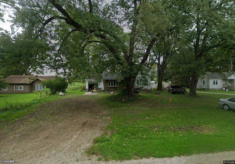
5390 W Us Highway 12 Buchanan, MI 49107
Estimated Value: $137,000 - $203,000
3
Beds
1
Bath
1,344
Sq Ft
$132/Sq Ft
Est. Value
About This Home
This home is located at 5390 W Us Highway 12, Buchanan, MI 49107 and is currently estimated at $176,887, approximately $131 per square foot. 5390 W Us Highway 12 is a home located in Berrien County with nearby schools including River Valley Middle/High School and Lutie High School.
Ownership History
Date
Name
Owned For
Owner Type
Purchase Details
Closed on
Aug 27, 2010
Sold by
Fannie Mae
Bought by
Lippert Michael A
Current Estimated Value
Purchase Details
Closed on
Aug 23, 2010
Sold by
Bac Home Loans Servicing Lp
Bought by
Federal National Mortgage Association
Purchase Details
Closed on
Jan 21, 2010
Sold by
Sebasty Jason E
Bought by
Bac Home Loans Servicing Lp and Countrywide Home Loans Servicing Lp
Purchase Details
Closed on
Aug 29, 2005
Sold by
American General Financial Services Inc
Bought by
Sebasty Jason E
Home Financials for this Owner
Home Financials are based on the most recent Mortgage that was taken out on this home.
Original Mortgage
$38,500
Interest Rate
6.48%
Mortgage Type
New Conventional
Purchase Details
Closed on
Jun 22, 2005
Sold by
Harroff Carlene Jo and Harroff Carlene J
Bought by
American General Financial Services Inc
Create a Home Valuation Report for This Property
The Home Valuation Report is an in-depth analysis detailing your home's value as well as a comparison with similar homes in the area
Home Values in the Area
Average Home Value in this Area
Purchase History
| Date | Buyer | Sale Price | Title Company |
|---|---|---|---|
| Lippert Michael A | $16,000 | None Available | |
| Federal National Mortgage Association | -- | None Available | |
| Bac Home Loans Servicing Lp | $77,622 | None Available | |
| Sebasty Jason E | $38,500 | None Available | |
| American General Financial Services Inc | -- | -- |
Source: Public Records
Mortgage History
| Date | Status | Borrower | Loan Amount |
|---|---|---|---|
| Previous Owner | Sebasty Jason E | $38,500 |
Source: Public Records
Tax History Compared to Growth
Tax History
| Year | Tax Paid | Tax Assessment Tax Assessment Total Assessment is a certain percentage of the fair market value that is determined by local assessors to be the total taxable value of land and additions on the property. | Land | Improvement |
|---|---|---|---|---|
| 2025 | $605 | $52,000 | $0 | $0 |
| 2024 | $352 | $47,700 | $0 | $0 |
| 2023 | $335 | $41,200 | $0 | $0 |
| 2022 | $319 | $36,600 | $0 | $0 |
| 2021 | $573 | $35,600 | $15,000 | $20,600 |
| 2020 | $558 | $35,300 | $0 | $0 |
| 2019 | $548 | $26,800 | $12,000 | $14,800 |
| 2018 | $552 | $26,800 | $0 | $0 |
| 2017 | $543 | $25,800 | $0 | $0 |
| 2016 | $530 | $27,600 | $0 | $0 |
| 2015 | $430 | $25,600 | $0 | $0 |
| 2014 | $230 | $22,500 | $0 | $0 |
Source: Public Records
Map
Nearby Homes
- 5320 W US Highway 12
- 0 Us 12 W
- 4630 W US Highway 12
- 4935 Curran Rd
- 6460 E Galien Buchanan Rd
- 16091 Roe St
- 15973 Walnut St
- 15646 W Clear Lake Rd
- 000 W Clear Lake Rd
- 0 Mount Zion Rd
- 2934 W Front St
- 1936 E Clear Lake Rd
- 6475 Olive Branch Rd
- 15657 Lakeview Dr
- 0 E Clear Lake Rd
- Track 4 W Us 12 Hwy Trail
- 347 Georgetown Colony
- 15326 Madron Lake Rd
- 331 Charlestown Colony Unit 18
- 0 Madron Lake Unit 25057714
- 5390 W Us Highway 12
- 5380 W Us Highway 12
- 5410 W Us Highway 12
- 5370 W Us Highway 12
- 5395 W Us Highway 12
- 5395 W Us Highway 12
- 5405 U S 12
- 5405 W Us Highway 12
- 5350 W Us Highway 12
- 5435 W Us Highway 12
- 2010 Sage Rd
- 1990 Sage Rd
- 5345 W Us Highway 12
- 5375 U S 12
- 5375 W Us Highway 12
- 5455 W Us Highway 12
- 5455 W Us Highway 12
- 1980 Sage Rd
- 5450 W Us Highway 12 W
- 1970 Sage Rd