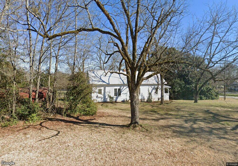
5391 Highway 72 E Carlton, GA 30627
Estimated Value: $170,973 - $268,000
--
Bed
--
Bath
1,696
Sq Ft
$130/Sq Ft
Est. Value
About This Home
This home is located at 5391 Highway 72 E, Carlton, GA 30627 and is currently estimated at $220,493, approximately $130 per square foot. 5391 Highway 72 E is a home located in Madison County with nearby schools including Madison County High School.
Ownership History
Date
Name
Owned For
Owner Type
Purchase Details
Closed on
May 27, 2025
Sold by
Joffrion Jaden C
Bought by
Hitzman Elizabeth N and Joffrion Jaden C
Current Estimated Value
Home Financials for this Owner
Home Financials are based on the most recent Mortgage that was taken out on this home.
Original Mortgage
$159,200
Outstanding Balance
$158,199
Interest Rate
6.62%
Mortgage Type
New Conventional
Estimated Equity
$62,294
Purchase Details
Closed on
May 12, 2025
Sold by
Knight Winston
Bought by
Joffrion Jaden C
Home Financials for this Owner
Home Financials are based on the most recent Mortgage that was taken out on this home.
Original Mortgage
$159,200
Outstanding Balance
$158,199
Interest Rate
6.62%
Mortgage Type
New Conventional
Estimated Equity
$62,294
Purchase Details
Closed on
Aug 16, 2013
Sold by
Thompson William G
Bought by
Knight Winston and Jolley Ronald E
Purchase Details
Closed on
Jan 1, 1967
Bought by
Thompson William G
Create a Home Valuation Report for This Property
The Home Valuation Report is an in-depth analysis detailing your home's value as well as a comparison with similar homes in the area
Home Values in the Area
Average Home Value in this Area
Purchase History
| Date | Buyer | Sale Price | Title Company |
|---|---|---|---|
| Hitzman Elizabeth N | -- | -- | |
| Joffrion Jaden C | $199,000 | -- | |
| Knight Winston | $20,000 | -- | |
| Thompson William G | -- | -- |
Source: Public Records
Mortgage History
| Date | Status | Borrower | Loan Amount |
|---|---|---|---|
| Open | Joffrion Jaden C | $159,200 |
Source: Public Records
Tax History Compared to Growth
Tax History
| Year | Tax Paid | Tax Assessment Tax Assessment Total Assessment is a certain percentage of the fair market value that is determined by local assessors to be the total taxable value of land and additions on the property. | Land | Improvement |
|---|---|---|---|---|
| 2025 | $729 | $26,227 | $8,736 | $17,491 |
| 2024 | $730 | $25,611 | $8,736 | $16,875 |
| 2023 | $653 | $22,913 | $7,280 | $15,633 |
| 2022 | $555 | $18,789 | $5,005 | $13,784 |
| 2021 | $485 | $14,228 | $5,005 | $9,223 |
| 2020 | $463 | $13,500 | $4,277 | $9,223 |
| 2019 | $505 | $14,574 | $4,705 | $9,869 |
| 2018 | $477 | $13,720 | $4,304 | $9,416 |
| 2017 | $391 | $12,146 | $3,640 | $8,506 |
| 2016 | $551 | $17,042 | $3,308 | $13,734 |
| 2015 | $512 | $17,042 | $3,308 | $13,734 |
| 2014 | $241 | $17,222 | $3,308 | $13,914 |
| 2013 | -- | $17,222 | $3,308 | $13,914 |
Source: Public Records
Map
Nearby Homes
- 670 S Railroad Ave
- 724 Bertha Willis Rd
- 88 S Railroad Ave
- 6367 Highway 72 E
- 6476 Georgia 72
- 667 Paoli Rd
- 376 Paoli Rd
- 3614 Georgia 72
- 600 Piney Grove Rd
- 0 Broad River Rd Unit 10650042
- 00 River Rd
- 0 Berkley Rd Unit 10545423
- 0 River Rd Unit 10639917
- 730 Osley Mill Rd
- 474 Watson Mill
- 490 Watson Mill
- 1163 Nickville Rd
- 219 Piney Grove Rd
- 754 Highway 72 E
- 5391 Highway 72 E
- 27 North St
- 884 S Railroad Ave
- 904 S Railroad Ave
- 948 S Railroad Ave
- 5303 Highway 72 E
- 52 Fourth St
- 52 4th St
- 836 S Railroad Ave
- 6433 Georgia 72
- 1010 S Railroad Ave
- 5281 Highway 72 E
- 5281 Georgia 72
- 817 S Railroad Ave
- 5281 Hwy 72e
- 51 Fourth St
- 68 4th St
- 0 Highway 72 Unit 7141058
- 0 Highway 72 Unit 6807069
- 0 Highway 72 Unit 8687412