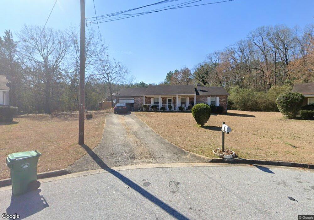
5391 Robertson Path Unit 1 Lithonia, GA 30038
Estimated Value: $215,000 - $237,000
3
Beds
2
Baths
1,462
Sq Ft
$152/Sq Ft
Est. Value
About This Home
This home is located at 5391 Robertson Path Unit 1, Lithonia, GA 30038 and is currently estimated at $222,213, approximately $151 per square foot. 5391 Robertson Path Unit 1 is a home located in DeKalb County with nearby schools including Flat Rock Elementary School, Salem Middle School, and Martin Luther King- Jr. High School.
Ownership History
Date
Name
Owned For
Owner Type
Purchase Details
Closed on
May 5, 1994
Sold by
Federal Home Loan Mtg Co
Bought by
Brown Polly D
Current Estimated Value
Home Financials for this Owner
Home Financials are based on the most recent Mortgage that was taken out on this home.
Original Mortgage
$62,700
Interest Rate
8.48%
Purchase Details
Closed on
Feb 1, 1994
Sold by
Glenn Beverly M
Bought by
Federal Home Loan Mtg Co
Create a Home Valuation Report for This Property
The Home Valuation Report is an in-depth analysis detailing your home's value as well as a comparison with similar homes in the area
Home Values in the Area
Average Home Value in this Area
Purchase History
| Date | Buyer | Sale Price | Title Company |
|---|---|---|---|
| Brown Polly D | -- | -- | |
| Federal Home Loan Mtg Co | $49,165 | -- |
Source: Public Records
Mortgage History
| Date | Status | Borrower | Loan Amount |
|---|---|---|---|
| Closed | Brown Polly D | $62,700 |
Source: Public Records
Tax History Compared to Growth
Tax History
| Year | Tax Paid | Tax Assessment Tax Assessment Total Assessment is a certain percentage of the fair market value that is determined by local assessors to be the total taxable value of land and additions on the property. | Land | Improvement |
|---|---|---|---|---|
| 2025 | $4,341 | $87,240 | $12,000 | $75,240 |
| 2024 | $4,408 | $89,400 | $12,000 | $77,400 |
| 2023 | $4,408 | $77,920 | $6,600 | $71,320 |
| 2022 | $3,613 | $74,720 | $6,600 | $68,120 |
| 2021 | $2,730 | $53,800 | $6,600 | $47,200 |
| 2020 | $2,381 | $46,440 | $6,600 | $39,840 |
| 2019 | $2,206 | $42,760 | $6,600 | $36,160 |
| 2018 | $1,694 | $39,360 | $6,600 | $32,760 |
| 2017 | $1,805 | $33,480 | $6,600 | $26,880 |
| 2016 | $1,791 | $33,080 | $6,600 | $26,480 |
| 2014 | $1,555 | $27,080 | $6,600 | $20,480 |
Source: Public Records
Map
Nearby Homes
- 5407 Effingham Ct
- 5415 Radford Ln
- 3340 Fannin Ct
- 5331 Salem Rd
- 5360 Tasman Trail
- 5263 Salem Rd
- 5209 Salem Rd
- 5338 Timor Trail
- 3274 Adelade Ct
- 5421 Salem Springs Dr
- 5436 Brisbane Ct Unit 1
- 5487 Walnut Ln
- 3248 Brisbane Way
- 3635 Crossvale Rd
- 5600 Rock Springs Rd
- 5279 Rock Springs Rd
- 5632 Rock Springs Rd
- 5385 Robertson Path
- 5395 Robertson Path
- 5390 Radford Ln
- 5394 Radford Ln
- 5394 Radford Ln Unit 1
- 5370 Bleckley Ct Unit 6
- 5370 Bleckley Ct
- 5386 Radford Ln
- 5386 Radford Ln Unit 15
- 5401 Robertson Path
- 5363 Bleckley Ct
- 5402 Radford Ln
- 5392 Robertson Path
- 5400 Robertson Path
- 5364 Bleckley Ct
- 5409 Robertson Path
- 0 Robertson Path Unit 3036784
- 0 Robertson Path Unit 7036130
- 0 Robertson Path
- 5410 Radford Ln