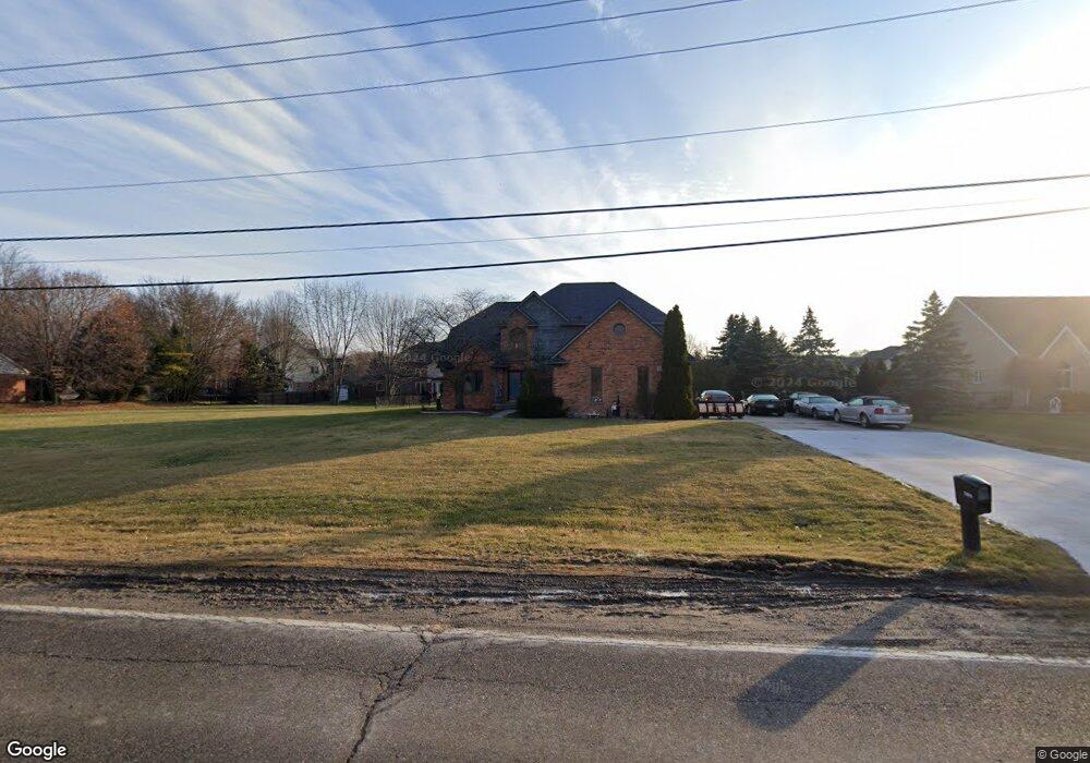
53910 Baker Rd Chesterfield, MI 48047
Estimated Value: $428,095 - $474,000
4
Beds
3
Baths
2,163
Sq Ft
$208/Sq Ft
Est. Value
About This Home
This home is located at 53910 Baker Rd, Chesterfield, MI 48047 and is currently estimated at $449,274, approximately $207 per square foot. 53910 Baker Rd is a home located in Macomb County with nearby schools including Lighthouse Elementary School, Anchor Bay Middle School North, and Anchor Bay High School.
Ownership History
Date
Name
Owned For
Owner Type
Purchase Details
Closed on
Dec 2, 2011
Sold by
Baumgart Jeffry D
Bought by
Yoe Henry F
Current Estimated Value
Purchase Details
Closed on
Jun 2, 2011
Sold by
Baumgart Jeffrey D and Gmac Mortgage Llc
Bought by
Federal National Mortgage Association
Purchase Details
Closed on
Jun 12, 2006
Sold by
Baumgart Jeffrey Dale and Baumgart Lisa K
Bought by
Baumgart Jeffrey D
Home Financials for this Owner
Home Financials are based on the most recent Mortgage that was taken out on this home.
Original Mortgage
$242,200
Interest Rate
6.62%
Mortgage Type
Purchase Money Mortgage
Create a Home Valuation Report for This Property
The Home Valuation Report is an in-depth analysis detailing your home's value as well as a comparison with similar homes in the area
Home Values in the Area
Average Home Value in this Area
Purchase History
| Date | Buyer | Sale Price | Title Company |
|---|---|---|---|
| Yoe Henry F | $155,000 | Greater Macomb Title Agency | |
| Federal National Mortgage Association | $240,795 | None Available | |
| Baumgart Jeffrey D | -- | None Available |
Source: Public Records
Mortgage History
| Date | Status | Borrower | Loan Amount |
|---|---|---|---|
| Previous Owner | Baumgart Jeffrey D | $242,200 |
Source: Public Records
Tax History Compared to Growth
Tax History
| Year | Tax Paid | Tax Assessment Tax Assessment Total Assessment is a certain percentage of the fair market value that is determined by local assessors to be the total taxable value of land and additions on the property. | Land | Improvement |
|---|---|---|---|---|
| 2025 | $4,965 | $192,100 | $0 | $0 |
| 2024 | $2,708 | $187,100 | $0 | $0 |
| 2023 | $2,567 | $177,200 | $0 | $0 |
| 2022 | $4,512 | $163,400 | $0 | $0 |
| 2021 | $4,375 | $158,200 | $0 | $0 |
| 2020 | $2,359 | $156,700 | $0 | $0 |
| 2019 | $4,131 | $147,700 | $0 | $0 |
| 2018 | $3,972 | $144,100 | $24,100 | $120,000 |
| 2017 | $3,928 | $132,550 | $24,100 | $108,450 |
| 2016 | $3,905 | $132,550 | $0 | $0 |
| 2015 | $1,902 | $124,950 | $0 | $0 |
| 2014 | $1,902 | $105,250 | $10,200 | $95,050 |
| 2012 | -- | $0 | $0 | $0 |
Source: Public Records
Map
Nearby Homes
- - Baker Rd
- 53302 Zachary Dr
- 54822 Heron Cir
- 54820 Mockingbird Dr
- 54790 Heron Cir
- 54759 Heron Cir
- 54375 Heron Cir
- Sawyer Plan at Creekside Park
- Peyton Plan at Creekside Park
- Aubrey Plan at Creekside Park
- Brooklyn Plan at Creekside Park
- Juliet Plan at Creekside Park
- 54695 Heron Cir
- 34433 Sandpiper Ct
- 54253 Bradshaw Dr
- 55060 Baker Rd
- 35614 Hermitage Ct
- 54620 Washington St
- 54597 Mockingbird
- 54791 Heron Cir
- 53954 Baker
- 53870 Baker Rd
- 34449 Devon Ct
- 34455 Devon Ct
- 53982 Baker Rd
- 34420 Philip Dr
- 34426 Philip Dr
- 34450 Devon Ct
- 34432 Philip Dr
- 34438 Philip Dr
- 53409 Zachary Dr
- 34456 Devon Ct
- 53397 Zachary Dr
- 53359 Lorina Ct
- 53385 Zachary Dr
- 34462 Devon Ct
- 53360 Lorina Ct
- 53347 Lorina Ct
- 53448 Zachary Dr
- 53875 Baker Rd