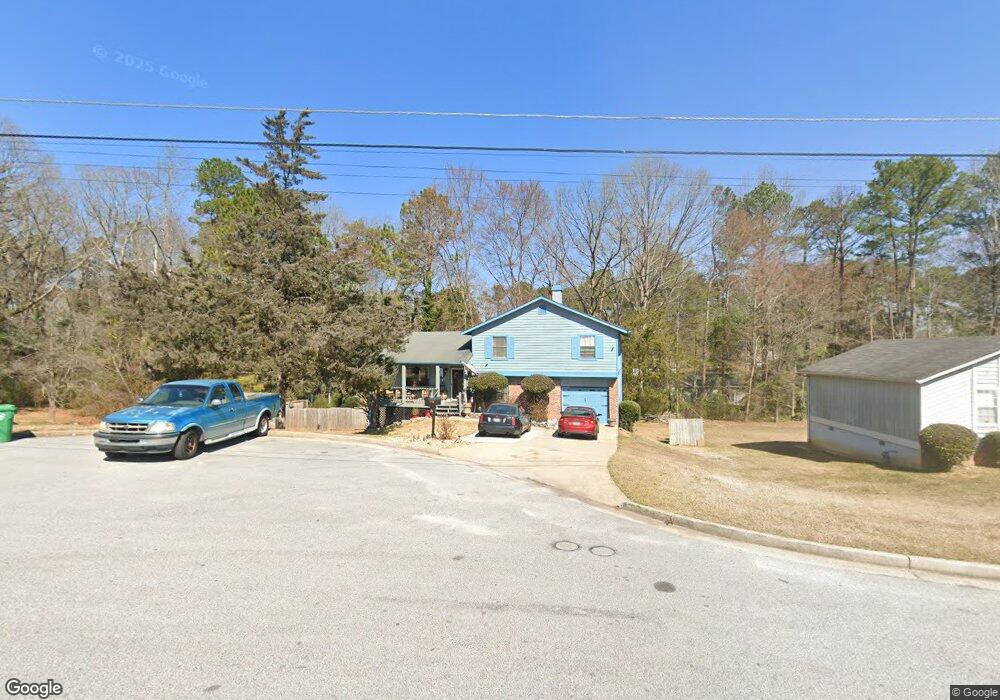
5392 Robertson Path Lithonia, GA 30038
Estimated Value: $215,000 - $233,000
3
Beds
2
Baths
1,630
Sq Ft
$137/Sq Ft
Est. Value
About This Home
This home is located at 5392 Robertson Path, Lithonia, GA 30038 and is currently estimated at $222,888, approximately $136 per square foot. 5392 Robertson Path is a home located in DeKalb County with nearby schools including Flat Rock Elementary School, Salem Middle School, and Martin Luther King- Jr. High School.
Ownership History
Date
Name
Owned For
Owner Type
Purchase Details
Closed on
Jan 10, 2003
Sold by
Gordon Bobby F and Gordon Gloria B
Bought by
Williams Judith
Current Estimated Value
Home Financials for this Owner
Home Financials are based on the most recent Mortgage that was taken out on this home.
Original Mortgage
$118,500
Outstanding Balance
$50,058
Interest Rate
6.01%
Mortgage Type
New Conventional
Estimated Equity
$172,830
Create a Home Valuation Report for This Property
The Home Valuation Report is an in-depth analysis detailing your home's value as well as a comparison with similar homes in the area
Home Values in the Area
Average Home Value in this Area
Purchase History
| Date | Buyer | Sale Price | Title Company |
|---|---|---|---|
| Williams Judith | $118,500 | -- |
Source: Public Records
Mortgage History
| Date | Status | Borrower | Loan Amount |
|---|---|---|---|
| Open | Williams Judith | $118,500 |
Source: Public Records
Tax History
| Year | Tax Paid | Tax Assessment Tax Assessment Total Assessment is a certain percentage of the fair market value that is determined by local assessors to be the total taxable value of land and additions on the property. | Land | Improvement |
|---|---|---|---|---|
| 2025 | $2,483 | $86,120 | $12,000 | $74,120 |
| 2024 | $2,594 | $88,960 | $12,000 | $76,960 |
| 2023 | $2,594 | $71,480 | $6,600 | $64,880 |
Source: Public Records
Map
Nearby Homes
- 5415 Radford Ln
- 5360 Tasman Trail
- 3274 Adelade Ct
- 5436 Brisbane Ct Unit 1
- 5515 Rock Springs Rd
- 5536 La Fleur Trail
- 5207 Oaktree Ct
- 5566 La Fleur Trail
- 5438 Salem Springs Dr
- 5600 Rock Springs Rd
- 5487 Walnut Ln
- 5332 Winslow Crossing
- 3812 Walnut Path
- 3251 Hunters Crossing Point
- 5664 Reynard Trail
- 3703 Salem Springs Ct
- 5544 Alpine Ct
- 5635 Hunters Crossing Ct
- 5437 Winslow Crossing N
- 3520 Valley Chase Ct
- 5400 Robertson Path
- 5415 Effingham Ct
- 5423 Effingham Ct
- 5385 Robertson Path
- 5408 Robertson Path
- 5395 Robertson Path
- 5431 Effingham Ct
- 5391 Robertson Path Unit 1
- 5401 Robertson Path
- 5364 Bleckley Ct
- 5370 Bleckley Ct Unit 6
- 5370 Bleckley Ct
- 5400 Effingham Ct
- 5409 Robertson Path
- 5416 Robertson Path Unit 1
- 5439 Effingham Ct
- 5410 Effingham Ct
- 5390 Radford Ln
- 5426 Effingham Ct
- 5418 Effingham Ct
Your Personal Tour Guide
Ask me questions while you tour the home.