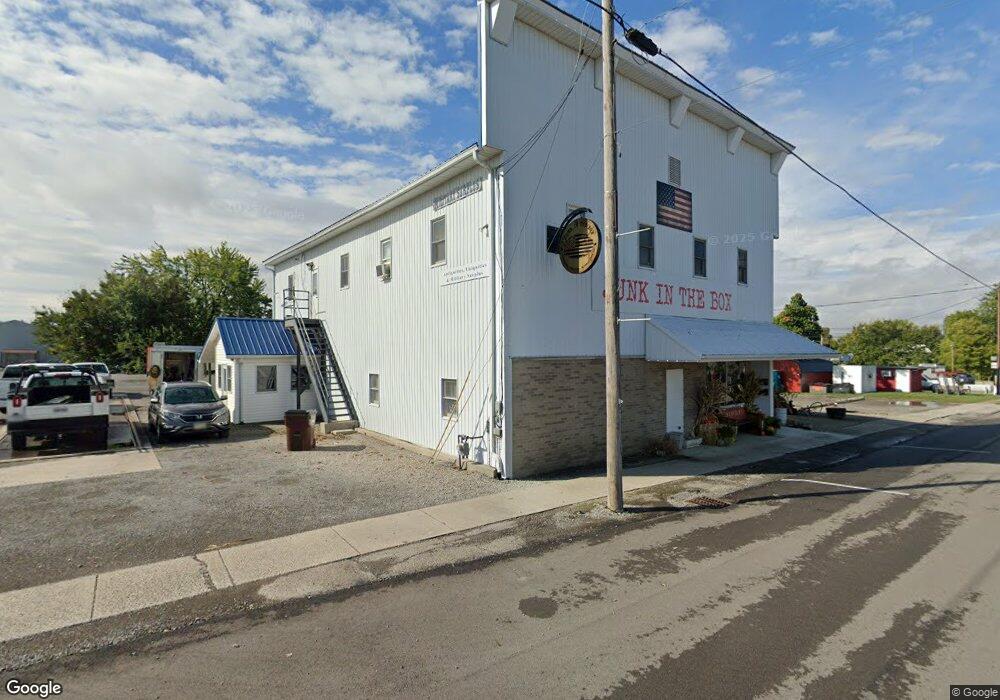
5393 Twp Rd Huntsville, OH 43324
Estimated Value: $354,000 - $396,000
2
Beds
2
Baths
1,676
Sq Ft
$226/Sq Ft
Est. Value
About This Home
This home is located at 5393 Twp Rd, Huntsville, OH 43324 and is currently estimated at $379,352, approximately $226 per square foot. 5393 Twp Rd is a home located in Logan County with nearby schools including Indian Lake Elementary School, Indian Lake Middle School, and Indian Lake High School.
Ownership History
Date
Name
Owned For
Owner Type
Purchase Details
Closed on
Dec 19, 2024
Sold by
Duff Development Company Llc
Bought by
Perez Matthew S and Perez Amber R
Current Estimated Value
Home Financials for this Owner
Home Financials are based on the most recent Mortgage that was taken out on this home.
Original Mortgage
$371,025
Outstanding Balance
$368,107
Interest Rate
6.79%
Mortgage Type
New Conventional
Estimated Equity
$11,245
Create a Home Valuation Report for This Property
The Home Valuation Report is an in-depth analysis detailing your home's value as well as a comparison with similar homes in the area
Home Values in the Area
Average Home Value in this Area
Purchase History
| Date | Buyer | Sale Price | Title Company |
|---|---|---|---|
| Perez Matthew S | $382,500 | None Listed On Document | |
| Perez Matthew S | $382,500 | None Listed On Document |
Source: Public Records
Mortgage History
| Date | Status | Borrower | Loan Amount |
|---|---|---|---|
| Open | Perez Matthew S | $371,025 | |
| Closed | Perez Matthew S | $371,025 |
Source: Public Records
Tax History Compared to Growth
Tax History
| Year | Tax Paid | Tax Assessment Tax Assessment Total Assessment is a certain percentage of the fair market value that is determined by local assessors to be the total taxable value of land and additions on the property. | Land | Improvement |
|---|---|---|---|---|
| 2024 | $2,702 | $84,120 | $8,560 | $75,560 |
| 2023 | $2,675 | $84,120 | $8,560 | $75,560 |
| 2022 | $2,922 | $64,710 | $6,590 | $58,120 |
| 2021 | $2,378 | $64,710 | $6,590 | $58,120 |
| 2020 | $2,380 | $62,400 | $4,840 | $57,560 |
| 2019 | $2,399 | $62,400 | $4,840 | $57,560 |
| 2018 | $2,253 | $62,400 | $4,840 | $57,560 |
| 2016 | $2,164 | $59,430 | $4,610 | $54,820 |
| 2014 | $2,128 | $59,430 | $4,610 | $54,820 |
| 2013 | $2,010 | $59,430 | $4,610 | $54,820 |
| 2012 | $1,952 | $56,760 | $4,610 | $52,150 |
Source: Public Records
Map
Nearby Homes
- 4917 Rude St
- 6602 Catamaran Dr
- 4435 State Route 274 W
- 8556 State Route 117
- 5313 County Road 130
- 8556
- 7225 Ohio 368
- 7063 Clark Dr
- 7109 Hancock Dr
- 2552 Township Road 37 W
- 7926 Anne Bonny Ct Unit 13B
- 7932 Anne Bonny Ct Unit 13C
- 7665 Walnut St
- 7748 Walnut St
- 8312 Ohio 366 Unit 25
- 8312 Ohio 366 Unit 17
- 7655 Kooteney St
- 7824 Maple St
- 7809 Maple St
- 6157 State Route 274 W
- 5200 T R 99
- 6081 Ohio 274
- 6081 State Route 274 W
- 6213 State Route 274 W
- 5156 Township Road 99
- 5797 Ohio 274
- 5797 State Route 274 W
- 4963 Township Road 99
- 4966 Township Road 99
- 4966 Township Rd
- 4785 Township Road 221
- 4584 Township Road 221
- 4681 Township Road 221
- 4512 Township Road 221
- 5357 Ohio 274
- 6950 State Route 274 W
- 15760 St Route
- 7101 Hancock Dr
- 6601 Rude St
