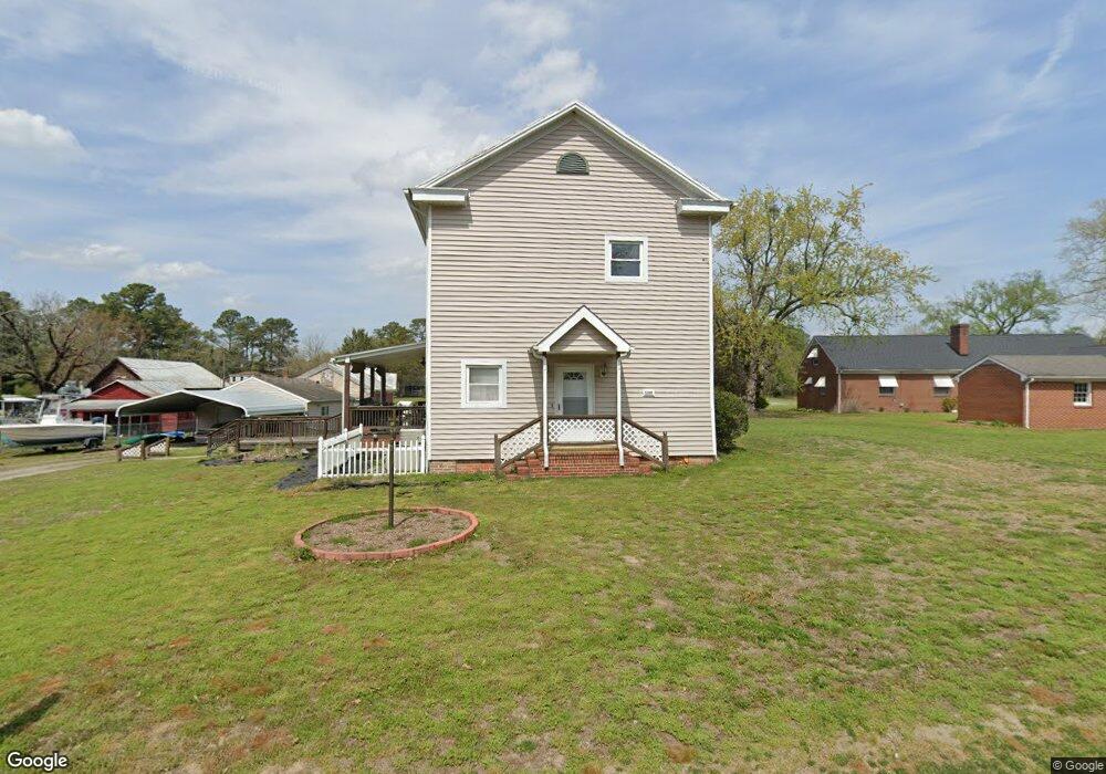
5399 Zuni Cir Zuni, VA 23898
Southern Isle of Wight NeighborhoodEstimated Value: $247,000 - $354,000
3
Beds
3
Baths
1,920
Sq Ft
$155/Sq Ft
Est. Value
About This Home
This home is located at 5399 Zuni Cir, Zuni, VA 23898 and is currently estimated at $297,780, approximately $155 per square foot. 5399 Zuni Cir is a home located in Isle of Wight County with nearby schools including Windsor Elementary School, Georgie D. Tyler Middle School, and Windsor High School.
Ownership History
Date
Name
Owned For
Owner Type
Purchase Details
Closed on
Jul 31, 2024
Sold by
Lowe Quentin D
Bought by
Lowe Quentin D
Current Estimated Value
Home Financials for this Owner
Home Financials are based on the most recent Mortgage that was taken out on this home.
Original Mortgage
$271,219
Outstanding Balance
$267,492
Interest Rate
6.25%
Mortgage Type
FHA
Estimated Equity
$30,288
Purchase Details
Closed on
Dec 29, 2015
Purchase Details
Closed on
Jan 29, 1998
Sold by
Omeara Delbert E
Create a Home Valuation Report for This Property
The Home Valuation Report is an in-depth analysis detailing your home's value as well as a comparison with similar homes in the area
Home Values in the Area
Average Home Value in this Area
Purchase History
| Date | Buyer | Sale Price | Title Company |
|---|---|---|---|
| Lowe Quentin D | -- | First American Title | |
| -- | $171,000 | -- | |
| -- | $36,000 | -- |
Source: Public Records
Mortgage History
| Date | Status | Borrower | Loan Amount |
|---|---|---|---|
| Open | Lowe Quentin D | $271,219 |
Source: Public Records
Tax History Compared to Growth
Tax History
| Year | Tax Paid | Tax Assessment Tax Assessment Total Assessment is a certain percentage of the fair market value that is determined by local assessors to be the total taxable value of land and additions on the property. | Land | Improvement |
|---|---|---|---|---|
| 2025 | $1,820 | $234,900 | $25,000 | $209,900 |
| 2024 | $1,715 | $234,900 | $25,000 | $209,900 |
| 2023 | $1,722 | $234,900 | $25,000 | $209,900 |
| 2022 | $1,419 | $160,600 | $25,000 | $135,600 |
| 2021 | $1,419 | $160,600 | $25,000 | $135,600 |
| 2020 | $1,419 | $160,600 | $25,000 | $135,600 |
| 2019 | $1,419 | $160,600 | $25,000 | $135,600 |
| 2018 | $1,360 | $153,700 | $25,000 | $128,700 |
| 2016 | $1,378 | $153,700 | $25,000 | $128,700 |
| 2015 | $1,208 | $153,700 | $25,000 | $128,700 |
| 2014 | $1,208 | $133,700 | $25,000 | $108,700 |
| 2013 | -- | $133,700 | $25,000 | $108,700 |
Source: Public Records
Map
Nearby Homes
- 20460 Sand Pit Rd
- 5217 Blackie Ln
- 7496 Yellow Hammer Rd
- 11525 Tucker Swamp Rd
- 36295 Seacock Chapel Rd
- 36093 Seacock Chapel Rd
- 18101 Foxfire Trail
- 38556 Warrique Rd
- LOT 10 Strawberry Plains Rd
- 51 Browns Ave
- 4AC General Mahone Blvd
- 35258 Amanda Loop
- 35242 Amanda Loop
- 35250 Amanda Loop
- 5+AC Ivor Rd
- 61+AC Ivor Rd
- 5 AC Ivor Rd
- 15241 Strawberry Plains Rd
- 42 AC Strawberry Plains Rd
- 7b Strawberry Plains Rd
- 5411 Zuni Cir
- 5387 Zuni Cir
- 5352 Windsor Blvd
- 5390 Zuni Cir
- 5404 Zuni Cir
- 5379 Zuni Cir
- 5344 Windsor Blvd
- 5416 Zuni Cir
- 5359 Windsor Blvd
- 5431 Zuni Cir
- 5380 Zuni Cir
- 5375 Windsor Blvd
- 5367 Zuni Cir
- 5374 Zuni Cir
- 5359 Zuni Cir
- 5430 Zuni Cir
- 5328 Windsor Blvd
- 5439 Zuni Cir
- 5439 Zuni Cir
- 20298 Clayton Ln