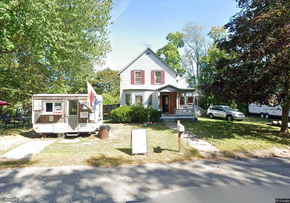
54 Albert Dr Leominster, MA 01453
Estimated Value: $363,000 - $444,000
2
Beds
1
Bath
1,317
Sq Ft
$300/Sq Ft
Est. Value
About This Home
This home is located at 54 Albert Dr, Leominster, MA 01453 and is currently estimated at $395,326, approximately $300 per square foot. 54 Albert Dr is a home located in Worcester County with nearby schools including Leominster High School, St. Anna Catholic School, and St. Leo School.
Ownership History
Date
Name
Owned For
Owner Type
Purchase Details
Closed on
Aug 31, 2018
Sold by
Soucy Ruth L Est and Bouchard
Bought by
Scherer Jack E and Scherer Diane E
Current Estimated Value
Home Financials for this Owner
Home Financials are based on the most recent Mortgage that was taken out on this home.
Original Mortgage
$163,975
Outstanding Balance
$142,888
Interest Rate
4.75%
Mortgage Type
FHA
Estimated Equity
$252,438
Purchase Details
Closed on
Jan 23, 1973
Bought by
Soucy Ruth L
Create a Home Valuation Report for This Property
The Home Valuation Report is an in-depth analysis detailing your home's value as well as a comparison with similar homes in the area
Home Values in the Area
Average Home Value in this Area
Purchase History
| Date | Buyer | Sale Price | Title Company |
|---|---|---|---|
| Scherer Jack E | $167,000 | -- | |
| Scherer Jack E | $167,000 | -- | |
| Soucy Ruth L | -- | -- |
Source: Public Records
Mortgage History
| Date | Status | Borrower | Loan Amount |
|---|---|---|---|
| Open | Scherer Jack E | $163,975 | |
| Closed | Soucy Ruth L | $163,975 |
Source: Public Records
Tax History Compared to Growth
Tax History
| Year | Tax Paid | Tax Assessment Tax Assessment Total Assessment is a certain percentage of the fair market value that is determined by local assessors to be the total taxable value of land and additions on the property. | Land | Improvement |
|---|---|---|---|---|
| 2025 | $4,170 | $297,200 | $100,200 | $197,000 |
| 2024 | $4,045 | $278,800 | $95,400 | $183,400 |
| 2023 | $3,887 | $250,100 | $82,800 | $167,300 |
| 2022 | $3,718 | $224,500 | $72,100 | $152,400 |
| 2021 | $3,622 | $199,800 | $56,100 | $143,700 |
| 2020 | $3,528 | $196,200 | $56,100 | $140,100 |
| 2019 | $3,369 | $181,700 | $53,300 | $128,400 |
| 2018 | $3,093 | $160,000 | $56,200 | $103,800 |
| 2017 | $3,007 | $152,400 | $52,500 | $99,900 |
| 2016 | $2,806 | $143,300 | $52,500 | $90,800 |
| 2015 | $2,685 | $138,100 | $52,500 | $85,600 |
| 2014 | $2,552 | $135,100 | $66,400 | $68,700 |
Source: Public Records
Map
Nearby Homes
- 556 Central St Unit 43
- 556 Central St Unit 39
- 36 Meadow Pond Dr Unit I
- 57 Chapman Place
- 177 Chapman Place
- 93 Chapman Place Unit 93
- 30 Abbey Rd Unit 207
- 10 Abbey Rd Unit 108
- 30 Abbey Rd Unit 202
- 10 Abbey Rd Unit 205
- 197 Chapman Place Unit 197
- 399 Union St
- 45 Tisdale St
- 6 Longwood Ave
- 31 Johnson St
- 498 Lancaster St
- 740 Central St Unit R24
- 740 Central St Unit L22
- 59 Webber St
- 104 Sylvan Ave
- 464 Central St
- 40 Albert Dr Unit 1A
- 40 Albert Dr
- 467 Central St
- 479 Central St
- 485 Central St
- 444 Central St Unit L
- 444 Central St Unit A & B
- 444 Central St Unit C
- 444 Central St Unit E
- 444 Central St Unit A
- 444 Central St Unit B-1
- 444 Central St Unit B
- 444 Central St Unit D
- 444 Central St Unit Whse
- 444 Central St Unit Retail
- 444 Central St Unit Whse B
- 444 Central St Unit A-1
- 444 Central St
- 556 Central St