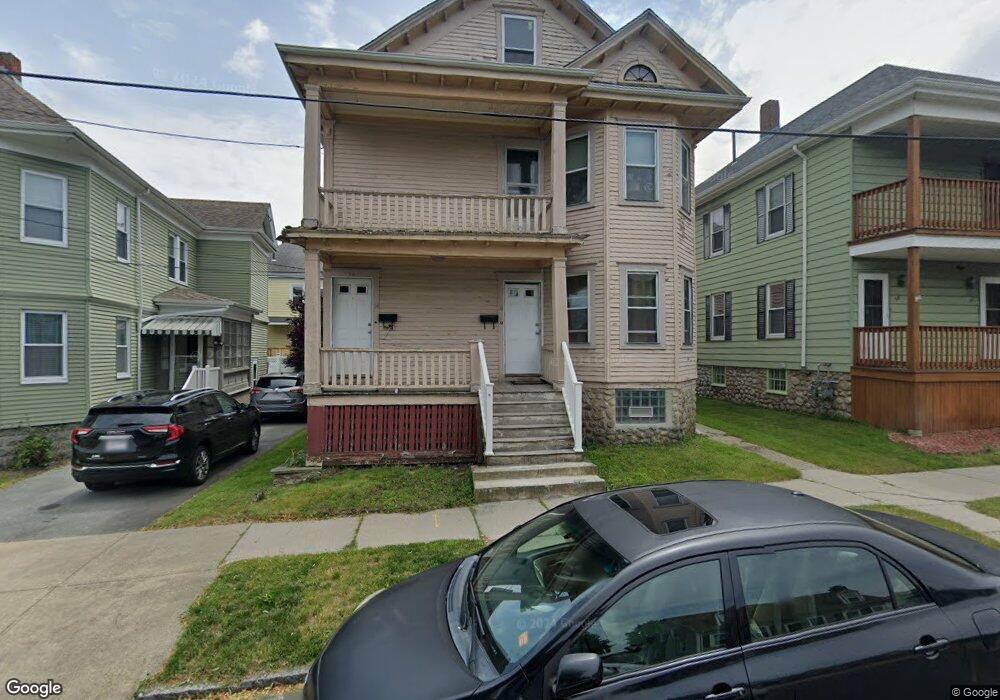
54 Brewster St Unit 56 New Bedford, MA 02745
Acushnet Station NeighborhoodEstimated Value: $473,524 - $621,000
6
Beds
2
Baths
2,336
Sq Ft
$226/Sq Ft
Est. Value
About This Home
This home is located at 54 Brewster St Unit 56, New Bedford, MA 02745 and is currently estimated at $528,381, approximately $226 per square foot. 54 Brewster St Unit 56 is a home located in Bristol County with nearby schools including Jireh Swift School, Normandin Middle School, and New Bedford High School.
Ownership History
Date
Name
Owned For
Owner Type
Purchase Details
Closed on
Jul 3, 2007
Sold by
Deutsche Bank Natl T C
Bought by
Dasilva Joe M and Dasilva Maria S
Current Estimated Value
Home Financials for this Owner
Home Financials are based on the most recent Mortgage that was taken out on this home.
Original Mortgage
$226,348
Interest Rate
6.24%
Mortgage Type
Purchase Money Mortgage
Purchase Details
Closed on
Jan 5, 2007
Sold by
Fullard Nova
Bought by
Deutsche Bank Natl T C
Purchase Details
Closed on
Oct 28, 2005
Sold by
Lebeau Henry
Bought by
Fullard Nova
Create a Home Valuation Report for This Property
The Home Valuation Report is an in-depth analysis detailing your home's value as well as a comparison with similar homes in the area
Home Values in the Area
Average Home Value in this Area
Purchase History
| Date | Buyer | Sale Price | Title Company |
|---|---|---|---|
| Dasilva Joe M | $229,900 | -- | |
| Dasilva Joe M | $229,900 | -- | |
| Deutsche Bank Natl T C | $241,222 | -- | |
| Deutsche Bank Natl T C | $241,222 | -- | |
| Fullard Nova | $278,400 | -- | |
| Fullard Nova | $278,400 | -- |
Source: Public Records
Mortgage History
| Date | Status | Borrower | Loan Amount |
|---|---|---|---|
| Open | Fullard Nova | $229,743 | |
| Closed | Fullard Nova | $226,348 |
Source: Public Records
Tax History Compared to Growth
Tax History
| Year | Tax Paid | Tax Assessment Tax Assessment Total Assessment is a certain percentage of the fair market value that is determined by local assessors to be the total taxable value of land and additions on the property. | Land | Improvement |
|---|---|---|---|---|
| 2025 | $4,702 | $415,700 | $98,600 | $317,100 |
| 2024 | $4,110 | $342,500 | $95,400 | $247,100 |
| 2023 | $3,803 | $266,100 | $80,100 | $186,000 |
| 2022 | $3,453 | $222,200 | $76,300 | $145,900 |
| 2021 | $3,464 | $222,200 | $76,300 | $145,900 |
| 2020 | $3,515 | $217,500 | $77,900 | $139,600 |
| 2019 | $3,447 | $209,300 | $77,900 | $131,400 |
| 2018 | $3,296 | $198,200 | $77,900 | $120,300 |
| 2017 | $2,912 | $174,500 | $71,500 | $103,000 |
| 2016 | $2,752 | $166,900 | $68,400 | $98,500 |
| 2015 | $2,583 | $164,200 | $68,400 | $95,800 |
| 2014 | $2,464 | $162,500 | $66,800 | $95,700 |
Source: Public Records
Map
Nearby Homes
- 263 Hersom St
- 187 Tarkiln Hill Rd
- 6 Illinois St
- 27 Jean St
- 11 Moynan St
- 42 Princeton St
- 4 Tisbury St
- 22 Rock St
- 1840 1846 Acushnet Ave
- 65 Armsby St
- 11 Saucier St
- 42 Query St
- 162 Princeton St
- 250-252 Shaw St
- 135-137 Query St
- 203 S Main St
- 208 Princeton St
- 12 Hayes St Unit 1
- 14 Hayes St Unit 1
- 223 225 Prinston
- 54-56 Brewster St
- 50 Brewster St Unit 52
- 50 Brewster St Unit 2
- 60 Brewster St
- 177 Wood St
- 62 Brewster St Unit 64
- 167 Wood St Unit 169
- 167-169 Wood St
- 48 Brewster St
- 157 Wood St Unit 159
- 181 Wood St Unit 183
- 59 Brewster St
- 42 Brewster St Unit 44
- 151 Wood St Unit 153
- 49 Brewster St
- 2082 Acushnet Ave
- 2082 Acushnet Ave Unit 1
- 147 Wood St Unit 149
- 147 Wood St Unit 1
- 149 Wood St Unit 1