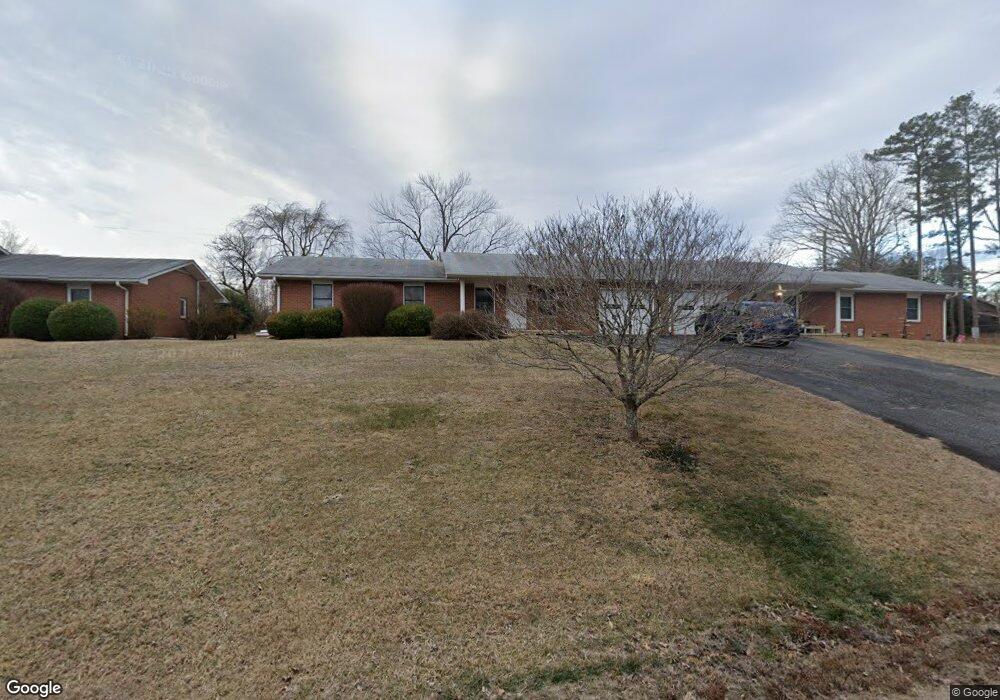
54 Brookside Dr Hendersonville, NC 28792
Estimated Value: $667,000 - $1,046,000
--
Bed
2
Baths
3,180
Sq Ft
$269/Sq Ft
Est. Value
About This Home
This home is located at 54 Brookside Dr, Hendersonville, NC 28792 and is currently estimated at $854,092, approximately $268 per square foot. 54 Brookside Dr is a home located in Henderson County with nearby schools including Clear Creek Elementary School, Apple Valley Middle School, and North Henderson High School.
Ownership History
Date
Name
Owned For
Owner Type
Purchase Details
Closed on
Sep 25, 2025
Sold by
Stanley Will Revocable Trust and Will Kenneth Lamar
Bought by
Will Brothers Llc
Current Estimated Value
Purchase Details
Closed on
Jul 10, 2025
Sold by
Will Brothers Llc
Bought by
Big Woods Investments Llc
Purchase Details
Closed on
Nov 4, 2014
Sold by
Will Kenneth Lamar and Will Wil
Bought by
Will Brothers Llc
Purchase Details
Closed on
Jul 15, 2014
Sold by
Will Stanley S
Bought by
Will Stanley S
Create a Home Valuation Report for This Property
The Home Valuation Report is an in-depth analysis detailing your home's value as well as a comparison with similar homes in the area
Home Values in the Area
Average Home Value in this Area
Purchase History
| Date | Buyer | Sale Price | Title Company |
|---|---|---|---|
| Will Brothers Llc | -- | Chicago Title | |
| Big Woods Investments Llc | $860,000 | Chicago Title | |
| Will Brothers Llc | -- | -- | |
| Will Stanley S | -- | -- |
Source: Public Records
Tax History Compared to Growth
Tax History
| Year | Tax Paid | Tax Assessment Tax Assessment Total Assessment is a certain percentage of the fair market value that is determined by local assessors to be the total taxable value of land and additions on the property. | Land | Improvement |
|---|---|---|---|---|
| 2025 | $4,679 | $857,000 | $81,000 | $776,000 |
| 2024 | $4,679 | $857,000 | $81,000 | $776,000 |
| 2023 | $4,679 | $857,000 | $81,000 | $776,000 |
| 2022 | $4,149 | $609,200 | $66,000 | $543,200 |
| 2021 | $4,149 | $609,200 | $66,000 | $543,200 |
| 2020 | $4,149 | $609,200 | $0 | $0 |
| 2019 | $4,149 | $609,200 | $0 | $0 |
| 2018 | $3,613 | $527,400 | $0 | $0 |
| 2017 | $3,613 | $527,400 | $0 | $0 |
| 2016 | $3,613 | $527,400 | $0 | $0 |
| 2015 | -- | $527,400 | $0 | $0 |
| 2014 | -- | $513,600 | $0 | $0 |
Source: Public Records
Map
Nearby Homes
- 65 Brookside Dr Unit 35
- 1042 Brookside Camp Rd
- 103 Oakwood Place Unit 3
- 103 Oakwood Place Unit 4
- 125 Fulton Dr
- 111 Laura Trace
- 231 Kimberly Ann Dr
- 208 Bragg Ct
- 49 Gosling Cir E
- 324 Whispering Hills Dr
- 21 Fox Run Dr
- 0 Empress Ln
- 701 Salisbury Rd
- 256 Burge Mountain Rd
- 2049 Brookside Camp Rd
- LOT 149 Willow Bend Unit 149
- 71 Willow Bend
- 530 Burge Mountain Rd
- 150 Baton Ln
- TBD Fiver Ln
- 50 Brookside Dr
- 55 Brookside Dr
- 55 Brookside Dr
- 55 Brookside Dr
- 55 Brookside Dr Unit 33
- 55 Brookside Dr Unit 32
- 55 Brookside Dr Unit 31
- 55 Brookside Dr Unit 30
- 55 Brookside Dr Unit 33
- 102 Wynnbrook Dr
- 65 Brookside Dr
- 65 Brookside Dr Unit 37
- 65 Brookside Dr Unit 36
- 65 Brookside Dr Unit 34
- 910 Brookside Camp Rd
- 910 Brookside Camp Rd Unit 22
- 910 Brookside Camp Rd Unit 21
- 910 Brookside Camp Rd
- 910 20 Brookside Camp Rd Unit 20
- 74 Brookside Dr