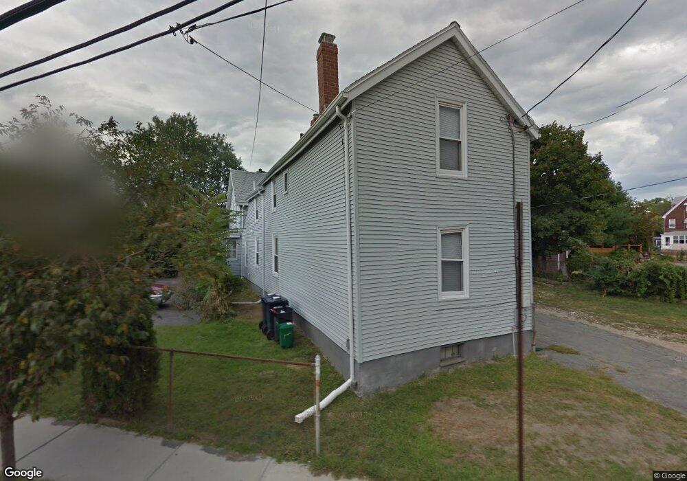
54 Cedar St Cambridge, MA 02140
North Cambridge NeighborhoodEstimated Value: $997,000 - $1,448,000
2
Beds
3
Baths
1,414
Sq Ft
$901/Sq Ft
Est. Value
About This Home
This home is located at 54 Cedar St, Cambridge, MA 02140 and is currently estimated at $1,274,399, approximately $901 per square foot. 54 Cedar St is a home located in Middlesex County with nearby schools including Benjamin Banneker Charter Public School, Cambridge Friends School, and International School of Boston.
Ownership History
Date
Name
Owned For
Owner Type
Purchase Details
Closed on
Dec 8, 2025
Sold by
Lacourt Family Llc
Bought by
Lacourt Legacy Llc
Current Estimated Value
Purchase Details
Closed on
Nov 1, 2019
Sold by
Bingham Thorne and Bingham Keith
Bought by
Bingham Thorne and Bingham Keith C
Purchase Details
Closed on
Apr 18, 2014
Sold by
Bingham Wayne J
Bought by
Thorne-Bingham Keith
Home Financials for this Owner
Home Financials are based on the most recent Mortgage that was taken out on this home.
Original Mortgage
$308,750
Interest Rate
4.26%
Mortgage Type
New Conventional
Create a Home Valuation Report for This Property
The Home Valuation Report is an in-depth analysis detailing your home's value as well as a comparison with similar homes in the area
Home Values in the Area
Average Home Value in this Area
Purchase History
| Date | Buyer | Sale Price | Title Company |
|---|---|---|---|
| Lacourt Legacy Llc | -- | -- | |
| Bingham Thorne | -- | -- | |
| Thorne-Bingham Keith | $325,000 | -- | |
| Thorne-Bingham Keith | $325,000 | -- |
Source: Public Records
Mortgage History
| Date | Status | Borrower | Loan Amount |
|---|---|---|---|
| Previous Owner | Thorne-Bingham Keith | $308,750 | |
| Previous Owner | Thorne-Bingham Keith | $200,000 | |
| Previous Owner | Thorne-Bingham Keith | $100,000 |
Source: Public Records
Tax History
| Year | Tax Paid | Tax Assessment Tax Assessment Total Assessment is a certain percentage of the fair market value that is determined by local assessors to be the total taxable value of land and additions on the property. | Land | Improvement |
|---|---|---|---|---|
| 2025 | $6,102 | $961,000 | $427,400 | $533,600 |
| 2024 | $5,778 | $976,000 | $465,000 | $511,000 |
| 2023 | $5,366 | $915,700 | $473,500 | $442,200 |
| 2022 | $5,178 | $874,600 | $482,800 | $391,800 |
| 2021 | $4,840 | $827,400 | $473,000 | $354,400 |
| 2020 | $4,590 | $798,300 | $462,600 | $335,700 |
| 2019 | $4,135 | $696,100 | $384,500 | $311,600 |
| 2018 | $3,906 | $621,000 | $323,800 | $297,200 |
| 2017 | $3,953 | $609,100 | $303,600 | $305,500 |
| 2016 | $3,814 | $545,700 | $263,100 | $282,600 |
| 2015 | $3,781 | $483,500 | $231,300 | $252,200 |
| 2014 | $3,781 | $451,200 | $202,400 | $248,800 |
Source: Public Records
Map
Nearby Homes
- 69 Harvey St Unit 1
- 151 Sherman St
- 151 Sherman St Unit 151
- 124 Jackson St
- 127 Harvey St
- 97 Elmwood St Unit 313
- 97 Elmwood St Unit 110
- 97 Elmwood St Unit 310
- 9-11 Edmunds St
- 49 Clifton St
- 11 Cogswell Ave Unit 15
- 11 Cogswell Ave Unit 13
- 54 Bellis Cir
- 5 Glendale Ave Unit 5
- 7 Russell St Unit 1
- 38 Brookford St Unit 2
- 34 Elmwood St Unit 2
- 178 Richdale Ave
- 17 Holland St Unit 301
- 7 Beech St Unit 319
- 54 Cedar St Unit R
- 54 Cedar St Unit 59-3R
- 54 Cedar St Unit 3
- 54 Cedar St Unit 1
- 54 Cedar St
- 54 Cedar St Unit 6
- 56 Cedar St Unit 2R
- 56 Cedar St Unit 3
- 56 Cedar St Unit 57-1
- 56 Cedar St Unit 57-3
- 56 Cedar St Unit Cedar St
- 56 Cedar St
- 56 Cedar St Unit 6
- 56 Cedar St Unit 57-6
- 56 Cedar St Unit 5
- 56 Cedar St
- 63 Rice St
- 58 Norris St
- 52 Cedar St
- 60 Norris St
Your Personal Tour Guide
Ask me questions while you tour the home.