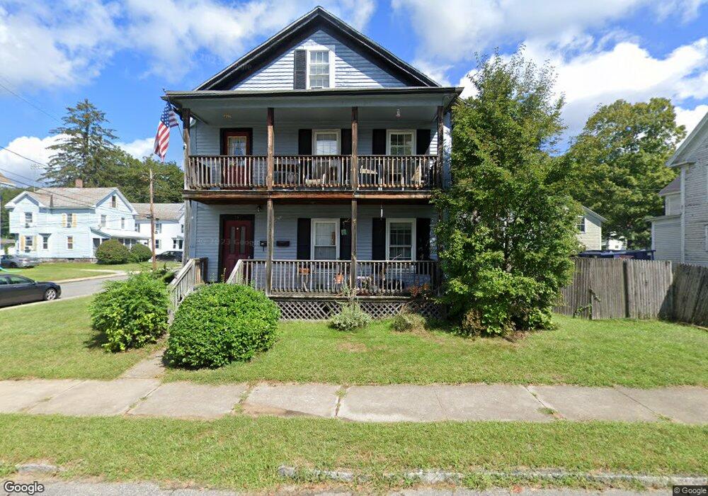
54 Converse St Palmer, MA 01069
Estimated Value: $258,612 - $355,000
5
Beds
2
Baths
1,976
Sq Ft
$151/Sq Ft
Est. Value
About This Home
This home is located at 54 Converse St, Palmer, MA 01069 and is currently estimated at $298,903, approximately $151 per square foot. 54 Converse St is a home located in Hampden County with nearby schools including Old Mill Pond Elementary School, Converse Middle School, and Palmer High School.
Ownership History
Date
Name
Owned For
Owner Type
Purchase Details
Closed on
Jun 21, 2011
Sold by
Menard Louis M
Bought by
Cole Justin
Current Estimated Value
Home Financials for this Owner
Home Financials are based on the most recent Mortgage that was taken out on this home.
Original Mortgage
$93,600
Outstanding Balance
$64,627
Interest Rate
4.74%
Mortgage Type
Purchase Money Mortgage
Estimated Equity
$234,276
Purchase Details
Closed on
Feb 28, 2005
Sold by
Soltys Marie H
Bought by
Menard Louis Michael
Home Financials for this Owner
Home Financials are based on the most recent Mortgage that was taken out on this home.
Original Mortgage
$152,000
Interest Rate
5.73%
Mortgage Type
Purchase Money Mortgage
Purchase Details
Closed on
Jul 1, 1999
Sold by
Usher Frederick C and Usher Judith M
Bought by
Soltys Marie H
Create a Home Valuation Report for This Property
The Home Valuation Report is an in-depth analysis detailing your home's value as well as a comparison with similar homes in the area
Home Values in the Area
Average Home Value in this Area
Purchase History
| Date | Buyer | Sale Price | Title Company |
|---|---|---|---|
| Cole Justin | $117,000 | -- | |
| Cole Justin | $117,000 | -- | |
| Menard Louis Michael | $190,000 | -- | |
| Menard Louis Michael | $190,000 | -- | |
| Soltys Marie H | $117,000 | -- | |
| Soltys Marie H | $117,000 | -- |
Source: Public Records
Mortgage History
| Date | Status | Borrower | Loan Amount |
|---|---|---|---|
| Open | Cole Justin | $93,600 | |
| Closed | Soltys Marie H | $93,600 | |
| Previous Owner | Menard Louis Michael | $152,000 | |
| Previous Owner | Menard Louis Michael | $38,000 |
Source: Public Records
Tax History
| Year | Tax Paid | Tax Assessment Tax Assessment Total Assessment is a certain percentage of the fair market value that is determined by local assessors to be the total taxable value of land and additions on the property. | Land | Improvement |
|---|---|---|---|---|
| 2025 | $3,717 | $204,800 | $50,200 | $154,600 |
| 2024 | $3,196 | $171,200 | $45,700 | $125,500 |
| 2023 | $3,062 | $157,500 | $45,700 | $111,800 |
| 2022 | $2,844 | $132,900 | $40,100 | $92,800 |
| 2021 | $2,675 | $118,200 | $44,500 | $73,700 |
| 2020 | $2,604 | $114,200 | $44,500 | $69,700 |
| 2019 | $2,528 | $114,200 | $44,500 | $69,700 |
| 2018 | $2,471 | $111,900 | $43,200 | $68,700 |
| 2017 | $2,414 | $111,900 | $43,200 | $68,700 |
| 2016 | $2,431 | $114,300 | $41,900 | $72,400 |
| 2015 | $2,358 | $114,300 | $41,900 | $72,400 |
Source: Public Records
Map
Nearby Homes
- 1242 S Main St
- 1240 S Main St
- 0 St Unit 73414881
- 7,37,38 Thorndike and Lawrence St
- 62-91 Lawrence St
- Lots 39-42 Lawrence
- Lot 8 Breckenridge St
- 405 Shearer St
- 1415 Park St
- 268 Palmer Rd Unit 27
- 69 E Palmer Park Dr
- 0 Hovey Rd
- 15 Quaboag Valley Co-Op St Unit 15
- 54-57 Breton and Calkins Rd
- 101 Ware St
- 22 Pine View
- 0 Old Warren Rd
- 4452 High St
- Lot 14 Center St
- 135 Thompson St
- 47 Walnut St
- 47 Walnut St Unit 2
- 1064 Central St
- 46 Walnut St
- 51 Walnut St
- 1070 Central St
- 48 Walnut St
- 48 Converse St
- 49 Converse St
- 49 Converse St Unit 1
- 46 Converse St
- 53 Walnut St
- 50 Walnut St
- 1072 Central St
- 45 Converse St
- 52 Walnut St
- 1071 Central St Unit 1073
- 1065 Central St
- 1065 Central St Unit B
- 1075 Central St
Your Personal Tour Guide
Ask me questions while you tour the home.