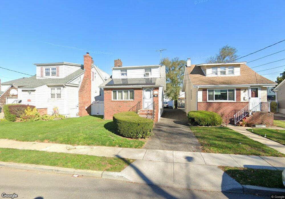
54 Dart St East Rockaway, NY 11518
Estimated Value: $620,070 - $747,000
3
Beds
1
Bath
1,391
Sq Ft
$491/Sq Ft
Est. Value
About This Home
This home is located at 54 Dart St, East Rockaway, NY 11518 and is currently estimated at $683,535, approximately $491 per square foot. 54 Dart St is a home located in Nassau County with nearby schools including East Rockaway Junior/Senior High School and Our Lady Of Peace School.
Ownership History
Date
Name
Owned For
Owner Type
Purchase Details
Closed on
Mar 13, 2006
Sold by
Masterson Joseph
Current Estimated Value
Purchase Details
Closed on
Oct 18, 2000
Sold by
Heitman Linda
Bought by
Masterson Joseph S and Masterson Donna L
Purchase Details
Closed on
Mar 22, 1999
Create a Home Valuation Report for This Property
The Home Valuation Report is an in-depth analysis detailing your home's value as well as a comparison with similar homes in the area
Home Values in the Area
Average Home Value in this Area
Purchase History
| Date | Buyer | Sale Price | Title Company |
|---|---|---|---|
| -- | -- | -- | |
| Masterson Joseph S | $187,000 | Jodi Linsky | |
| -- | -- | -- |
Source: Public Records
Tax History Compared to Growth
Tax History
| Year | Tax Paid | Tax Assessment Tax Assessment Total Assessment is a certain percentage of the fair market value that is determined by local assessors to be the total taxable value of land and additions on the property. | Land | Improvement |
|---|---|---|---|---|
| 2025 | $10,925 | $443 | $167 | $276 |
| 2024 | $1,770 | $443 | $167 | $276 |
| 2023 | $10,613 | $443 | $167 | $276 |
| 2022 | $10,613 | $443 | $167 | $276 |
| 2021 | $15,452 | $430 | $162 | $268 |
| 2020 | $10,370 | $644 | $397 | $247 |
| 2019 | $8,859 | $644 | $397 | $247 |
| 2018 | $8,112 | $644 | $0 | $0 |
| 2017 | $5,630 | $644 | $340 | $304 |
| 2016 | $7,100 | $644 | $340 | $304 |
| 2015 | $1,685 | $752 | $397 | $355 |
| 2014 | $1,685 | $752 | $397 | $355 |
| 2013 | $1,568 | $752 | $397 | $355 |
Source: Public Records
Map
Nearby Homes