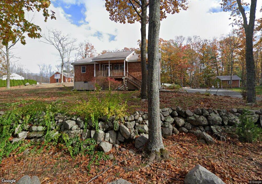
54 Fernald St Gloucester, MA 01930
West Gloucester NeighborhoodEstimated Value: $647,000 - $811,000
2
Beds
2
Baths
1,344
Sq Ft
$525/Sq Ft
Est. Value
About This Home
This home is located at 54 Fernald St, Gloucester, MA 01930 and is currently estimated at $705,226, approximately $524 per square foot. 54 Fernald St is a home located in Essex County with nearby schools including West Parish, Ralph B O'maley Middle School, and Faith Christian School.
Ownership History
Date
Name
Owned For
Owner Type
Purchase Details
Closed on
May 7, 2003
Sold by
Jacobs Donald W and Jacobs Russell W
Bought by
Jacobs Michael W
Current Estimated Value
Create a Home Valuation Report for This Property
The Home Valuation Report is an in-depth analysis detailing your home's value as well as a comparison with similar homes in the area
Home Values in the Area
Average Home Value in this Area
Purchase History
| Date | Buyer | Sale Price | Title Company |
|---|---|---|---|
| Jacobs Michael W | -- | -- |
Source: Public Records
Mortgage History
| Date | Status | Borrower | Loan Amount |
|---|---|---|---|
| Open | Jacobs Michael W | $140,000 | |
| Closed | Jacobs Michael W | $100,000 |
Source: Public Records
Tax History Compared to Growth
Tax History
| Year | Tax Paid | Tax Assessment Tax Assessment Total Assessment is a certain percentage of the fair market value that is determined by local assessors to be the total taxable value of land and additions on the property. | Land | Improvement |
|---|---|---|---|---|
| 2025 | $6,463 | $664,900 | $232,800 | $432,100 |
| 2024 | $6,301 | $647,600 | $221,700 | $425,900 |
| 2023 | $6,357 | $600,300 | $197,800 | $402,500 |
| 2022 | $6,063 | $516,900 | $172,100 | $344,800 |
| 2021 | $6,208 | $499,000 | $156,700 | $342,300 |
| 2020 | $5,852 | $474,600 | $156,700 | $317,900 |
| 2019 | $5,832 | $459,600 | $156,700 | $302,900 |
| 2018 | $5,798 | $448,400 | $156,700 | $291,700 |
| 2017 | $5,665 | $429,500 | $149,200 | $280,300 |
| 2016 | $5,552 | $407,900 | $155,700 | $252,200 |
| 2015 | $5,476 | $401,200 | $155,700 | $245,500 |
Source: Public Records
Map
Nearby Homes
- 11 Overlook Ave
- 7 Leaman Dr
- 587 Essex Ave
- 368 Essex Ave
- 30 Atlantic St
- 12 Woodward Ave
- 139 Eastern Ave
- 227 Essex Ave
- 5 Samoset Rd Unit A
- 109 Riverview Rd
- 145 Essex Ave Unit 610
- 188 Atlantic St
- 53 Southern Ave
- 162 Main St
- 63 Southern Ave
- 90 Southern Ave Unit 90
- 49 Thurston Point Rd
- 226 Atlantic St
- 18 Cherry St
- 196 Washington St
- 61 Fernald St
- 52 Fernald St
- 65 Fernald St
- 67 Fernald St
- 49 Fernald St
- 47 Fernald St
- 63 Fernald St
- 50 Fernald St
- 73 Fernald St
- 41 Fernald St
- 46 Fernald St
- 35 Fernald St
- 31 Fernald St
- 38 Fernald St
- 23 A Fernald St Unit A
- 23 Fernald St Unit B
- 23 Fernald St Unit A
- 23 Fernald St
- 34 Fernald St
- 25 Fernald St