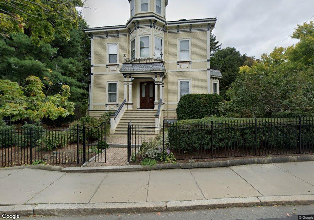
54 Francis St Brookline, MA 02446
Coolidge Corner NeighborhoodEstimated Value: $3,053,138 - $3,276,000
4
Beds
3
Baths
3,224
Sq Ft
$979/Sq Ft
Est. Value
About This Home
This home is located at 54 Francis St, Brookline, MA 02446 and is currently estimated at $3,157,785, approximately $979 per square foot. 54 Francis St is a home located in Norfolk County with nearby schools including Amos A. Lawrence School, Brookline High School, and St. Mary of the Assumption Elementary School.
Ownership History
Date
Name
Owned For
Owner Type
Purchase Details
Closed on
Jun 30, 2009
Sold by
Kozakewich Harry P and Andrus Cornelia S
Bought by
Andrus Cornelia S
Current Estimated Value
Purchase Details
Closed on
Sep 30, 1982
Bought by
Kozakewich Harry P W and Andrus Cornelia S
Create a Home Valuation Report for This Property
The Home Valuation Report is an in-depth analysis detailing your home's value as well as a comparison with similar homes in the area
Home Values in the Area
Average Home Value in this Area
Purchase History
| Date | Buyer | Sale Price | Title Company |
|---|---|---|---|
| Andrus Cornelia S | -- | None Available | |
| Kozakewich Harry P W | $150,000 | -- |
Source: Public Records
Mortgage History
| Date | Status | Borrower | Loan Amount |
|---|---|---|---|
| Previous Owner | Kozakewich Harry P W | $260,000 | |
| Previous Owner | Kozakewich Harry P W | $259,500 | |
| Previous Owner | Kozakewich Harry P W | $60,000 | |
| Previous Owner | Kozakewich Harry P W | $200,000 |
Source: Public Records
Tax History
| Year | Tax Paid | Tax Assessment Tax Assessment Total Assessment is a certain percentage of the fair market value that is determined by local assessors to be the total taxable value of land and additions on the property. | Land | Improvement |
|---|---|---|---|---|
| 2025 | $26,004 | $2,634,700 | $1,440,200 | $1,194,500 |
| 2024 | $24,777 | $2,536,000 | $1,384,900 | $1,151,100 |
| 2023 | $22,686 | $2,275,400 | $1,147,000 | $1,128,400 |
| 2022 | $22,081 | $2,166,900 | $1,092,300 | $1,074,600 |
| 2021 | $20,419 | $2,083,600 | $1,050,300 | $1,033,300 |
| 2020 | $18,652 | $1,973,800 | $954,800 | $1,019,000 |
| 2019 | $17,614 | $1,879,800 | $909,300 | $970,500 |
| 2018 | $16,272 | $1,720,100 | $761,400 | $958,700 |
| 2017 | $16,033 | $1,622,800 | $718,300 | $904,500 |
| 2016 | $15,525 | $1,489,900 | $671,300 | $818,600 |
| 2015 | $14,262 | $1,335,400 | $570,400 | $765,000 |
| 2014 | $14,650 | $1,286,200 | $517,700 | $768,500 |
Source: Public Records
Map
Nearby Homes
- 65 Francis St Unit A
- 216 Aspinwall Ave
- 216 Aspinwall Ave Unit 3
- 96 Brook St Unit 3
- 60 Longwood Ave Unit 802
- 60 Longwood Ave Unit 307
- 45 Longwood Ave Unit 812
- 100 Sewall Ave Unit 5
- 50 Longwood Ave Unit 518
- 50 Longwood Ave Unit 611
- 20 Chapel St Unit APH4
- 20 Chapel St Unit A303
- 20 Chapel St Unit B712
- 20 Chapel St Unit A703
- 1243 Beacon St Unit 5A
- 6 Parkway Rd Unit 6
- 58 Kent St Unit 301
- 58 Kent St Unit 305
- 58 Kent St Unit 402
- 58 Kent St Unit 404
- 48 Francis St
- 48 Francis St
- 48 Francis St Unit 2
- 97 Toxteth St
- 44 Francis St
- 44 Francis St
- 44 Francis St Unit 1
- 66 Harrison St Unit 1
- 60 Harrison St Unit 2
- 60 Harrison St Unit 1
- 104 Toxteth St Unit 1
- 104 Toxteth St Unit 5
- 104 Toxteth St Unit 2
- 104 Toxteth St
- 104 Toxteth St Unit 3
- 64 Francis St Unit B
- 63 Francis St
- 54 Harrison St Unit 56
- 98 Toxteth St Unit 6
- 98 Toxteth St Unit 2