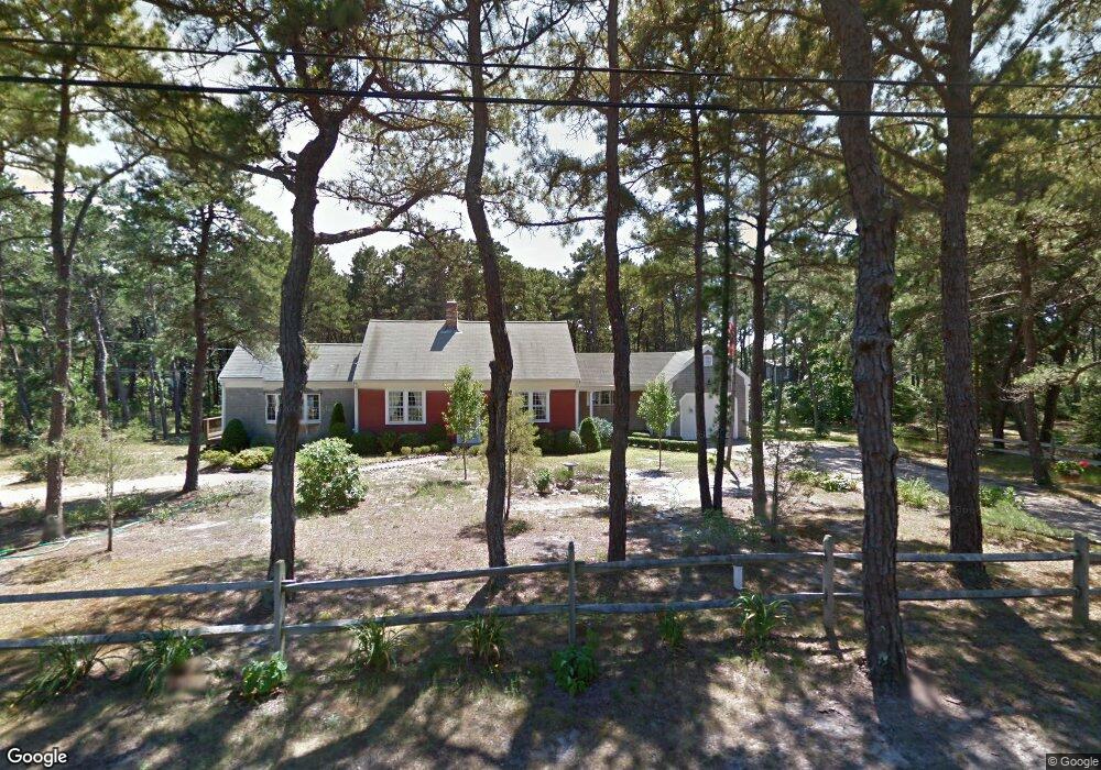
54 Fresh Brook Ln Wellfleet, MA 02667
Estimated Value: $605,000 - $697,000
2
Beds
1
Bath
1,048
Sq Ft
$619/Sq Ft
Est. Value
About This Home
This home is located at 54 Fresh Brook Ln, Wellfleet, MA 02667 and is currently estimated at $649,125, approximately $619 per square foot. 54 Fresh Brook Ln is a home located in Barnstable County with nearby schools including Wellfleet Elementary School, Nauset Regional Middle School, and Nauset Regional High School.
Ownership History
Date
Name
Owned For
Owner Type
Purchase Details
Closed on
Aug 15, 2024
Sold by
Freimuth Paul I and Freimuth Susan M
Bought by
Freimuth Ft and Freimuth
Current Estimated Value
Purchase Details
Closed on
Oct 1, 1965
Bought by
Freimuth Irving G and Freimuth Mary M
Create a Home Valuation Report for This Property
The Home Valuation Report is an in-depth analysis detailing your home's value as well as a comparison with similar homes in the area
Home Values in the Area
Average Home Value in this Area
Purchase History
| Date | Buyer | Sale Price | Title Company |
|---|---|---|---|
| Freimuth Ft | -- | None Available | |
| Freimuth Susan M | -- | None Available | |
| Freimuth Ft | -- | None Available | |
| Freimuth Ft | -- | None Available | |
| Freimuth Susan M | -- | None Available | |
| Freimuth Susan M | -- | None Available | |
| Freimuth Irving G | -- | -- |
Source: Public Records
Tax History
| Year | Tax Paid | Tax Assessment Tax Assessment Total Assessment is a certain percentage of the fair market value that is determined by local assessors to be the total taxable value of land and additions on the property. | Land | Improvement |
|---|---|---|---|---|
| 2025 | $4,051 | $569,800 | $256,500 | $313,300 |
| 2024 | $3,774 | $552,500 | $244,300 | $308,200 |
| 2023 | $3,367 | $483,700 | $207,100 | $276,600 |
| 2022 | $2,975 | $382,400 | $181,600 | $200,800 |
| 2021 | $2,632 | $334,900 | $162,200 | $172,700 |
| 2020 | $2,716 | $350,500 | $180,700 | $169,800 |
| 2019 | $2,820 | $364,800 | $200,800 | $164,000 |
| 2018 | $2,596 | $361,600 | $200,800 | $160,800 |
| 2017 | $2,444 | $360,400 | $200,800 | $159,600 |
| 2016 | $2,223 | $325,500 | $169,000 | $156,500 |
| 2015 | $2,113 | $311,600 | $157,500 | $154,100 |
Source: Public Records
Map
Nearby Homes
- 205 Blue Heron Rd
- 46 Spring Brook Rd
- 90 Ring Rd
- 25 Oakwood Rd
- 100 Gigi Ln
- 5470 State Hwy
- 115 Wamsutta Rd
- 311 S Sunken Meadow Rd
- 80 Quason Dr
- 95 Toland Dr
- 65 Harmes Way
- 495 Aspinet Rd
- 18 Jay Dee Ln
- 255 Epanow Rd
- 190 Silver Spring Beach Rd
- 35 Wiley Ln
- 157 Brownell Rd
- 20 Oak Rd
- 344 King Phillip Rd
- 88 Cottontail Rd
- 240 Route 6
- 38 Fresh Brook Ln
- 68 Fresh Brook Ln
- 45 Fresh Brook Ln
- 55 Fresh Brook Ln
- 60 Old Bay Rd
- 56 Old Bay Rd
- 79 Fresh Brook Ln
- 84 Fresh Brook Ln
- 85 Sea Pine Rd
- 85 Old Bay Rd
- 76 Sea Pine Rd
- 1 Fresh Brook Ln
- 165 Fresh Brook Ln
- 198 Fresh Brook Ln
- 40 Old Bay Rd
- 113 Fresh Brook Ln
- 55 Old Bay Rd
- 17 Fresh Brook Ln
- 100 Fresh Brook Ln
Your Personal Tour Guide
Ask me questions while you tour the home.