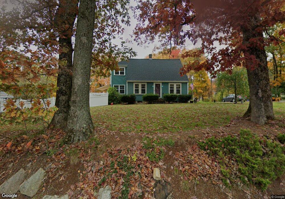
54 George St Mendon, MA 01756
Estimated Value: $551,000 - $729,000
3
Beds
2
Baths
2,591
Sq Ft
$245/Sq Ft
Est. Value
About This Home
This home is located at 54 George St, Mendon, MA 01756 and is currently estimated at $635,655, approximately $245 per square foot. 54 George St is a home located in Worcester County with nearby schools including Nipmuc Regional High School, Bethany Christian Academy, and Mendon Mennonite School.
Ownership History
Date
Name
Owned For
Owner Type
Purchase Details
Closed on
Mar 27, 2020
Sold by
Clifton Theresa A and Clifton Bruce L
Bought by
Theresa A Clifton Lt
Current Estimated Value
Purchase Details
Closed on
Mar 6, 1996
Sold by
Est Cox Nathaniel and Cox Daniel W
Bought by
Clifton Bruce and Cliftno Theresa
Home Financials for this Owner
Home Financials are based on the most recent Mortgage that was taken out on this home.
Original Mortgage
$88,000
Interest Rate
7%
Mortgage Type
Purchase Money Mortgage
Create a Home Valuation Report for This Property
The Home Valuation Report is an in-depth analysis detailing your home's value as well as a comparison with similar homes in the area
Home Values in the Area
Average Home Value in this Area
Purchase History
| Date | Buyer | Sale Price | Title Company |
|---|---|---|---|
| Theresa A Clifton Lt | -- | None Available | |
| Clifton Bruce | $110,000 | -- |
Source: Public Records
Mortgage History
| Date | Status | Borrower | Loan Amount |
|---|---|---|---|
| Previous Owner | Clifton Bruce | $88,000 |
Source: Public Records
Tax History Compared to Growth
Tax History
| Year | Tax Paid | Tax Assessment Tax Assessment Total Assessment is a certain percentage of the fair market value that is determined by local assessors to be the total taxable value of land and additions on the property. | Land | Improvement |
|---|---|---|---|---|
| 2025 | $7,334 | $547,700 | $133,200 | $414,500 |
| 2024 | $7,184 | $524,000 | $128,100 | $395,900 |
| 2023 | $6,941 | $475,400 | $114,300 | $361,100 |
| 2022 | $6,441 | $418,000 | $111,400 | $306,600 |
| 2021 | $6,298 | $375,100 | $108,000 | $267,100 |
| 2020 | $6,112 | $364,900 | $108,000 | $256,900 |
| 2019 | $5,772 | $344,800 | $104,900 | $239,900 |
| 2018 | $5,451 | $321,400 | $104,900 | $216,500 |
| 2017 | $5,572 | $313,900 | $104,900 | $209,000 |
| 2016 | $5,475 | $317,400 | $111,400 | $206,000 |
| 2015 | $4,857 | $303,400 | $111,400 | $192,000 |
| 2014 | $4,638 | $289,500 | $107,900 | $181,600 |
Source: Public Records
Map
Nearby Homes
- 2 Crestview Dr
- 8 Neck Hill Rd
- 10 Bicknell Dr
- 46 Crestview Dr
- 22 Neck Hill Rd
- 103 Laurelwood Dr
- 25 Bens Way
- 164 Greene St
- 54 Hill St
- 57 Hill St
- 112 Greene St
- 10 Applewood Ln
- 26 Brookview Ln Unit 26
- 11 Heron Ln
- 11-13 Malquin Dr
- 4 Megan Ct Unit B
- 8 Puffer Dr
- 17 Harmony Trail
- 29 Harmony Trail
- 1 Haven Way