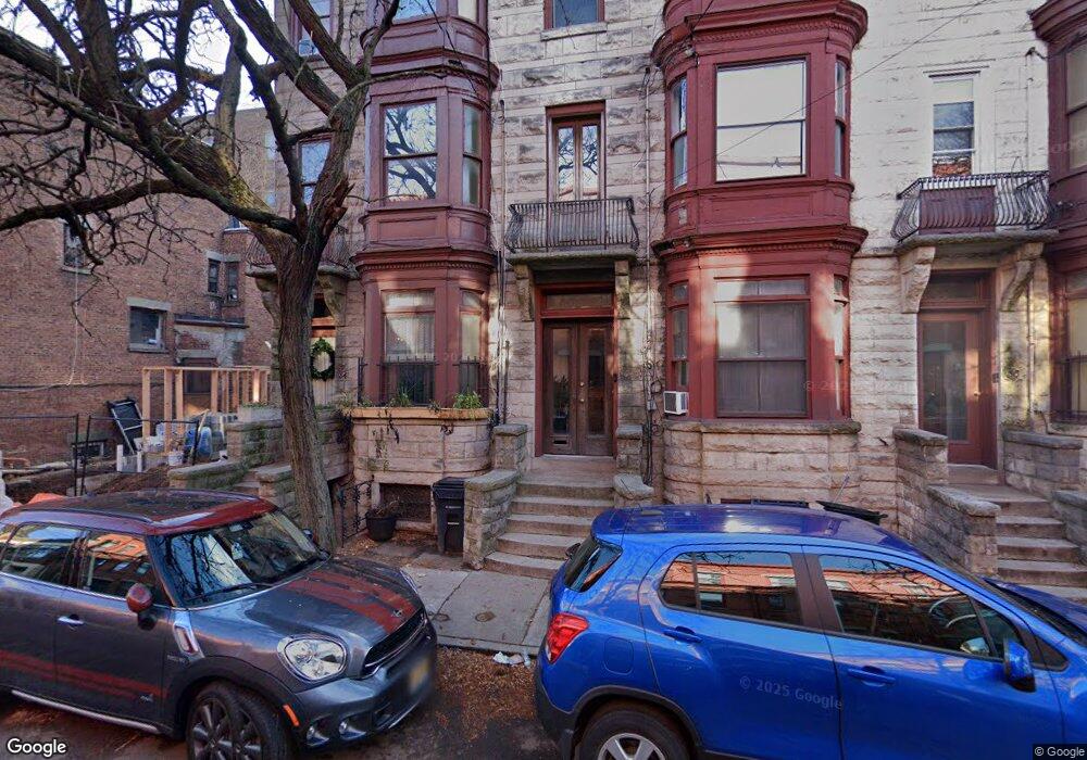
54 James St Newark, NJ 07102
University Heights NeighborhoodEstimated Value: $535,172 - $642,000
3
Beds
2
Baths
3,715
Sq Ft
$164/Sq Ft
Est. Value
About This Home
This home is located at 54 James St, Newark, NJ 07102 and is currently estimated at $607,793, approximately $163 per square foot. 54 James St is a home located in Essex County with nearby schools including Sir Isaac Newton Elementary School, Lafayette Street Elementary School, and Cleveland Elementary School.
Create a Home Valuation Report for This Property
The Home Valuation Report is an in-depth analysis detailing your home's value as well as a comparison with similar homes in the area
Home Values in the Area
Average Home Value in this Area
Tax History
We collect this data history from publicly available records. To have your information removed, we recommend requesting removal directly through your county’s website.
| Year | Tax Paid | Tax Assessment Tax Assessment Total Assessment is a certain percentage of the fair market value that is determined by local assessors to be the total taxable value of land and additions on the property. | Land | Improvement |
|---|---|---|---|---|
| 2025 | $5,623 | $140,600 | $37,000 | $103,600 |
| 2024 | $5,242 | $140,600 | $37,000 | $103,600 |
| 2022 | $5,253 | $140,600 | $37,000 | $103,600 |
| 2021 | $5,250 | $140,600 | $37,000 | $103,600 |
| 2020 | $5,343 | $140,600 | $37,000 | $103,600 |
| 2019 | $5,288 | $140,600 | $37,000 | $103,600 |
| 2018 | $5,192 | $140,600 | $37,000 | $103,600 |
| 2017 | $5,005 | $140,600 | $37,000 | $103,600 |
| 2016 | $4,837 | $140,600 | $37,000 | $103,600 |
| 2015 | $4,652 | $140,600 | $37,000 | $103,600 |
| 2014 | $4,360 | $140,600 | $37,000 | $103,600 |
Source: Public Records
Map
Nearby Homes
- 279 Dr Martin Luther King J
- 62 S Orange Ave
- 17 8th Ave
- 272-274 Orange St
- 201 Dey St Unit C124
- 201 Dey St Unit C126
- 25-27 Norfolk St
- 310 Passaic Ave Unit 301
- 43 Crane St
- 308-310 Passaic Ave Unit 402
- 308-310 Passaic Ave Unit 215
- 308-310 Passaic Ave Unit 301
- 49B Wickliffe St
- 91 Callahan Ct
- 286 Broad St
- 286 Mayor Kenneth A Gibson Blvd
- 72 Marrow St Unit 3101
- 72 Marrow St
- 116 1st St
- 104 Harrison Ave
Your Personal Tour Guide
Ask me questions while you tour the home.