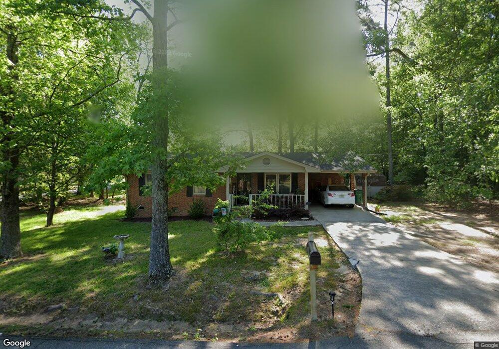
54 Linwood Ave Unit 11 Winder, GA 30680
Estimated Value: $275,000 - $283,160
3
Beds
2
Baths
1,050
Sq Ft
$267/Sq Ft
Est. Value
About This Home
This home is located at 54 Linwood Ave Unit 11, Winder, GA 30680 and is currently estimated at $280,540, approximately $267 per square foot. 54 Linwood Ave Unit 11 is a home located in Barrow County with nearby schools including County Line Elementary School, Russell Middle School, and Winder-Barrow High School.
Ownership History
Date
Name
Owned For
Owner Type
Purchase Details
Closed on
Jul 17, 2019
Sold by
Blackwell Gordon L
Bought by
Jones David and Jones Kelly
Current Estimated Value
Home Financials for this Owner
Home Financials are based on the most recent Mortgage that was taken out on this home.
Original Mortgage
$112,400
Outstanding Balance
$98,432
Interest Rate
3.8%
Mortgage Type
New Conventional
Estimated Equity
$182,108
Purchase Details
Closed on
May 7, 2019
Sold by
Smith Lucy F
Bought by
Blackwell Gordon
Purchase Details
Closed on
Nov 8, 2002
Sold by
Smith Lucy F
Bought by
Smith Lucy F and Smith Beverly M
Purchase Details
Closed on
Nov 28, 1994
Sold by
Saxton Randall
Bought by
Smith Lucy
Home Financials for this Owner
Home Financials are based on the most recent Mortgage that was taken out on this home.
Original Mortgage
$44,520
Interest Rate
8%
Mortgage Type
FHA
Create a Home Valuation Report for This Property
The Home Valuation Report is an in-depth analysis detailing your home's value as well as a comparison with similar homes in the area
Home Values in the Area
Average Home Value in this Area
Purchase History
| Date | Buyer | Sale Price | Title Company |
|---|---|---|---|
| Jones David | $140,500 | -- | |
| Blackwell Gordon | $102,000 | -- | |
| Smith Lucy F | -- | -- | |
| Smith Lucy | $17,500 | -- |
Source: Public Records
Mortgage History
| Date | Status | Borrower | Loan Amount |
|---|---|---|---|
| Open | Jones David | $112,400 | |
| Previous Owner | Smith Lucy | $44,520 | |
| Closed | Smith Lucy | $17,760 |
Source: Public Records
Tax History Compared to Growth
Tax History
| Year | Tax Paid | Tax Assessment Tax Assessment Total Assessment is a certain percentage of the fair market value that is determined by local assessors to be the total taxable value of land and additions on the property. | Land | Improvement |
|---|---|---|---|---|
| 2024 | $2,781 | $98,143 | $14,000 | $84,143 |
| 2023 | $2,772 | $98,143 | $14,000 | $84,143 |
| 2022 | $2,597 | $75,931 | $14,000 | $61,931 |
| 2021 | $2,475 | $67,823 | $10,000 | $57,823 |
| 2020 | $1,952 | $55,501 | $10,000 | $45,501 |
| 2019 | $983 | $25,400 | $8,000 | $17,400 |
| 2018 | $981 | $25,400 | $8,000 | $17,400 |
| 2017 | $780 | $26,152 | $8,000 | $18,152 |
| 2016 | $310 | $26,152 | $8,000 | $18,152 |
| 2015 | $310 | $26,152 | $8,000 | $18,152 |
| 2014 | $171 | $23,640 | $5,488 | $18,152 |
| 2013 | -- | $22,758 | $5,488 | $17,270 |
Source: Public Records
Map
Nearby Homes
- 273 Nancy St
- 323 Lumpkin St
- 317 Georgia Ave
- 131 Pinehurst Dr
- 0 W Williams St Unit 10464682
- 270 Griffith St
- 154 Blake Ln
- 52 Saint Ives Cir
- 227 Martin Luther King jr Dr
- 165 Shields St
- 260 Westlyn Way
- 311 N Broad St
- 206 Atlas Ln
- 193 Atlas Ln
- 181 Atlas Ln
- 153 Atlas Ln Unit 2
- 78 Shoal Ct
- 218 Atlas Ln
- 153 Atlas Ln
- 211 Atlas Ln
- 54 Linwood Ave
- 303 Lumpkin St
- 293 Lumpkin St
- 309 Lumpkin St
- 0 Lumpkin St Unit 7306477
- 0 Lumpkin St Unit 8151673
- 0 Lumpkin St Unit 8130780
- 0 Lumpkin St Unit 8075622
- 0 Lumpkin St Unit 7431021
- 0 Lumpkin St Unit 9020126
- 0 Lumpkin St Unit 8839328
- 0 Lumpkin St
- 282 Nancy St
- 286 Nancy St
- 40 Mimosa St
- 276 Nancy St
- 289 Lumpkin St
- 311 Lumpkin St
- 311 Lumpkin St Unit 14
- 308 Lumpkin St