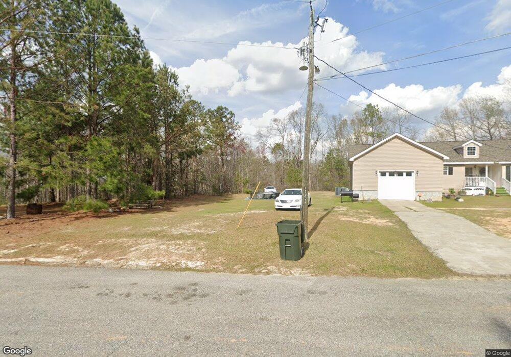
54 Longleaf Dr Swainsboro, GA 30401
Estimated Value: $144,000 - $226,000
3
Beds
2
Baths
1,670
Sq Ft
$114/Sq Ft
Est. Value
About This Home
This home is located at 54 Longleaf Dr, Swainsboro, GA 30401 and is currently estimated at $190,167, approximately $113 per square foot. 54 Longleaf Dr is a home with nearby schools including Swainsboro Primary School, Swainsboro Elementary School, and Swainsboro Middle School.
Ownership History
Date
Name
Owned For
Owner Type
Purchase Details
Closed on
Nov 6, 2008
Sold by
Oak Ridge Inc
Bought by
Cheeks Stephanie L
Current Estimated Value
Purchase Details
Closed on
Nov 5, 2008
Sold by
Oak Crest Investments Lllp
Bought by
Oak Ridge Inc
Purchase Details
Closed on
Sep 22, 2008
Sold by
Rankine Robert
Bought by
Oakridge Corporation
Purchase Details
Closed on
Aug 5, 2008
Sold by
City Of Swainsboro
Bought by
Rankine Robert
Create a Home Valuation Report for This Property
The Home Valuation Report is an in-depth analysis detailing your home's value as well as a comparison with similar homes in the area
Home Values in the Area
Average Home Value in this Area
Purchase History
| Date | Buyer | Sale Price | Title Company |
|---|---|---|---|
| Cheeks Stephanie L | $115,000 | -- | |
| Oak Ridge Inc | -- | -- | |
| Oakridge Corporation | -- | -- | |
| Rankine Robert | $1,380 | -- |
Source: Public Records
Tax History Compared to Growth
Tax History
| Year | Tax Paid | Tax Assessment Tax Assessment Total Assessment is a certain percentage of the fair market value that is determined by local assessors to be the total taxable value of land and additions on the property. | Land | Improvement |
|---|---|---|---|---|
| 2024 | $2,199 | $57,414 | $2,760 | $54,654 |
| 2023 | $855 | $49,490 | $2,760 | $46,730 |
| 2022 | $1,074 | $45,274 | $2,760 | $42,514 |
| 2021 | $1,020 | $42,262 | $2,400 | $39,862 |
| 2020 | $993 | $39,150 | $1,314 | $37,836 |
| 2019 | $993 | $39,150 | $1,314 | $37,836 |
| 2018 | $1,124 | $42,524 | $4,688 | $37,836 |
| 2017 | $1,127 | $42,524 | $4,688 | $37,836 |
| 2016 | $1,074 | $42,524 | $4,688 | $37,836 |
| 2015 | -- | $42,184 | $4,688 | $37,496 |
| 2014 | -- | $41,215 | $4,688 | $36,527 |
| 2013 | -- | $40,747 | $4,688 | $36,059 |
Source: Public Records
Map
Nearby Homes
- 0 Modoc Rd Unit 10587358
- 0 Modoc Rd Unit 25131986
- 625 Allen St Unit 12
- 211 Wells St
- 629 Thompson Rd
- 217 Fowler St
- 646 N Main St
- 423 E Martin Luther King Junior Blvd
- 625 N Main St
- 150 Blackberry Trail
- 1513 Paris Ave
- 402 N Main St
- 400 N Main St
- 14.53 ACRES Gumlog Rd
- 323 N Main St
- 1016 Old Wadley Rd
- 310 Advantage Ln
- 219 Lucky St
- 178 Advantage Ln
- 327 W Church St