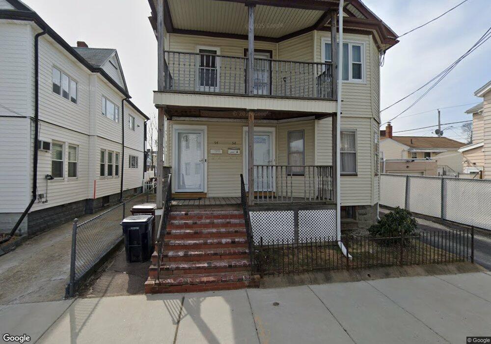
54 Myrtle St Everett, MA 02149
Glendale NeighborhoodEstimated Value: $788,025 - $895,000
4
Beds
2
Baths
2,240
Sq Ft
$372/Sq Ft
Est. Value
About This Home
This home is located at 54 Myrtle St, Everett, MA 02149 and is currently estimated at $832,756, approximately $371 per square foot. 54 Myrtle St is a home located in Middlesex County with nearby schools including Everett High School and Pioneer Charter School of Science.
Ownership History
Date
Name
Owned For
Owner Type
Purchase Details
Closed on
Dec 12, 2003
Sold by
Cataldo Olympia M Est
Bought by
Caldas Wander
Current Estimated Value
Home Financials for this Owner
Home Financials are based on the most recent Mortgage that was taken out on this home.
Original Mortgage
$402,800
Outstanding Balance
$186,911
Interest Rate
5.9%
Mortgage Type
Purchase Money Mortgage
Estimated Equity
$645,845
Create a Home Valuation Report for This Property
The Home Valuation Report is an in-depth analysis detailing your home's value as well as a comparison with similar homes in the area
Home Values in the Area
Average Home Value in this Area
Purchase History
| Date | Buyer | Sale Price | Title Company |
|---|---|---|---|
| Caldas Wander | $424,000 | -- |
Source: Public Records
Mortgage History
| Date | Status | Borrower | Loan Amount |
|---|---|---|---|
| Open | Caldas Wander | $402,800 |
Source: Public Records
Tax History
| Year | Tax Paid | Tax Assessment Tax Assessment Total Assessment is a certain percentage of the fair market value that is determined by local assessors to be the total taxable value of land and additions on the property. | Land | Improvement |
|---|---|---|---|---|
| 2025 | $8,806 | $773,100 | $252,300 | $520,800 |
| 2024 | $8,055 | $702,900 | $224,300 | $478,600 |
| 2023 | $7,751 | $658,000 | $205,600 | $452,400 |
| 2022 | $6,364 | $614,300 | $196,300 | $418,000 |
| 2021 | $5,648 | $572,200 | $175,700 | $396,500 |
| 2020 | $5,938 | $558,100 | $175,700 | $382,400 |
| 2019 | $6,283 | $507,500 | $167,300 | $340,200 |
| 2018 | $6,140 | $445,600 | $145,800 | $299,800 |
| 2017 | $5,575 | $386,100 | $112,100 | $274,000 |
| 2016 | $5,151 | $356,500 | $112,100 | $244,400 |
| 2015 | $4,889 | $334,600 | $105,400 | $229,200 |
Source: Public Records
Map
Nearby Homes
- 21 Central Ave Unit 10
- 210 Hancock St
- 21 Staples Ave Unit 26
- 15 Staples Ave Unit 45
- 15 Staples Ave Unit 31
- 132 Vernal St
- 19 Mills St
- 13 Coolidge St
- 44 Walnut St
- 139 Bucknam St
- 48 Cleveland Ave
- 272-274 Cross St Unit 4
- 272-274 Cross St Unit 3
- 40-42 Upham St Unit 1
- 89 Judson St
- 80 Main St Unit 9
- 80 Main St Unit 4
- 340 Main St
- 21 Hillside Ave Unit 21
- 68 Linden St Unit 49
- 50 Myrtle St
- 203 Bradford St
- 46 Myrtle St
- 197 Bradford St
- 195 Bradford St
- 51 Myrtle St
- 51 Myrtle St Unit 3
- 51 Myrtle St Unit 1
- 53 Myrtle St
- 55 Myrtle St
- 55 Myrtle St Unit 2
- 55 Myrtle St Unit 1
- 57 Myrtle St Unit 2
- 57 Myrtle St Unit 3
- 193 Bradford St
- 193 Bradford St Unit 2
- 47 Myrtle St
- 64 Highland Ave Unit A
- 59 Myrtle St
- 59 Myrtle St Unit 1
Your Personal Tour Guide
Ask me questions while you tour the home.