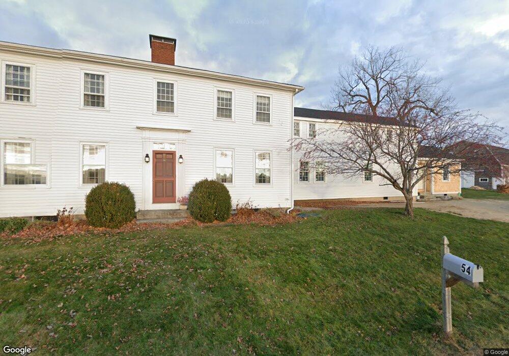
54 Pennell Way Brunswick, ME 04011
Estimated Value: $616,000 - $1,301,000
4
Beds
3
Baths
3,322
Sq Ft
$258/Sq Ft
Est. Value
About This Home
This home is located at 54 Pennell Way, Brunswick, ME 04011 and is currently estimated at $856,665, approximately $257 per square foot. 54 Pennell Way is a home located in Cumberland County with nearby schools including Priest Elementary-Middle School, Kate Furbish Elementary School, and Brunswick Jr High School.
Ownership History
Date
Name
Owned For
Owner Type
Purchase Details
Closed on
Apr 8, 2022
Sold by
Dunbar Charles F and Dunbar Nelia G
Bought by
Dunbar Andrew B and Dunbar Anne B
Current Estimated Value
Home Financials for this Owner
Home Financials are based on the most recent Mortgage that was taken out on this home.
Original Mortgage
$0
Interest Rate
3.89%
Mortgage Type
Purchase Money Mortgage
Create a Home Valuation Report for This Property
The Home Valuation Report is an in-depth analysis detailing your home's value as well as a comparison with similar homes in the area
Home Values in the Area
Average Home Value in this Area
Purchase History
| Date | Buyer | Sale Price | Title Company |
|---|---|---|---|
| Dunbar Andrew B | $425,000 | None Available | |
| Dunbar Andrew B | $425,000 | None Available |
Source: Public Records
Mortgage History
| Date | Status | Borrower | Loan Amount |
|---|---|---|---|
| Closed | Dunbar Andrew B | $0 |
Source: Public Records
Tax History Compared to Growth
Tax History
| Year | Tax Paid | Tax Assessment Tax Assessment Total Assessment is a certain percentage of the fair market value that is determined by local assessors to be the total taxable value of land and additions on the property. | Land | Improvement |
|---|---|---|---|---|
| 2024 | $9,798 | $410,800 | $171,800 | $239,000 |
| 2023 | $9,568 | $410,800 | $171,800 | $239,000 |
| 2022 | $8,332 | $0 | $0 | $0 |
| 2021 | $8,488 | $406,900 | $171,500 | $235,400 |
| 2020 | $8,289 | $406,900 | $171,500 | $235,400 |
| 2019 | $8,024 | $406,900 | $171,500 | $235,400 |
| 2018 | $7,320 | $406,900 | $171,500 | $235,400 |
| 2017 | $7,482 | $407,300 | $171,500 | $235,800 |
| 2016 | $6,263 | $213,400 | $60,900 | $152,500 |
| 2015 | $6,052 | $213,400 | $60,900 | $152,500 |
| 2014 | $5,847 | $213,400 | $60,900 | $152,500 |
| 2013 | $6,240 | $235,100 | $82,600 | $152,500 |
Source: Public Records
Map
Nearby Homes
- 0 Gundalo Gap Rd Unit 1638108
- 250 Mere Point Rd
- 270 Harpswell Neck Rd
- 6 Chebeague Ln
- 49 Gleed Dr
- 853 Mere Point Rd
- 6 Melden Dr
- 0 Melden Dr
- 10 Betina Ln
- Map 80 Lot 18-0 White Island
- 10 Kitt St
- 54 Linnell Cir
- 11 Elwell Ln
- 29 Elwell Ln
- Lot 14 Village Cir
- Lot 8 Village Cir
- 32 Village Cir
- 23 Village Cir
- 20 Village Cir
- 9 Village Cir
- 29 Pennell Way
- 30 Pennell Way
- 0 Pennell Way Unit 266889
- 0 Pennell Way Unit 1540342
- 0 Pennell Way Unit 1528611
- 24 Pennell Way
- 15 Pennell Way
- 16 Pennell Way
- 23 Pennell Way
- 236 Pennellville Rd
- 222 Pennellville Rd
- 258 Pennellville Rd
- 22 Ocean Dr
- 17 Pennell Point Dr
- 10 Ocean View Dr
- 17 Ocean View Dr
- 261 Simpson's Point
- 11 Pennell Point Dr
- 292 Pennellville Rd
- 43 Ocean Dr