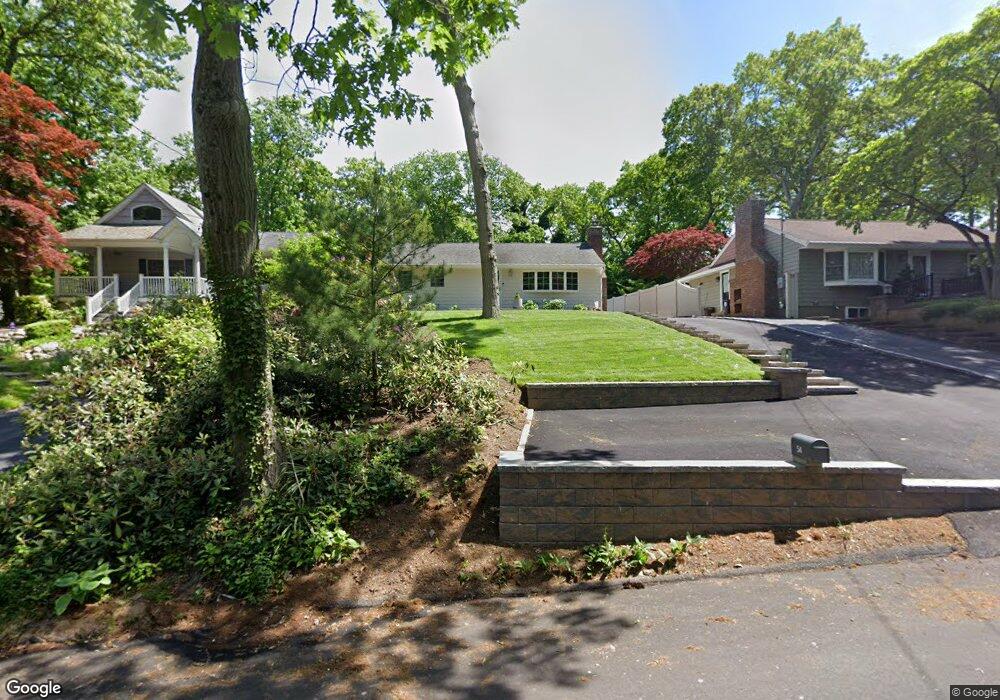
54 Polk Ave East Northport, NY 11731
Estimated Value: $610,000 - $793,000
3
Beds
1
Bath
--
Sq Ft
9,148
Sq Ft Lot
About This Home
This home is located at 54 Polk Ave, East Northport, NY 11731 and is currently estimated at $701,294. 54 Polk Ave is a home located in Suffolk County with nearby schools including Northport Senior High School, The School House, and Trinity Regional School-East Northport Campus.
Ownership History
Date
Name
Owned For
Owner Type
Purchase Details
Closed on
Aug 31, 2017
Sold by
Dara Helen and Mazane Frank
Bought by
Reiter Keri and Ello George
Current Estimated Value
Home Financials for this Owner
Home Financials are based on the most recent Mortgage that was taken out on this home.
Original Mortgage
$125,000
Outstanding Balance
$104,468
Interest Rate
3.93%
Mortgage Type
New Conventional
Estimated Equity
$596,826
Purchase Details
Closed on
Jan 27, 1998
Sold by
Stewart Joseph and Stewart Dolores
Bought by
Mazane Frank and Dara Helen
Home Financials for this Owner
Home Financials are based on the most recent Mortgage that was taken out on this home.
Original Mortgage
$118,300
Interest Rate
6.85%
Create a Home Valuation Report for This Property
The Home Valuation Report is an in-depth analysis detailing your home's value as well as a comparison with similar homes in the area
Home Values in the Area
Average Home Value in this Area
Purchase History
| Date | Buyer | Sale Price | Title Company |
|---|---|---|---|
| Reiter Keri | $425,000 | None Available | |
| Mazane Frank | $182,000 | First American Title Ins Co |
Source: Public Records
Mortgage History
| Date | Status | Borrower | Loan Amount |
|---|---|---|---|
| Open | Reiter Keri | $125,000 | |
| Previous Owner | Mazane Frank | $118,300 |
Source: Public Records
Tax History Compared to Growth
Tax History
| Year | Tax Paid | Tax Assessment Tax Assessment Total Assessment is a certain percentage of the fair market value that is determined by local assessors to be the total taxable value of land and additions on the property. | Land | Improvement |
|---|---|---|---|---|
| 2024 | $9,060 | $2,600 | $100 | $2,500 |
| 2023 | $4,530 | $2,600 | $100 | $2,500 |
| 2022 | $8,558 | $2,600 | $100 | $2,500 |
| 2021 | $8,309 | $2,600 | $100 | $2,500 |
| 2020 | $8,184 | $2,600 | $100 | $2,500 |
| 2019 | $16,367 | $0 | $0 | $0 |
| 2018 | $6,955 | $2,600 | $100 | $2,500 |
| 2017 | $6,955 | $2,600 | $100 | $2,500 |
| 2016 | $6,842 | $2,600 | $100 | $2,500 |
| 2015 | -- | $2,600 | $100 | $2,500 |
| 2014 | -- | $2,600 | $100 | $2,500 |
Source: Public Records
Map
Nearby Homes
- 44 Grant St
- 33 Alsace Place
- 292 Laurel Rd
- 267 Laurel Rd
- 301 Laurel Rd
- 27 Brittany Ct
- 167 Vernon Valley Rd
- 224 Catherine St
- 26 Gilbert St
- 119 Catherine St
- 107 Soper Ave
- 29 Cornell St
- 18 Norton Dr
- 330 Scudder Ave
- 36 Ripley Dr
- 22 Middleville Rd
- 30 Middleville Rd
- 15 Crest Dr
- 32 Middleville Rd Unit 2
- 54A Upland Dr