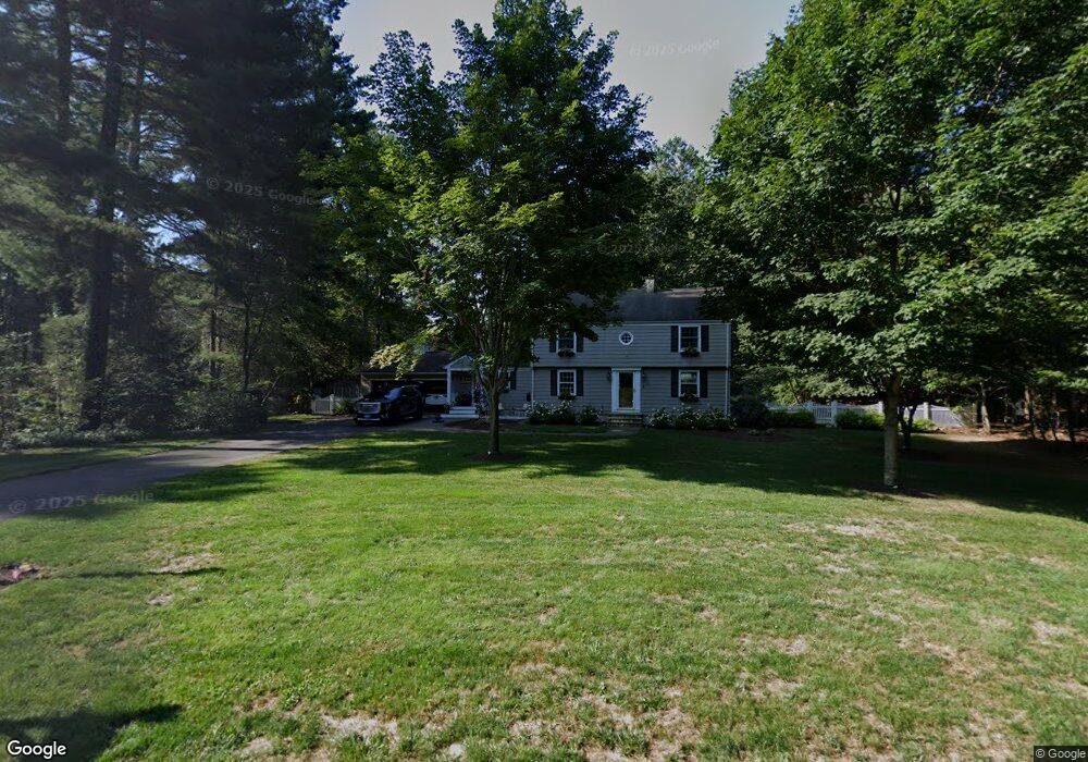
54 Quorn Hunt Rd West Simsbury, CT 06092
Estimated Value: $534,000 - $697,000
3
Beds
3
Baths
2,074
Sq Ft
$285/Sq Ft
Est. Value
About This Home
This home is located at 54 Quorn Hunt Rd, West Simsbury, CT 06092 and is currently estimated at $591,232, approximately $285 per square foot. 54 Quorn Hunt Rd is a home located in Hartford County with nearby schools including Tootin' Hills School, Henry James Memorial School, and Simsbury High School.
Ownership History
Date
Name
Owned For
Owner Type
Purchase Details
Closed on
Oct 28, 2019
Sold by
Pappa James J
Bought by
Harbour Ryan A and Harbour Marcy C
Current Estimated Value
Home Financials for this Owner
Home Financials are based on the most recent Mortgage that was taken out on this home.
Original Mortgage
$370,500
Outstanding Balance
$325,292
Interest Rate
3.5%
Mortgage Type
Purchase Money Mortgage
Estimated Equity
$265,940
Purchase Details
Closed on
Apr 28, 1995
Sold by
Cullinan Peter and Weickert Amy
Bought by
Pappa James and Pappa Kelly
Purchase Details
Closed on
Jan 17, 1990
Sold by
George Timothy
Bought by
Cullinan Peter
Purchase Details
Closed on
Apr 18, 1988
Sold by
Turnbull David
Bought by
George Timothy
Create a Home Valuation Report for This Property
The Home Valuation Report is an in-depth analysis detailing your home's value as well as a comparison with similar homes in the area
Home Values in the Area
Average Home Value in this Area
Purchase History
| Date | Buyer | Sale Price | Title Company |
|---|---|---|---|
| Harbour Ryan A | $390,000 | -- | |
| Pappa James | $189,900 | -- | |
| Cullinan Peter | $220,000 | -- | |
| George Timothy | $229,000 | -- |
Source: Public Records
Mortgage History
| Date | Status | Borrower | Loan Amount |
|---|---|---|---|
| Open | Harbour Ryan A | $370,500 | |
| Previous Owner | George Timothy | $338,089 | |
| Previous Owner | George Timothy | $347,145 | |
| Previous Owner | George Timothy | $339,031 |
Source: Public Records
Tax History Compared to Growth
Tax History
| Year | Tax Paid | Tax Assessment Tax Assessment Total Assessment is a certain percentage of the fair market value that is determined by local assessors to be the total taxable value of land and additions on the property. | Land | Improvement |
|---|---|---|---|---|
| 2025 | $9,978 | $292,110 | $91,490 | $200,620 |
| 2024 | $9,730 | $292,110 | $91,490 | $200,620 |
| 2023 | $9,295 | $292,110 | $91,490 | $200,620 |
| 2022 | $8,794 | $227,640 | $98,410 | $129,230 |
| 2021 | $8,794 | $227,640 | $98,410 | $129,230 |
| 2020 | $8,443 | $227,640 | $98,410 | $129,230 |
| 2019 | $7,859 | $210,580 | $98,410 | $112,170 |
| 2018 | $7,916 | $210,580 | $98,410 | $112,170 |
| 2017 | $7,521 | $194,030 | $96,050 | $97,980 |
| 2016 | $7,202 | $194,030 | $96,050 | $97,980 |
| 2015 | $7,202 | $194,030 | $96,050 | $97,980 |
| 2014 | $7,206 | $194,030 | $96,050 | $97,980 |
Source: Public Records
Map
Nearby Homes
- 10 Sachems Trail
- 143 N Mountain Rd
- 23 Red Fox Run
- 15 Red Fox Run
- 21 Christmas Tree Hill
- 121 Gracey Rd
- 18 Meadowlark Rd
- 269 W Mountain Rd
- 42 Garrett Rd
- 265 E Hill Rd
- 5 Fox Den Rd
- 391 Cherry Brook Rd
- 301 Bushy Hill Rd
- 302 Bushy Hill Rd
- 6 Highwood Rd
- 395 Bushy Hill Rd
- 152 E Hill Rd
- 10 Mountain Spring Rd
- 207 Cherry Brook Rd
- 35 Rustle Meadow Ln