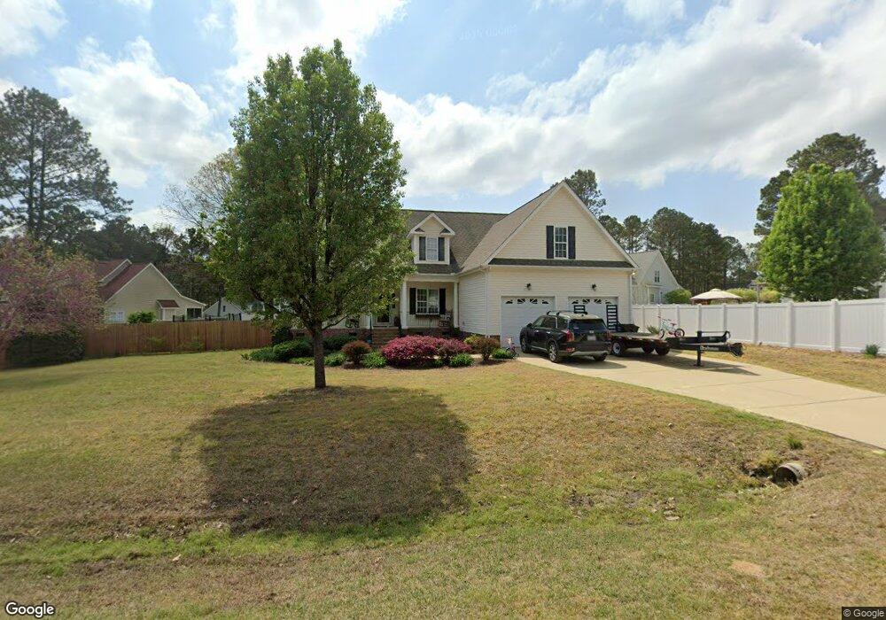
54 Round Pond Cir Angier, NC 27501
Pleasant Grove NeighborhoodEstimated Value: $378,600 - $430,000
3
Beds
2
Baths
2,244
Sq Ft
$184/Sq Ft
Est. Value
About This Home
This home is located at 54 Round Pond Cir, Angier, NC 27501 and is currently estimated at $411,900, approximately $183 per square foot. 54 Round Pond Cir is a home located in Johnston County with nearby schools including McGee's Crossroads Elementary School, McGee's Crossroads Middle School, and West Johnston High School.
Ownership History
Date
Name
Owned For
Owner Type
Purchase Details
Closed on
Aug 11, 2017
Sold by
Mason Patricia A and Killion Patricia M
Bought by
Lambert Christopher Ray and Lindley Blair
Current Estimated Value
Home Financials for this Owner
Home Financials are based on the most recent Mortgage that was taken out on this home.
Original Mortgage
$218,250
Outstanding Balance
$181,718
Interest Rate
3.88%
Mortgage Type
New Conventional
Estimated Equity
$230,182
Purchase Details
Closed on
Sep 22, 2006
Sold by
Stephenson John R and Wood John W
Bought by
Killion Patricia M
Purchase Details
Closed on
Aug 25, 2005
Sold by
Crossroads Dev Corp
Bought by
Stephenson John R and Wood John W
Home Financials for this Owner
Home Financials are based on the most recent Mortgage that was taken out on this home.
Original Mortgage
$183,200
Interest Rate
5.61%
Mortgage Type
FHA
Create a Home Valuation Report for This Property
The Home Valuation Report is an in-depth analysis detailing your home's value as well as a comparison with similar homes in the area
Home Values in the Area
Average Home Value in this Area
Purchase History
| Date | Buyer | Sale Price | Title Company |
|---|---|---|---|
| Lambert Christopher Ray | $225,000 | None Available | |
| Killion Patricia M | $215,000 | None Available | |
| Stephenson John R | $33,000 | None Available |
Source: Public Records
Mortgage History
| Date | Status | Borrower | Loan Amount |
|---|---|---|---|
| Open | Lambert Christopher Ray | $218,250 | |
| Previous Owner | Stephenson John R | $183,200 |
Source: Public Records
Tax History Compared to Growth
Tax History
| Year | Tax Paid | Tax Assessment Tax Assessment Total Assessment is a certain percentage of the fair market value that is determined by local assessors to be the total taxable value of land and additions on the property. | Land | Improvement |
|---|---|---|---|---|
| 2025 | $2,485 | $391,330 | $80,000 | $311,330 |
| 2024 | $1,916 | $236,590 | $38,000 | $198,590 |
| 2023 | $1,857 | $236,590 | $38,000 | $198,590 |
| 2022 | $1,916 | $236,590 | $38,000 | $198,590 |
| 2021 | $1,916 | $236,590 | $38,000 | $198,590 |
| 2020 | $1,987 | $236,590 | $38,000 | $198,590 |
| 2019 | $1,940 | $236,590 | $38,000 | $198,590 |
| 2018 | $1,776 | $211,410 | $30,000 | $181,410 |
| 2017 | $1,776 | $211,410 | $30,000 | $181,410 |
| 2016 | $1,776 | $211,410 | $30,000 | $181,410 |
| 2015 | $1,776 | $211,410 | $30,000 | $181,410 |
| 2014 | $1,776 | $211,410 | $30,000 | $181,410 |
Source: Public Records
Map
Nearby Homes
- 160 Old Cabin Ct
- 135 White Memorial Rd
- 170 Parrish Landing Way
- 175 White Memorial Rd
- 100 Pine Needle Dr
- 115 Wiggins Rd
- 38.2 Acres Wiggins Rd
- 230 Paula Dr
- 19 Lake Refuge Ct
- 105 Pinecrest Dr
- 250 Crosscreek Ln
- 197 Silverside Dr
- 823 Shadow Lake Dr
- 3002 Red Cir
- 19 Silverside Dr
- 135 Brookstone Way
- 1025 Lake Path Rd
- 365 Landmark Rd
- 623 Canady Ct
- 506 Harbor Cove Dr
- 96 Round Pond Cir
- 28 W Thicket Dr
- 28 Round Pond Cir
- 233 W Thicket Dr
- 265 W Thicket Dr
- 65 Round Pond Cir
- 27 Round Pond Cir
- 81 Round Pond Cir
- 112 Round Pond Cir
- 49 Round Pond Cir
- 137 W Thicket Dr
- 107 Round Pond Cir
- 279 W Thicket Dr
- 164 W Thicket Dr
- 214 W Thicket Dr
- 118 Round Pond Cir
- 222 W Thicket Dr
- 192 W Thicket Dr
- 248 W Thicket Dr
- 162 W Thicket Dr